Physical Geology
Unit 1
Introduction: Definition, Aim and Scope of geology, relationship with other branches of science, branches of Geology.
INTRODUCTION TO GEOLOGY
Geology (in Greek, Geo means Earth, Logos means Science) is a branch of science dealing with the
study of the Earth. It is also known as earth science. The study of the earth comprises of the whole
earth, its origin, structure, composition and history (including the development of life) and the nature of
the processes. The word was first used in 1778 in the work of Jean Andrea de Luc (a Swiss-born
scientist who lived at Windsor for much of his life as adviser to Queen Charlotte) and at much the same
time in the work of Swiss Chemist, S.B. Saucer.
Geology is a fascinating subject.
Geology feels the pulse of the earth.
Geologists contribute their part to the nation through the discovery of new deposits of rocks and
minerals of economic value.
A student should know what lies beneath the crust and how long back the earth came into existence.
DIFFERENT BRANCHES OF GEOLOGY
For studying the earth in detail, the subject of Geology has been divided into various branches as
follows:
(i) Physical Geology
(ii) Crystallography
(iii) Mineralogy
(iv) Petrology
(v) Structural Geology
(vi) Stratigraphy
(vii) Paleontology
(viii) Historical Geology
(ix) Economic Geology
(x) Mining Geology
(xi) Civil Engineering Geology
(xii) Hydrology
(xiii) Indian Geology
(xiv) Resources Engineering
(xv) Photo Geology
(i) Physical Geology
As a branch of geology, it deals with the “various processes of physical agents such as wind, water,
glaciers and sea waves”, run on these agents go on modifying the surface of the earth continuously.
Physical geology includes the study of Erosion, Transportation and Deposition (ETD).
The study of physical geology plays a vital role in civil engineering thus:
(a) It reveals constructive and destructive processes of physical agents at a particular site.
(b) It helps in selecting a suitable site for different types of project to be under taken after studying
the effects of physical agents which go on modifying the surface of the earth physically,
chemically and mechanically.
(ii) Crystallography
As a branch of geology, it deals with ‘the study of crystals’. A crystal is a regular polyhedral form
bounded by smooth surfaces.
The study of crystallography is not much important to civil engineering, but to recognize the minerals
the study of crystallography is necessary.
(iii) Mineralogy
As a branch of geology, it deals with ‘the study of minerals’. A mineral may be defined as a naturally
occurring, homogeneous solid, inorganically formed, having a definite chemical composition and ordered
atomic arrangement. The study of mineralogy is most important.
(a) For a civil engineering student to identify the rocks.
(b) In industries such as cement, iron and steel, fertilizers, glass industry and so on.
(c) In the production of atomic energy.
(iv) Petrology
As a branch of geology it deals with ‘the study of rocks’. A rock is defined as “the aggregation of
minerals found in the earth’s crust”.
The study of petrology is most important for a civil engineer, in the selection of suitable rocks for
building stones, road metals, etc.
(v) Structural Geology
As a branch of geology, it deals with ‘the study of structures found in rocks’. It is also known as
tectonic geology or simply tectonics.
Structural geology is an arrangement of rocks and plays an important role in civil engineering in the
selection of suitable sites for all types of projects such as dams, tunnels, multistoried buildings, etc.
(vi) Stratigraphy
As a branch of geology it deals with ‘the study of stratified rocks and their correlation’.
(vii) Paleontology
As a branch of geology, it deals with ‘the study of fossils’ and the ancient remains of plants and animals
are referred to as fossils. Fossils are useful in the study of evolution and migration of animals and plants
through ages, ancient geography and climate of an area.Introduction and Scope 3
(viii) Historical Geology
As a branch of geology, it includes “the study of both stratigraphy and paleontology”. Its use in civil
engineering is to know about the land and seas, the climate and the life of early times upon the earth.
(ix) Economic Geology
As a branch of Geology, it deals with “the study of minerals, rocks and materials of economic importance
like coal and petroleum”.
(x) Mining Geology
As a branch of geology, it deals with “the study of application of geology to mining engineering in such
a way that the selection of suitable sites for quarrying and mines can be determined”.
(xi) Civil Engineering Geology
As a branch of geology, it deals with “all the geological problems that arise in the field of civil engineering
along with suitable treatments”. Thus, it includes the construction of dams, tunnels, mountain roads,
building stones and road metals.
(xii) Hydrology
As a branch of geology, it deals with “the studies of both quality and quantity of water that are present
in the rocks in different states”(Conditions). Moreover, it includes:
(a) Atmospheric water,
(b) Surface water, and
(c) Underground water.
(xiii) Indian Geology
As a branch of geology, it deals with “the study of our motherland in connection with the coal/petroleum,
physoigraphy, stratigraphy and economic mineral of India”.
(xiv) Resources Engineering
As a branch of geology deals with “the study of water, land, solar energy, minerals, forests, etc. fulfill
the human wants”.
(xv) Photo Geology
As a branch of geology deals with “the study of aerial photographs”.
RELATIONSHIP OF GEOLOGY WITH OTHER BRANCHES OF SCIENCE
AND ENGINEERING
In order to carry out civil engineering projects safely and successfully, geology should be related to the
other branches of bordering sciences as described as follows:4 A Textbook of Applied Engineering Geology
1. Geochemistry
As a branch of science, it deals with geology in such a way that it concerns with the abundance and
distribution of various elements and compounds in the earth.
2. Geophysics
As a branch of science, it is related with geology in such a way that it concerns with the constitution of
the earth and the nature of the physical forces operating on with in the earth.
3. Geohydrology
As a branch of science, it is related with geology in setting of ground water. In other words, Geohydrology
is an “interaction between Geology and Hydrology”.
4. Rock Mechanics
As a branch of science, it is related with geology in dealing with the behaviour of rocks that is subjected
to static and dynamic loads (force fields).
5. Mining Engineering
Geology is related to mining engineering in dealing with the formation and distribution of economic
minerals and response to fracturing processes. With out the knowledge of structural features of rock
masses and mode of occurrence and mineral deposits, a mining engineer cannot determine the method
of mining.
6. Civil Engineering
Before constructing roads, bridges, tunnels, tanks, reservoirs and buildings, selection of site is important
from the viewpoint of stability of foundation and availability of construction materials. Geology of area
is important and rock-forming region, their physical nature, permeability, faults, joints, etc. Thus, geology
is related to civil engineering in construction jobs with economy and success.
IMPORTANCE OF GEOLOGY FOR CIVIL ENGINEERING
The role of geology in civil engineering may be briefly outlined as follows:
1. Geology provides a systematic knowledge of construction materials, their structure and
properties.
2. The knowledge of Erosion, Transportation and Deposition (ETD) by surface water helps in
soil conservation, river control, coastal and harbour works.
3. The knowledge about the nature of the rocks is very necessary in tunneling, constructing
roads and in determining the stability of cuts and slopes. Thus, geology helps in civil engineering.
4. The foundation problems of dams, bridges and buildings are directly related with geology of
the area where they are to be built.
5. The knowledge of ground water is necessary in connection with excavation works, water
supply, irrigation and many other purposes.
6. Geological maps and sections help considerably in planning many engineering projects.Introduction and Scope 5
7. If the geological features like faults, joints, beds, folds, solution channels are found, they have
to be suitably treated. Hence, the stability of the structure is greatly increased.
8. Pre-geological survey of the area concerned reduces the cost of engineering work.
SCOPE OF GEOLOGY
Engineering Geology: A well established interdisciplinary branch of Science and Engineering has a
scope in different fields as outlined below:
(a) In Civil Engineering: Geology provides necessary information about the site of construction
materials used in the construction of buildings, dams, tunnels, tanks, reservoirs, highways
and bridges. Geological information is most important in planning phase (stage), design phase
and construction phase of an engineering project.
(b) In Mining Engineering: Geology is useful to know the method of mining of rock and mineral
deposits on earth’s surface and subsurface.
(c) In Ground Water: Resources development geology is applied in various aspects of resources
and supply, storage, filling up of reservoirs, pollution disposal and contaminated water disposal.
(d) Land pollution.
(e) Nuclear explosion.
(f) Oceanography.
(g) Space exploration.
In each of the above-mentioned fields Geology has to deal with an integral part of the earth.
EARTH AS A PLANET
The earth is a planet belonging to the solar system of the Milky Way Galaxy, with a natural satellite, the
moon. It is the third planet from the Sun. The planet on which we live is called the earth. There is a lot
of disagreement between the scientists regarding the shape of the earth. In recent times a new phrase
being used is that the earth is like a GEOID (Greek, GEO = earth, OID = like) i.e., our planet is like the
earth. They believe that the interior of the earth is shrinking day by day. This shrinkage may be either due
to loss of heat or reorganization of molecules under enormous pressure and high temperature. It is thus
obvious that the outer portion must shorten its circumference to adjust the shrunken interior.
Chart of the diameter and the area of the earth, according to the present state of
knowledge about it

STRUCTURES AND COMPOSITION OF EARTH
The outer envelopes of the gaseous material surrounding the earth are called atmosphere. Under the
atmosphere is our earth on which we live. That part of the earth, which is in the form of a land, is
known as the earth’s crust. It also includes the highest peaks of mountains and floors of the oceans.
Part of the land, which is visible on the Globe, is called the Lithosphere (Greek, Litho = Stone).
We know that nearly 75 per cent of the whole surface of the earth is covered with natural waters
like oceans, seas, lakes, rivers etc. Which is in the form of more or less, a continuous envelope around
the earth. This envelope of water is called Hydrosphere (Greek, Hudous = Water). Thus, Lithosphere
and Hydrosphere in a combined form is known as the Earth’s crust. Under the Earth’s crust is the
interior of the Earth. It is further sub-divided into three shells. Depending upon the nature, the material
is made up as shown in the Fig. 1.1.

The earth is composed of different rocks. In an ordinary sense the term rock means something hard
and resistant but the meaning of the word has been extended so as to include all natural substances of
the Earth’s crust, which may be hard like granite or soft like clay and sand. It has been estimated that
95 per cent of the Earth’s crust is made up of primary i.e., first formed (Igneous) rocks which is mostly
composed of Granite having Quartz, Feldspar, Biotite mica and Hornblende in varying proportions the remaining 5 per cent of the crust is made up of Secondary (Sedimentary or Metamorphic) rocks (as shown in Fig. 1.2). The Earth’s crust is in the form of a very thin layer of solidified rocks and is
heterogeneous in nature. These rocks may be classified on the basis of their density into the following
two groups:
1. Sial (Si = Silicon and Al = Aluminium) having density 2.75 to 2.90.
2. Sima (Si = Silicon and Ma= Magnesium) having density 2.90 to 4.75.

It has been estimated that the Sial rocks are about 70 per cent of the Earth’s crust, which include
chiefly Granite and Silica. These rocks are generally on the upper regions of the crust.
Sima rocks include heavy and dark coloured rocks like Basalts. In these rocks, the percentage of
Silica is reduced and Magnesium attains the next importance in place of Aluminium of Sial rocks. These
rocks are generally found on the floors of the Oceans and beneath sial rocks.
Mantle: It is the part of the earth below the crust and surrounding the core. The imaginary line that
separates the lithosphere from the mantle is known as ‘Moho’ (Mohorovicic discontinuity). Because of
high temperature and great pressure, the mineral matter in this part is the molten condition.
Core: It is the innermost layer of the earth; it extends from below the mantle (Gutenberg discontinuity)
to the central part of the earth. On the basis of earthquake waves, the core has been further divided into
two cores.
(a) Outer core
(b) Inner core
The outer core is 2,250 km thick and surrounds the core. It is believed that it is still in molten
condition.
The inner core is also called ‘Nife’ because it consists of Nickel and iron. Its thickness is about
1,228 km. It is very hard in nature.
Table 1.2 Thickness and composition of different layers of the earth

SOLAR SYSTEM
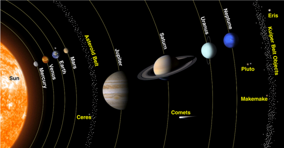

What Is The Solar System?
The Solar System is made up of all the planets that orbit our Sun. In addition to planets, the Solar System also consists of moons, comets, asteroids, minor planets, and dust and gas.
Everything in the Solar System orbits or revolves around the Sun. The Sun contains around 98% of all the material in the Solar System. The larger an object is, the more gravity it has. Because the Sun is so large, its powerful gravity attracts all the other objects in the Solar System towards it. At the same time, these objects, which are moving very rapidly, try to fly away from the Sun, outward into the emptiness of outer space. The result of the planets trying to fly away, at the same time that the Sun is trying to pull them inward is that they become trapped half-way in between. Balanced between flying towards the Sun, and escaping into space, they spend eternity orbiting around their parent star.
Everything in the Solar System orbits or revolves around the Sun. The Sun contains around 98% of all the material in the Solar System. The larger an object is, the more gravity it has. Because the Sun is so large, its powerful gravity attracts all the other objects in the Solar System towards it. At the same time, these objects, which are moving very rapidly, try to fly away from the Sun, outward into the emptiness of outer space. The result of the planets trying to fly away, at the same time that the Sun is trying to pull them inward is that they become trapped half-way in between. Balanced between flying towards the Sun, and escaping into space, they spend eternity orbiting around their parent star.
Our solar system is filled with a wide assortment of celestial bodies - the Sun itself, our eight planets, dwarf planets, and asteroids - and on Earth, life itself! The inner solar system is occasionally visited by comets that loop in from the outer reaches of the solar system on highly elliptical orbits. In the outer reaches of the solar system, we find the Kuiper Belt and the Oort cloud. Still farther out, we eventually reach the limits of the heliosphere, where the outer reaches of the solar system interact with interstellar space. Solar system formation began billions of years ago, when gases and dust began to come together to form the Sun, planets, and other bodies of the solar system.
Planet Earth: Forms and Dimensions of the Earth and its position in solar system.
From the perspective we get on Earth, our planet appears to be big and sturdy with an endless ocean of air. From space, astronauts often get the impression that the Earth is small with a thin, fragile layer of atmosphere. For a space traveler, the distinguishing Earth features are the blue waters, brown and green land masses and white clouds set against a black background.Many dream of traveling in space and viewing the wonders of the universe. In reality all of us are space travelers. Our spaceship is the planet Earth, traveling at the speed of 108,000 kilometers (67,000 miles) an hour.
Earth is the 3rd planet from the Sun at a distance of about 150 million kilometers (93.2 million miles). It takes 365.256 days for the Earth to travel around the Sun and 23.9345 hours for the Earth rotate a complete revolution. It has a diameter of 12,756 kilometers (7,973 miles), only a few hundred kilometers larger than that of Venus. Our atmosphere is composed of 78 percent nitrogen, 21 percent oxygen and 1 percent other constituents.
Earth is the only planet in the solar system known to harbor life. Our planet's rapid spin and molten nickel-iron core give rise to an extensive magnetic field, which, along with the atmosphere, shields us from nearly all of the harmful radiation coming from the Sun and other stars. Earth's atmosphere protects us from meteors, most of which burn up before they can strike the surface.
From our journeys into space, we have learned much about our home planet. The first American satellite, Explorer 1, discovered an intense radiation zone, now called the Van Allen radiation belts. This layer is formed from rapidly moving charged particles that are trapped by the Earth's magnetic field in a doughnut-shaped region surrounding the equator. Other findings from satellites show that our planet's magnetic field is distorted into a tear-drop shape by the solar wind. We also now know that our wispy upper atmosphere, once believed calm and uneventful, seethes with activity -- swelling by day and contracting by night. Affected by changes in solar activity, the upper atmosphere contributes to weather and climate on Earth.
Besides affecting Earth's weather, solar activity gives rise to a dramatic visual phenomenon in our atmosphere. When charged particles from the solar wind become trapped in Earth's magnetic field, they collide with air molecules above our planet's magnetic poles. These air molecules then begin to glow and are known as the auroras or the northern and southern lights.
Terrestrial planet
The Terrestrial Planets are small and solid (like the Earth) and are made of rock and metal. The are also called the Inner Planets because they are fairly close to the Sun. They have no or very few satellites. In order from the Sun, these planets are Mercury, Venus, Earth and Mars.
Terrestrial planets are Earth-like planets (in Latin, terra means Earth) made up of rocks or metals with a hard surface — making them different from other planets that lack a solid surface. Terrestrial planets also have a molten heavy metal core, few moons, and a variety of topological features like valleys, volcanoes and craters. In our solar system, there are four terrestrial planets, which also happen to be the four closest to the sun: Mercury, Venus Earth and Mars. During the creation of the solar system, there were likely more terrestrial planetoids, but they likely merged or were destroyed.
 |
| The terrestrial planets or our solar system: Mercury, Venus, Earth & Mars |
MERCURY

Mercury is the closest planet to the Sun and due to its proximity it is not easily seen except during twilight. For every two orbits of the Sun, Mercury completes three rotations about its axis and up until 1965 it was thought that the same side of Mercury constantly faced the Sun. Thirteen times a century Mercury can be observed from the Earth passing across the face of the Sun in an event called a transit, the next will occur on the 9th May 2016.
Planet Profile
Mass: 330,104,000,000,000 billion kg (0.055 x Earth)
Equatorial Diameter: 4,879
Polar Diameter: 4,879
Equatorial Circumference: 15,329 km
Known Moons: none
Notable Moons: none
Orbit Distance: 57,909,227 km (0.39 AU)
Orbit Period: 87.97 Earth days
Surface Temperature: -173 to 427°C
First Record: 14th century BC
Recorded By: Assyrian astronomers
Equatorial Diameter: 4,879
Polar Diameter: 4,879
Equatorial Circumference: 15,329 km
Known Moons: none
Notable Moons: none
Orbit Distance: 57,909,227 km (0.39 AU)
Orbit Period: 87.97 Earth days
Surface Temperature: -173 to 427°C
First Record: 14th century BC
Recorded By: Assyrian astronomers
Size Of Mercury Compared To The Earth

Facts About Mercury
A year in Mercury is just 88 days long:
One day on Mercury lasts the equivalent of 176 Earth days. Mercury is nearly tidally locked to the Sun and over time this has slowed the rotation of the planet to almost match its orbit around the Sun. Mercury also has the highest orbital eccentricity of all the planets with its distance from the Sun ranging from 46 to 70 million km
One day on Mercury lasts the equivalent of 176 Earth days. Mercury is nearly tidally locked to the Sun and over time this has slowed the rotation of the planet to almost match its orbit around the Sun. Mercury also has the highest orbital eccentricity of all the planets with its distance from the Sun ranging from 46 to 70 million km
Mercury is the smallest planet in the Solar System:
One of five planets visible with the naked eye a, Mercury is just 4,879 Kilometres across its equator, compared with 12,742 Kilometres for the Earth.
One of five planets visible with the naked eye a, Mercury is just 4,879 Kilometres across its equator, compared with 12,742 Kilometres for the Earth.
Mercury is the second densest planet:
Even though the planet is small, Mercury is very dense. Each cubic centimetre has a density of 5.4 grams, with only the Earth having a higher density. This is largely due to Mercury being composed mainly of heavy metals and rock.
Even though the planet is small, Mercury is very dense. Each cubic centimetre has a density of 5.4 grams, with only the Earth having a higher density. This is largely due to Mercury being composed mainly of heavy metals and rock.
Mercury has wrinkles:
As the iron core of the planet cooled and contracted, the surface of the planet became wrinkled. Scientist have named these wrinkles, Lobate Scarps. These Scarps can be up to a mile high and hundreds of miles long.
As the iron core of the planet cooled and contracted, the surface of the planet became wrinkled. Scientist have named these wrinkles, Lobate Scarps. These Scarps can be up to a mile high and hundreds of miles long.
Mercury has a molten core:
In recent years scientists from NASA have come to believe the solid iron core of Mercury could in fact be molten. Normally the core of smaller planets cools rapidly, but after extensive research, the results were not in line with those expected from a solid core. Scientists now believe the core to contain a lighter element such as sulphur, which would lower the melting temperature of the core material. It is estimated Mercury’s core makes up 42% of its volume, while the Earth’s core makes up 17%.
In recent years scientists from NASA have come to believe the solid iron core of Mercury could in fact be molten. Normally the core of smaller planets cools rapidly, but after extensive research, the results were not in line with those expected from a solid core. Scientists now believe the core to contain a lighter element such as sulphur, which would lower the melting temperature of the core material. It is estimated Mercury’s core makes up 42% of its volume, while the Earth’s core makes up 17%.
Mercury is only the second hottest planet:
Despite being further from the Sun, Venus experiences higher temperatures. The surface of Mercury which faces the Sun sees temperatures of up to 427°C, whilst on the alternate side this can be as low as -173°C. This is due to the planet having no atmosphere to help regulate the temperature.
Despite being further from the Sun, Venus experiences higher temperatures. The surface of Mercury which faces the Sun sees temperatures of up to 427°C, whilst on the alternate side this can be as low as -173°C. This is due to the planet having no atmosphere to help regulate the temperature.
Mercury is the most cratered planet in the Solar System:
Unlike many other planets which “self-heal” through natural geological processes, the surface of Mercury is covered in craters. These are caused by numerous encounters with asteroids and comets. Most Mercurian craters are named after famous writers and artists. Any crater larger than 250 kilometres in diameter is referred to as a Basin. The Caloris Basin is the largest impact crater on Mercury covering approximately 1,550 km in diameter and was discovered in 1974 by the Mariner 10 probe.
Unlike many other planets which “self-heal” through natural geological processes, the surface of Mercury is covered in craters. These are caused by numerous encounters with asteroids and comets. Most Mercurian craters are named after famous writers and artists. Any crater larger than 250 kilometres in diameter is referred to as a Basin. The Caloris Basin is the largest impact crater on Mercury covering approximately 1,550 km in diameter and was discovered in 1974 by the Mariner 10 probe.
Only two spacecraft have ever visited Mercury:
Owing to its proximity to the Sun, Mercury is a difficult planet to visit. During 1974 and 1975 Mariner 10 flew by Mercury three times, during this time they mapped just under half of the planet’s surface. On August 3rd 2004, the Messenger probe was launched from Cape Canaveral Air Force Station, this was the first spacecraft to visit since the mid 1970’s.
Owing to its proximity to the Sun, Mercury is a difficult planet to visit. During 1974 and 1975 Mariner 10 flew by Mercury three times, during this time they mapped just under half of the planet’s surface. On August 3rd 2004, the Messenger probe was launched from Cape Canaveral Air Force Station, this was the first spacecraft to visit since the mid 1970’s.
Mercury is named for the Roman messenger to the gods:
The exact date of Mercury’s discovery is unknown as it pre-dates its first historical mention, one of the first mentions being by the Sumerians around in 3,000 BC.
The exact date of Mercury’s discovery is unknown as it pre-dates its first historical mention, one of the first mentions being by the Sumerians around in 3,000 BC.
Mercury has an atmosphere (sort of):
Mercury has just 38% the gravity of Earth, this is too little to hold on to what atmosphere it has which is blown away by solar winds. However while gases escape into space they are constantly being replenished at the same time by the same solar winds, radioactive decay and dust caused by micrometeorites
Mercury has just 38% the gravity of Earth, this is too little to hold on to what atmosphere it has which is blown away by solar winds. However while gases escape into space they are constantly being replenished at the same time by the same solar winds, radioactive decay and dust caused by micrometeorites
VENUS

Venus is the second planet from the Sun and is the second brightest object in the night sky after the Moon. Named after the Roman goddess of love and beauty, Venus is the second largest terrestrial planet and is sometimes referred to as the Earth’s sister planet due the their similar size and mass. The surface of the planet is obscured by an opaque layer of clouds made up of sulfuric acid.
Planet Profile
Mass: 4,867,320,000,000,000 billion kg (0.815 x Earth)
Equatorial Diameter: 12,104 km
Polar Diameter: 12,104 km
Equatorial Circumference: 38,025 km
Known Moons: none
Notable Moons: none
Orbit Distance: 108,209,475 km (0.73 AU)
Orbit Period: 224.70 Earth days
Surface Temperature: 462 °C
First Record: 17th century BC
Recorded By: Babylonian astronomers
Equatorial Diameter: 12,104 km
Polar Diameter: 12,104 km
Equatorial Circumference: 38,025 km
Known Moons: none
Notable Moons: none
Orbit Distance: 108,209,475 km (0.73 AU)
Orbit Period: 224.70 Earth days
Surface Temperature: 462 °C
First Record: 17th century BC
Recorded By: Babylonian astronomers
Size Of Venus Compared To The Earth

Facts About Venus
A day on Venus lasts longer than a year:
It takes 243 Earth days to rotate once on its axis. The planet’s orbit around the Sun takes 225 Earth days, compared to the Earth’s 365.
It takes 243 Earth days to rotate once on its axis. The planet’s orbit around the Sun takes 225 Earth days, compared to the Earth’s 365.
Venus is often called the Earth’s sister planet:
The Earth and Venus are very similar in size with only a 638 km difference in diameter, Venus having 81.5% of the Earth’s mass. Both also have a central core, a molten mantle and a crust.
The Earth and Venus are very similar in size with only a 638 km difference in diameter, Venus having 81.5% of the Earth’s mass. Both also have a central core, a molten mantle and a crust.
Venus rotates counter-clockwise:
Also known as retrograde rotation. A possible reason might be a collision in the past with an asteroid or other object that caused the planet to alter its rotational path. It also differs from most other planets in our solar system by having no natural satellites.
Also known as retrograde rotation. A possible reason might be a collision in the past with an asteroid or other object that caused the planet to alter its rotational path. It also differs from most other planets in our solar system by having no natural satellites.
Venus is the second brightest object in the night sky:
Only the Moon is brighter. With a magnitude of between -3.8 to -4.6 Venus is so bright it can be seen during daytime on a clear day.
Only the Moon is brighter. With a magnitude of between -3.8 to -4.6 Venus is so bright it can be seen during daytime on a clear day.
Atmospheric pressure on Venus is 92 times greater than the Earth’s:
While its size and mass are similar to Earth, the small asteroids are crushed when entering its atmosphere, meaning no small craters lie on the surface of the planet. The pressure felt by a human on the surface would be equivalent to that experienced deep beneath the sea on Earth.
While its size and mass are similar to Earth, the small asteroids are crushed when entering its atmosphere, meaning no small craters lie on the surface of the planet. The pressure felt by a human on the surface would be equivalent to that experienced deep beneath the sea on Earth.
Venus is also known as the Morning Star and the Evening Star:
Early civilisations thought Venus was two different bodies, called Phosphorus and Hesperus by the Greeks, and Lucifer and Vesper by the Romans. This is because when its orbit around the Sun overtakes Earth’s orbit, it changes from being visible after sunset to being visible before sunrise. Mayan astronomers made detailed observations of Venus as early as 650 AD.
Early civilisations thought Venus was two different bodies, called Phosphorus and Hesperus by the Greeks, and Lucifer and Vesper by the Romans. This is because when its orbit around the Sun overtakes Earth’s orbit, it changes from being visible after sunset to being visible before sunrise. Mayan astronomers made detailed observations of Venus as early as 650 AD.
Venus is the hottest planet in our solar system:
The average surface temperature is 462 °C, and because Venus does not tilt on its axis, there is no seasonal variation. The dense atmosphere of around 96.5 percent carbon dioxide traps heat and causes a greenhouse effect.
The average surface temperature is 462 °C, and because Venus does not tilt on its axis, there is no seasonal variation. The dense atmosphere of around 96.5 percent carbon dioxide traps heat and causes a greenhouse effect.
A detailed study of Venus is currently underway:
In 2006, the Venus Express space shuttle was sent into orbit around Venus by the European Space Agency, and is sending back information about the planet. Originally planned to last five hundred Earth days, the mission has been extended several times. More than 1,000 volcanoes or volcanic centres larger than 20 km have been found on the surface of Venus.
In 2006, the Venus Express space shuttle was sent into orbit around Venus by the European Space Agency, and is sending back information about the planet. Originally planned to last five hundred Earth days, the mission has been extended several times. More than 1,000 volcanoes or volcanic centres larger than 20 km have been found on the surface of Venus.
The Russians sent the first mission to Venus:
The Venera 1 space probe was launched in 1961, but lost contact with base. The USA also lost their first probe to Venus, Mariner 1, although Mariner 2 was able to take measurements of the planet in 1962. The Soviet Union’s Venera 3 was the first man-made craft to land on Venus in 1966.
The Venera 1 space probe was launched in 1961, but lost contact with base. The USA also lost their first probe to Venus, Mariner 1, although Mariner 2 was able to take measurements of the planet in 1962. The Soviet Union’s Venera 3 was the first man-made craft to land on Venus in 1966.
At one point it was thought Venus might be a tropical paradise:
The dense clouds of sulphuric acid surrounding Venus make it impossible to view its surface from outside its atmosphere. It was only when radio mapping was developed in the 1960s that scientists were able to observe and measure the extreme temperatures and hostile environment. It is thought Venus did once have oceans but these evaporated as the planets temperature increased.
The dense clouds of sulphuric acid surrounding Venus make it impossible to view its surface from outside its atmosphere. It was only when radio mapping was developed in the 1960s that scientists were able to observe and measure the extreme temperatures and hostile environment. It is thought Venus did once have oceans but these evaporated as the planets temperature increased.
EARTH
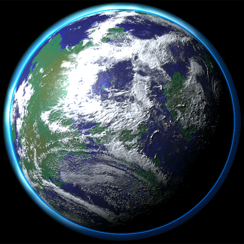
Earth is the third planet from the Sun and is the largest of the terrestrial planets. Unlike the other planets in the solar system that are named after classic deities the Earth’s name comes from the Anglo-Saxon worderda which means ground or soil. The Earth was formed approximately 4.54 billion years ago and is the only known planet to support life.
Planet Profile
Mass: 5,972,190,000,000,000 billion kg
Equatorial Diameter: 12,756 km
Polar Diameter: 12,714 km
Equatorial Circumference: 40,030 km
Known Moons: 1
Notable Moons: The Moon
Orbit Distance: 149,598,262 km (1 AU)
Orbit Period: 365.26 Earth days
Surface Temperature: -88 to 58°C
Equatorial Diameter: 12,756 km
Polar Diameter: 12,714 km
Equatorial Circumference: 40,030 km
Known Moons: 1
Notable Moons: The Moon
Orbit Distance: 149,598,262 km (1 AU)
Orbit Period: 365.26 Earth days
Surface Temperature: -88 to 58°C
Size Of The Earth Compared To The Moon

Facts About The Earth
The Earth’s rotation is gradually slowing:
This deceleration is happening almost imperceptibly, at approximately 17 milliseconds per hundred years, although the rate at which it occurs is not perfectly uniform. This has the effect of lengthening our days, but it happens so slowly that it could be as much as 140 million years before the length of a day will have increased to 25 hours.
This deceleration is happening almost imperceptibly, at approximately 17 milliseconds per hundred years, although the rate at which it occurs is not perfectly uniform. This has the effect of lengthening our days, but it happens so slowly that it could be as much as 140 million years before the length of a day will have increased to 25 hours.
The Earth was once believed to be the centre of the universe:
Due to the apparent movements of the Sun and planets in relation to their viewpoint, ancient scientists insisted that the Earth remained static, whilst other celestial bodies travelled in circular orbits around it. Eventually, the view that the Sun was at the centre of the universe was postulated by Copernicus, though this is also not the case.
Due to the apparent movements of the Sun and planets in relation to their viewpoint, ancient scientists insisted that the Earth remained static, whilst other celestial bodies travelled in circular orbits around it. Eventually, the view that the Sun was at the centre of the universe was postulated by Copernicus, though this is also not the case.
Earth has a powerful magnetic field:
This phenomenon is caused by the nickel-iron core of the planet, coupled with its rapid rotation. This field protects the Earth from the effects of solar wind.
This phenomenon is caused by the nickel-iron core of the planet, coupled with its rapid rotation. This field protects the Earth from the effects of solar wind.
There is only one natural satellite of the planet Earth:
As a percentage of the size of the body it orbits, the Moon is the largest satellite of any planet in our solar system. In real terms, however, it is only the fifth largest natural satellite.
As a percentage of the size of the body it orbits, the Moon is the largest satellite of any planet in our solar system. In real terms, however, it is only the fifth largest natural satellite.
Earth is the only planet not named after a god:
The other seven planets in our solar system are all named after Roman gods or goddesses. Although onlyMercury, Venus, Mars, Jupiter and Saturn were named during ancient times, because they were visible to the naked eye, the Roman method of naming planets was retained after the discovery of Uranus andNeptune.
The other seven planets in our solar system are all named after Roman gods or goddesses. Although onlyMercury, Venus, Mars, Jupiter and Saturn were named during ancient times, because they were visible to the naked eye, the Roman method of naming planets was retained after the discovery of Uranus andNeptune.
Of all the planets in our solar system, the Earth has the greatest density:
This varies according to the part of the planet; for example, the metallic core is denser than the crust. The average density of the Earth is approximately 5.52 grams per cubic centimetre.
This varies according to the part of the planet; for example, the metallic core is denser than the crust. The average density of the Earth is approximately 5.52 grams per cubic centimetre.
MARS

Mars is the fourth planet from the Sun. Named after the Roman god of war, and often described as the “Red Planet” due to its reddish appearance. Mars is a terrestrial planet with a thin atmosphere composed primarily of carbon dioxide.
Mars Contents: Facts – Missions – Moons – Pictures
Mars Features: Olympus Mons (Volcano) – Valles Marineris – Noctis Labyrinthus – Polar Ice Caps
Mars Characteristics: Size, Mass & Gravity – Orbit – Surface – Atmosphere – Composition
Mars Features: Olympus Mons (Volcano) – Valles Marineris – Noctis Labyrinthus – Polar Ice Caps
Mars Characteristics: Size, Mass & Gravity – Orbit – Surface – Atmosphere – Composition
Mars Planet Profile
Mass: 641,693,000,000,000 billion kg (0.107 x Earth)
Equatorial Diameter: 6,805
Polar Diameter: 6,755
Equatorial Circumference: 21,297 km
Known Moons: 2
Notable Moons: Phobos & Deimos
Orbit Distance: 227,943,824 km (1.38 AU)
Orbit Period: 686.98 Earth days (1.88 Earth years)
Surface Temperature: -87 to -5 °C
First Record: 2nd millennium BC
Recorded By: Egyptian astronomers


Facts About Mars
Mars and Earth have approximately the same landmass:
Even though Mars has only 15% of the Earth’s volume and just over 10% of the Earth’s mass, around two thirds of the Earth’s surface is covered in water. Martian surface gravity is only 37% of the Earth’s (meaning you could leap nearly three times higher on Mars).
Even though Mars has only 15% of the Earth’s volume and just over 10% of the Earth’s mass, around two thirds of the Earth’s surface is covered in water. Martian surface gravity is only 37% of the Earth’s (meaning you could leap nearly three times higher on Mars).
Mars is home to the tallest mountain in the solar system.
Olympus Mons, a shield volcano, is 21km high and 600km in diameter. Despite having formed over billions of years, evidence from volcanic lava flows is so recent many scientists believe it could still be active.
Olympus Mons, a shield volcano, is 21km high and 600km in diameter. Despite having formed over billions of years, evidence from volcanic lava flows is so recent many scientists believe it could still be active.
Only 18 missions to Mars have been successful
As of September 2014 there have been 40 missions to Mars, including orbiters, landers and rovers but not counting flybys. The most recent arrivals include the Mars Curiosity mission in 2012, the MAVEN mission, which arrived on September 22, 2014, followed by the Indian Space Research Organization’s MOM Mangalyaan orbiter, which arrived on September 24, 2014. The next missions to arrive will be the European Space Agency’s ExoMars mission, comprising an orbiter, lander, and a rover, followed by NASA’s InSight robotic lander mission, slated for launch in March 2016 and a planned arrival in September, 2016.”
As of September 2014 there have been 40 missions to Mars, including orbiters, landers and rovers but not counting flybys. The most recent arrivals include the Mars Curiosity mission in 2012, the MAVEN mission, which arrived on September 22, 2014, followed by the Indian Space Research Organization’s MOM Mangalyaan orbiter, which arrived on September 24, 2014. The next missions to arrive will be the European Space Agency’s ExoMars mission, comprising an orbiter, lander, and a rover, followed by NASA’s InSight robotic lander mission, slated for launch in March 2016 and a planned arrival in September, 2016.”
Mars has the largest dust storms in the solar system:
They can last for months and cover the entire planet. The seasons are extreme because its elliptical (oval-shaped) orbital path around the Sun is more elongated than most other planets in the solar system.
They can last for months and cover the entire planet. The seasons are extreme because its elliptical (oval-shaped) orbital path around the Sun is more elongated than most other planets in the solar system.
On Mars the Sun appears about half the size as it does on Earth:
At the closest point to the Sun, the Martian southern hemisphere leans towards the Sun, causing a short, intensely hot summer, while the northern hemisphere endures a brief, cold winter: at its farthest point from the Sun, the Martian northern hemisphere leans towards the Sun, causing a long, mild summer, while the southern hemisphere endures a lengthy, cold winter.
At the closest point to the Sun, the Martian southern hemisphere leans towards the Sun, causing a short, intensely hot summer, while the northern hemisphere endures a brief, cold winter: at its farthest point from the Sun, the Martian northern hemisphere leans towards the Sun, causing a long, mild summer, while the southern hemisphere endures a lengthy, cold winter.
Pieces of Mars have fallen to Earth:
Scientists have found tiny traces of Martian atmosphere within meteorites violently ejected from Mars, then orbiting the solar system amongst galactic debris for millions of years, before crash landing on Earth. This allowed scientists to begin studying Mars prior to launching space missions.
Scientists have found tiny traces of Martian atmosphere within meteorites violently ejected from Mars, then orbiting the solar system amongst galactic debris for millions of years, before crash landing on Earth. This allowed scientists to begin studying Mars prior to launching space missions.
Mars takes its name from the Roman god of war:
The ancient Greeks called the planet Ares, after their god of war; the Romans then did likewise, associating the planet’s blood-red colour with Mars, their own god of war. Interestingly, other ancient cultures also focused on colour – to China’s astronomers it was ‘the fire star’, whilst Egyptian priests called on ‘Her Desher’, or ‘the red one’. The red colour Mars is known for is due to the rock and dust covering its surface being rich in iron.
The ancient Greeks called the planet Ares, after their god of war; the Romans then did likewise, associating the planet’s blood-red colour with Mars, their own god of war. Interestingly, other ancient cultures also focused on colour – to China’s astronomers it was ‘the fire star’, whilst Egyptian priests called on ‘Her Desher’, or ‘the red one’. The red colour Mars is known for is due to the rock and dust covering its surface being rich in iron.
THE MAJOR PLANETS(non terrestrial planets)
The outer planets (sometimes called Jovian planets or gas giants) are huge planets swaddled in gas. They all have rings and all of plenty of moons each. Despite their size, only two of them are visible without telescopes: Jupiter and Saturn. Uranus and Neptune were the first planets discovered since antiquity, and showed astronomers the solar system was bigger than previously thought. The outer planets are further away, larger and made up mostly of gas.
JUPITER

The planet Jupiter is the fifth planet out from the Sun, and is two and a half times more massive than all the other planets in the solar system combined. It is made primarily of gases and is therefore known as a “gas giant”.
Jupiter Planet Profile
Mass: 1,898,130,000,000,000,000 billion kg (317.83 x Earth)
Equatorial Diameter: 142,984 km
Polar Diameter: 133,709 km
Equatorial Circumference: 439,264 km
Known Moons: 67
Notable Moons: Io, Europa, Ganymede, & Callisto more info
Known Rings: 4
Orbit Distance: 778,340,821 km (5.20 AU)
Orbit Period: 4,332.82 Earth days (11.86 Earth years)
Surface Temperature: -108°C
First Record: 7th or 8th century BC
Recorded By: Babylonian astronomers
Size Of Jupiter Compared To The Earth

Facts About Jupiter
Jupiter is the fourth brightest object in the solar system:
Only the Sun, Moon and Venus are brighter. It is one of five planets visible to the naked eye from Earth.
Only the Sun, Moon and Venus are brighter. It is one of five planets visible to the naked eye from Earth.
The ancient Babylonians were the first to record their sightings of Jupiter:
This was around the 7th or 8th century BC. Jupiter is named after the king of the Roman gods. To the Greeks, it represented Zeus, the god of thunder. The Mesopotamians saw Jupiter as the god Marduk and patron of the city of Babylon. Germanic tribes saw this planet as Donar, or Thor.
This was around the 7th or 8th century BC. Jupiter is named after the king of the Roman gods. To the Greeks, it represented Zeus, the god of thunder. The Mesopotamians saw Jupiter as the god Marduk and patron of the city of Babylon. Germanic tribes saw this planet as Donar, or Thor.
Jupiter has the shortest day of all the planets:
It turns on its axis once every 9 hours and 55 minutes. The rapid rotation flattens the planet slightly, giving it an oblate shape.
It turns on its axis once every 9 hours and 55 minutes. The rapid rotation flattens the planet slightly, giving it an oblate shape.
Jupiter orbits the Sun once every 11.8 Earth years:
From our point of view on Earth, it appears to move slowly in the sky, taking months to move from one constellation to another.
From our point of view on Earth, it appears to move slowly in the sky, taking months to move from one constellation to another.
Jupiter has unique cloud features:
The upper atmosphere of Jupiter is divided into cloud belts and zones. They are made primarily of ammonia crystals, sulfur, and mixtures of the two compounds.
The upper atmosphere of Jupiter is divided into cloud belts and zones. They are made primarily of ammonia crystals, sulfur, and mixtures of the two compounds.
The Great Red Spot is a huge storm on Jupiter:
It has raged for at least 350 years. It is so large that three Earths could fit inside it.
It has raged for at least 350 years. It is so large that three Earths could fit inside it.
Jupiter’s interior is made of rock, metal, and hydrogen compounds:
Below Jupiter’s massive atmosphere (which is made primarily of hydrogen), there are layers of compressed hydrogen gas, liquid metallic hydrogen, and a core of ice, rock, and metals.
Below Jupiter’s massive atmosphere (which is made primarily of hydrogen), there are layers of compressed hydrogen gas, liquid metallic hydrogen, and a core of ice, rock, and metals.
Jupiter’s moon Ganymede is the largest moon in the solar system:
Jupiter’s moons are sometimes called the Jovian satellites, the largest of these are Ganymeade, Callisto Io and Europa. Ganymeade measures 5,268 km across, making it larger than the planet Mercury.
Jupiter’s moons are sometimes called the Jovian satellites, the largest of these are Ganymeade, Callisto Io and Europa. Ganymeade measures 5,268 km across, making it larger than the planet Mercury.
Jupiter has a thin ring system:
Its rings are composed mainly of dust particles ejected from some of Jupiter’s smaller worlds during impacts from incoming comets and asteroids. The ring system begins some 92,000 kilometres above Jupiter’s cloud tops and stretches out to more than 225,000 km from the planet. They are between 2,000 to 12,500 kilometres thick.
Its rings are composed mainly of dust particles ejected from some of Jupiter’s smaller worlds during impacts from incoming comets and asteroids. The ring system begins some 92,000 kilometres above Jupiter’s cloud tops and stretches out to more than 225,000 km from the planet. They are between 2,000 to 12,500 kilometres thick.
Eight spacecraft have visited Jupiter:
Pioneer 10 and 11, Voyager 1 and 2, Galileo, Cassini, Ulysses, and New Horizons missions. The Juno mission is its way to Jupiter and will arrive in July 2016. Other future missions may focus on the Jovian moons Europa, Ganymede, and Callisto, and their subsurface oceans.
Pioneer 10 and 11, Voyager 1 and 2, Galileo, Cassini, Ulysses, and New Horizons missions. The Juno mission is its way to Jupiter and will arrive in July 2016. Other future missions may focus on the Jovian moons Europa, Ganymede, and Callisto, and their subsurface oceans.
SATURN
 Saturn is the sixth planet from the Sun and the most distant that can be seen with the naked eye. It is best known for its fabulous ring system that was discovered in 1610 by the astronomer Galileo Galilei.
Planet Profile
Mass: 568,319,000,000,000,000 billion kg (95.16 x Earth)
Equatorial Diameter: 120,536 km
Polar Diameter: 108,728 km
Equatorial Circumference: 365,882 km
Known Moons: 62
Notable Moons: Titan, Rhea & Enceladus more info
Known Rings: 30+ (7 Groups)
Orbit Distance: 1,426,666,422 km (9.58 AU)
Orbit Period: 10,755.70 Earth days (29.45 Earth years)
Surface Temperature: -139 °C
First Record: 8th century BC
Recorded By: Assyrians
Size Of Saturn Compared To The Earth

Facts About Saturn
Saturn can be seen with the naked eye:
It is the fifth brightest object in the solar system and is also easily studied through binoculars or a small telescope.
It is the fifth brightest object in the solar system and is also easily studied through binoculars or a small telescope.
Saturn was known to the ancients, including the Babylonians and Far Eastern observers:
It is named for the Roman god Saturnus, and was known to the Greeks as Cronus.
It is named for the Roman god Saturnus, and was known to the Greeks as Cronus.
Saturn is the flattest planet:
Its polar diameter is 90% of its equatorial diameter, this is due to its low density and fast rotation. Saturn turns on its axis once every 10 hours and 34 minutes giving it the second-shortest day of any of the solar system’s planets.
Its polar diameter is 90% of its equatorial diameter, this is due to its low density and fast rotation. Saturn turns on its axis once every 10 hours and 34 minutes giving it the second-shortest day of any of the solar system’s planets.
Saturn orbits the Sun once every 29.4 Earth years:
Its slow movement against the backdrop of stars earned it the nickname of “Lubadsagush” from the ancient Assyrians. The name means “oldest of the old”.
Its slow movement against the backdrop of stars earned it the nickname of “Lubadsagush” from the ancient Assyrians. The name means “oldest of the old”.
Saturn’s upper atmosphere is divided into bands of clouds:
The top layers are mostly ammonia ice. Below them, the clouds are largely water ice. Below are layers of cold hydrogen and sulfur ice mixtures.
The top layers are mostly ammonia ice. Below them, the clouds are largely water ice. Below are layers of cold hydrogen and sulfur ice mixtures.
Saturn has oval-shaped storms similar to Jupiter’s:
The region around its north pole has a hexagonal-shaped pattern of clouds. Scientists think this may be a wave pattern in the upper clouds. The planet also has a vortex over its south pole that resembles a hurricane-like storm.
The region around its north pole has a hexagonal-shaped pattern of clouds. Scientists think this may be a wave pattern in the upper clouds. The planet also has a vortex over its south pole that resembles a hurricane-like storm.
Saturn is made mostly of hydrogen:
It exists in layers that get denser farther into the planet. Eventually, deep inside, the hydrogen becomes metallic. At the core lies a hot interior.
It exists in layers that get denser farther into the planet. Eventually, deep inside, the hydrogen becomes metallic. At the core lies a hot interior.
Saturn has the most extensive rings in the solar system:
The Saturnian rings are made mostly of chunks of ice and small amounts of carbonaceous dust. The rings stretch out more than 120,700 km from the planet, but are are amazingly thin: only about 20 meters thick.
The Saturnian rings are made mostly of chunks of ice and small amounts of carbonaceous dust. The rings stretch out more than 120,700 km from the planet, but are are amazingly thin: only about 20 meters thick.
Saturn has 150 moons and smaller moonlets:
All are frozen worlds. The largest moons are Titan and Rhea. Enceladus appears to have an ocean below its frozen surface.
All are frozen worlds. The largest moons are Titan and Rhea. Enceladus appears to have an ocean below its frozen surface.
Titan is a moon with complex and dense nitrogen-rich atmosphere:
It is composed mostly of water ice and rock. Its frozen surface has lakes of liquid methane and landscapes covered with frozen nitrogen. Planetary scientists consider Titan to be a possible harbour for life, but not Earth-like life.
It is composed mostly of water ice and rock. Its frozen surface has lakes of liquid methane and landscapes covered with frozen nitrogen. Planetary scientists consider Titan to be a possible harbour for life, but not Earth-like life.
Four spacecraft have visited Saturn:
Pioneer 11, Voyager 1 and 2, and the Cassini-Huygens mission have all studied the planet. Cassini continues to orbit Saturn, sending back a wealth of data about the planet, its moons, and rings.
Pioneer 11, Voyager 1 and 2, and the Cassini-Huygens mission have all studied the planet. Cassini continues to orbit Saturn, sending back a wealth of data about the planet, its moons, and rings.
URANUS

Uranus is the seventh planet from the Sun. It’s not visible to the naked eye, and became the first planet discovered with the use of a telescope. Uranus is tipped over on its side with an axial tilt of 98 degrees. It is often described as “rolling around the Sun on its side.”
Uranus Planet Profile
Mass: 86,810,300,000,000,000 billion kg (14.536 x Earth)
Equatorial Diameter: 51,118 km
Polar Diameter: 49,946 km
Equatorial Circumference: 159,354 km
Known Moons: 27
Notable Moons: Oberon, Titania, Miranda, Ariel & Umbriel more info
Known Rings: 13
Orbit Distance: 2,870,658,186 km (19.22 AU)
Orbit Period: 30,687.15 Earth days (84.02 Earth years)
Surface Temperature: -197 °C
Discover Date: March 13th 1781
Discovered By: William Herschel
Size Of Uranus Compared To The Earth

Facts About Uranus
Uranus was officially discovered by Sir William Herschel in 1781:
It is too dim to have been seen by the ancients. At first Herschel thought it was a comet, but several years later it was confirmed as a planet. Herscal tried to have his discovery named “Georgian Sidus” after King George III. The name Uranus was suggested by astronomer Johann Bode. The name comes from the ancient Greek deity Ouranos.
It is too dim to have been seen by the ancients. At first Herschel thought it was a comet, but several years later it was confirmed as a planet. Herscal tried to have his discovery named “Georgian Sidus” after King George III. The name Uranus was suggested by astronomer Johann Bode. The name comes from the ancient Greek deity Ouranos.
Uranus turns on its axis once every 17 hours, 14 minutes:
The planet rotates in a retrograde direction, opposite to the way Earth and most other planets turn.
The planet rotates in a retrograde direction, opposite to the way Earth and most other planets turn.
Uranus makes one trip around the Sun every 84 Earth years:
During some parts of its orbit one or the other of its poles point directly at the Sun and get about 42 years of direct sunlight. The rest of the time they are in darkness.
During some parts of its orbit one or the other of its poles point directly at the Sun and get about 42 years of direct sunlight. The rest of the time they are in darkness.
Uranus is often referred to as an “ice giant” planet:
Like the other gas giants, it has a hydrogen upper layer, which has helium mixed in. Below that is an icy “mantle, which surrounds a rock and ice core. The upper atmosphere is made of water, ammonia and the methane ice crystals that give the planet its pale blue color.
Like the other gas giants, it has a hydrogen upper layer, which has helium mixed in. Below that is an icy “mantle, which surrounds a rock and ice core. The upper atmosphere is made of water, ammonia and the methane ice crystals that give the planet its pale blue color.
Uranus is the Coldest Planet:
With minimum atmospheric temperature of -224°C Uranus is the coldest planet in the solar system. The upper atmosphere of Uranus is covered by a methane haze. This hides the storms that take place in the cloud decks.
With minimum atmospheric temperature of -224°C Uranus is the coldest planet in the solar system. The upper atmosphere of Uranus is covered by a methane haze. This hides the storms that take place in the cloud decks.
Uranus has two sets of rings of very thin set of dark colored rings:
The ring particles are small, ranging from a dust-sized particles to small boulders. There are nine inner rings and two outer rings. They probably formed when one or more of Uranus’s moons were broken up in an impact. The first set of rings was discovered in 1977 and the second set was discovered in 2003 by the Hubble Space Telescope.
The ring particles are small, ranging from a dust-sized particles to small boulders. There are nine inner rings and two outer rings. They probably formed when one or more of Uranus’s moons were broken up in an impact. The first set of rings was discovered in 1977 and the second set was discovered in 2003 by the Hubble Space Telescope.
Uranus’ moons are named after characters created by William Shakespeare and Alaxander Pope:
These include Oberon, Titania and Miranda. All are frozen worlds with dark surfaces. Some are ice and rock mixtures. The most interesting Uranian moon is Miranda; it has ice canyons, terraces, and other strange-looking surface areas.
These include Oberon, Titania and Miranda. All are frozen worlds with dark surfaces. Some are ice and rock mixtures. The most interesting Uranian moon is Miranda; it has ice canyons, terraces, and other strange-looking surface areas.
Only one spacecraft has flown by Uranus:
In 1986, the Voyager 2 spacecraft swept past the planet at a distance of 81,500 km. It returned the first close-up images of the planet, its moons, and rings.
In 1986, the Voyager 2 spacecraft swept past the planet at a distance of 81,500 km. It returned the first close-up images of the planet, its moons, and rings.
NEPTUNE

Neptune is the eighth planet from the Sun and is the most distant planet from the Sun. This gas giantplanet may have formed much closer to the Sun in early solar system history before migrating to its present position.
Planet Profile
Mass: 102,410,000,000,000,000 billion kg (17.15x Earth)
Equatorial Diameter: 49,528 km
Polar Diameter: 48,682 km
Equatorial Circumference: 155,600 km
Known Moons: 14
Notable Moons: Triton more info
Known Rings: 5
Orbit Distance: 4,498,396,441 km (30.10 AU)
Orbit Period: 60,190.03 Earth days (164.79 Earth years)
Surface Temperature: -201 °C
Discover Date: September 23rd 1846
Discovered By: Urbain Le Verrier & Johann Galle
Size Of Neptune Compared To The Earth

Facts About Neptune
Neptune was not known to the ancients:
It is not visible to the naked eye and was first observed in 1846. Its position was determined using mathematical predictions. It was named after the Roman god of the sea.
It is not visible to the naked eye and was first observed in 1846. Its position was determined using mathematical predictions. It was named after the Roman god of the sea.
Neptune spins on its axis very rapidly:
Its equatorial clouds take 18 hours to make one rotation. This is because Neptune is not solid body.
Its equatorial clouds take 18 hours to make one rotation. This is because Neptune is not solid body.
Neptune makes one trip around the Sun every 164.8 Earth years:
During some parts of its orbit one or the other of its poles point directly at the Sun and get about 42 years of direct sunlight. The rest of the time they are in darkness.
During some parts of its orbit one or the other of its poles point directly at the Sun and get about 42 years of direct sunlight. The rest of the time they are in darkness.
Neptune is the smallest of the ice giants:
Despite being smaller than Uranus, Neptune has a greater mass. Below its heavy atmosphere, Uranus is made of layers of hydrogen, helium, and methane gases. They enclose a layer of water, ammonia and methane ice. The inner core of the planet is made of rock.
Despite being smaller than Uranus, Neptune has a greater mass. Below its heavy atmosphere, Uranus is made of layers of hydrogen, helium, and methane gases. They enclose a layer of water, ammonia and methane ice. The inner core of the planet is made of rock.
The atmosphere of Neptune is made of hydrogen and helium, with some methane:
The methane absorbs red light, which makes the planet appear a lovely blue. High, thin clouds drift in the upper atmosphere.
The methane absorbs red light, which makes the planet appear a lovely blue. High, thin clouds drift in the upper atmosphere.
Neptune has a very active climate:
Large storms whirl through its upper atmosphere, and high-speed winds track around the planet at up 600 meters per second. One of the largest storms ever seen was recorded in 1989. It was called the Great Dark Spot. It lasted about five years.
Large storms whirl through its upper atmosphere, and high-speed winds track around the planet at up 600 meters per second. One of the largest storms ever seen was recorded in 1989. It was called the Great Dark Spot. It lasted about five years.
Neptune has a very thin collection of rings:
They are likely made up of ice particles mixed with dust grains and possibly coated with a carbon-based substance.
They are likely made up of ice particles mixed with dust grains and possibly coated with a carbon-based substance.
Neptune has 14 moons:
The most interesting moon is Triton, a frozen world that is spewing nitrogen ice and dust particles out from below its surface. It was likely captured by the gravitational pull of Neptune. It is probably the coldest world in the solar system.
The most interesting moon is Triton, a frozen world that is spewing nitrogen ice and dust particles out from below its surface. It was likely captured by the gravitational pull of Neptune. It is probably the coldest world in the solar system.
Only one spacecraft has flown by Neptune:
In 1989, the Voyager 2 spacecraft swept past the planet. It returned the first close-up images of the Neptune system. The NASA/ESA Hubble Space Telescope has also studied this planet, as have a number of ground-based telescopes.
In 1989, the Voyager 2 spacecraft swept past the planet. It returned the first close-up images of the Neptune system. The NASA/ESA Hubble Space Telescope has also studied this planet, as have a number of ground-based telescopes.
PLUTO

Discovered in 1930, Pluto is the second closest dwarf planet to the Sun and was at one point classified as the ninth planet. Pluto is also the second most massive dwarf planet with Eris being the most massive.
Pluto Dwarf Planet Profile
Mass: 13,050,000,000,000 billion kg (0.00218 x Earth)
Diameter: 2,368 km (+- 20km)
Known Moons: 5
Notable Moons: Charon, Nix, Hydra, Kerberos and Styx more info
Orbit Distance: 5,874,000,000 km (39.26 AU)
Orbit Period: 246.04 Earth years
Surface Temperature: -229°C
Discovery Date: 18th February 1930
Discovered By: Clyde W. Tombaugh
Diameter: 2,368 km (+- 20km)
Known Moons: 5
Notable Moons: Charon, Nix, Hydra, Kerberos and Styx more info
Orbit Distance: 5,874,000,000 km (39.26 AU)
Orbit Period: 246.04 Earth years
Surface Temperature: -229°C
Discovery Date: 18th February 1930
Discovered By: Clyde W. Tombaugh
Size Of Pluto Compared To The Earth

Facts About Pluto
Pluto is named after the Greek god of the underworld:
This is a later name for the more well known Hades and was proposed by Venetia Burney an eleven year old schoolgirl from Oxford, England.
This is a later name for the more well known Hades and was proposed by Venetia Burney an eleven year old schoolgirl from Oxford, England.
Pluto was reclassified from a planet to a dwarf planet in 2006:
This is when the IAU formalised the definition of a planet as “A planet is a celestial body that (a) is in orbit around the Sun, (b) has sufficient mass for its self-gravity to overcome rigid body forces so that it assumes a hydrostatic equilibrium (nearly round) shape, and (c) has cleared the neighbourhood around its orbit.”
This is when the IAU formalised the definition of a planet as “A planet is a celestial body that (a) is in orbit around the Sun, (b) has sufficient mass for its self-gravity to overcome rigid body forces so that it assumes a hydrostatic equilibrium (nearly round) shape, and (c) has cleared the neighbourhood around its orbit.”
Pluto was discovered on February 18th, 1930 by the Lowell Observatory:
For the 76 years between Pluto being discovered and the time it was reclassified as a dwarf planet it completed under a third of its orbit around the Sun.
For the 76 years between Pluto being discovered and the time it was reclassified as a dwarf planet it completed under a third of its orbit around the Sun.
Pluto has five known moons:
They are Charon (discovered in 1978,), Hydra and Nix (both discovered in 2005), Kerberos originally P4 (discovered 2011) and Styx originally P5 (discovered 2012) official designations S/2011 (134340) 1 and S/2012 (134340) 1.
They are Charon (discovered in 1978,), Hydra and Nix (both discovered in 2005), Kerberos originally P4 (discovered 2011) and Styx originally P5 (discovered 2012) official designations S/2011 (134340) 1 and S/2012 (134340) 1.
Pluto may be the largest dwarf planet:
Or it could be Eris. Currently the most accurate measurements give Eris an average diameter of 2,326km with a margin of error of 12km, while Pluto’s diameter is 2,368km with a 20km margin of error, however due to Pluto’s atmosphere it is difficult to say for certain.
Or it could be Eris. Currently the most accurate measurements give Eris an average diameter of 2,326km with a margin of error of 12km, while Pluto’s diameter is 2,368km with a 20km margin of error, however due to Pluto’s atmosphere it is difficult to say for certain.
Pluto is smaller than a number of moons:
These are Ganymede, Titan, Callisto, Io, Europa, Triton, and the Earth’s moon. Pluto has 66% of the diameter of the Earth’s moon and 18% of its mass.
These are Ganymede, Titan, Callisto, Io, Europa, Triton, and the Earth’s moon. Pluto has 66% of the diameter of the Earth’s moon and 18% of its mass.
Pluto has a eccentric and inclined orbit:
This takes it between 4.4 and 7.4 billion km from the Sun meaning Pluto is periodically closer to the Sun than Neptune.
This takes it between 4.4 and 7.4 billion km from the Sun meaning Pluto is periodically closer to the Sun than Neptune.
No spacecraft have visited Pluto:
Though in July 2015 the spacecraft New Horizons, which was launched in 2006, is scheduled to fly by Pluto on its way to the Kuiper Belt.
Though in July 2015 the spacecraft New Horizons, which was launched in 2006, is scheduled to fly by Pluto on its way to the Kuiper Belt.
Pluto’s location was predicted by Percival Lowell in 1915:
The prediction came from deviations he initially observed in 1905 in the orbits of Uranus and Neptune.
The prediction came from deviations he initially observed in 1905 in the orbits of Uranus and Neptune.
Pluto sometimes has an atmosphere:
During Pluto’s elliptical when Pluto is closer to the Sun its surface ice thaws and forms a thin atmosphere primarily of nitrogen with a little methane and carbon monoxide. When Pluto travels away from the Sun the atmosphere then freezes back to its solid state.
During Pluto’s elliptical when Pluto is closer to the Sun its surface ice thaws and forms a thin atmosphere primarily of nitrogen with a little methane and carbon monoxide. When Pluto travels away from the Sun the atmosphere then freezes back to its solid state.
MOON

The Moon (or Luna) is the Earth’s only natural satellite and was formed 4.6 billion years ago around some 30–50 million years after the formation of the solar system. The Moon is in synchronous rotation with Earth meaning the same side is always facing the Earth. The first unmanned mission to the Moon was in 1959 by the Soviet Lunar Program with the first manned landing being Apollo 11 in 1969.
Moon Profile
Circumference at Equator: 10,917.0 km
Diameter: 3,475 km
Mass: 73,476,730,924,573,500 million kg (0.0123 x Earth)
Orbits: The Earth
Average Distance from Earth: 384,400 km
Length of Orbit: 27.3 Earth days
Surface Temperature: -233 to 123 °C
Diameter: 3,475 km
Mass: 73,476,730,924,573,500 million kg (0.0123 x Earth)
Orbits: The Earth
Average Distance from Earth: 384,400 km
Length of Orbit: 27.3 Earth days
Surface Temperature: -233 to 123 °C
Size Of The Moon Compared To The Earth
Facts About The Moon
The dark side of the moon is a myth:
In reality both sides of the Moon see the same amount of sunlight however only one face of the Moon is ever seen from Earth this is because the Moon rotates around on its own axis in exactly the same time it takes to orbit the Earth, meaning the same side is always facing the Earth. The side we see is lit by reflected sunlight, while the side facing away from Earth lies in darkness and has only been seen by the human eye from a spacecraft.
In reality both sides of the Moon see the same amount of sunlight however only one face of the Moon is ever seen from Earth this is because the Moon rotates around on its own axis in exactly the same time it takes to orbit the Earth, meaning the same side is always facing the Earth. The side we see is lit by reflected sunlight, while the side facing away from Earth lies in darkness and has only been seen by the human eye from a spacecraft.
The rise and fall of the tides on Earth is caused by the Moon:
There are two bulges in the Earth due to the gravitational pull that the Moon exerts; one on the side facing the Moon, and the other on the opposite side that faces away from the Moon, The bulges move around the oceans as the Earth rotates, causing high and low tides around the globe.
There are two bulges in the Earth due to the gravitational pull that the Moon exerts; one on the side facing the Moon, and the other on the opposite side that faces away from the Moon, The bulges move around the oceans as the Earth rotates, causing high and low tides around the globe.
The Moon is drifting away from the Earth:
The Moon is moving approximately 3.8 cm away from our planet every year. It is estimated that it will continue to do so for around 50 billion years. By the time that happens, the Moon will be taking around 47 days to orbit the Earth instead of the current 27.3 days.
The Moon is moving approximately 3.8 cm away from our planet every year. It is estimated that it will continue to do so for around 50 billion years. By the time that happens, the Moon will be taking around 47 days to orbit the Earth instead of the current 27.3 days.
A person would weigh much less on the Moon:
The Moon has much weaker gravity than Earth, due to its smaller mass, so you would weigh about one sixth (16.5%) of your weight on Earth. This is why the lunar astronauts could leap and bound so high in the air.
The Moon has much weaker gravity than Earth, due to its smaller mass, so you would weigh about one sixth (16.5%) of your weight on Earth. This is why the lunar astronauts could leap and bound so high in the air.
The Moon has only been walked on by 12 people; all American males:
The first man to set foot on the Moon in 1969 was Neil Armstrong on the Apollo 11 mission, while the last man to walk on the Moon in 1972 was Gene Cernan on the Apollo 17 mission. Since then the Moon has only be visited by unmanned vehicles.
The first man to set foot on the Moon in 1969 was Neil Armstrong on the Apollo 11 mission, while the last man to walk on the Moon in 1972 was Gene Cernan on the Apollo 17 mission. Since then the Moon has only be visited by unmanned vehicles.
The Moon has no atmosphere:
This means that the surface of the Moon is unprotected from cosmic rays, meteorites and solar winds, and has huge temperature variations. The lack of atmosphere means no sound can be heard on the Moon, and the sky always appears black.
This means that the surface of the Moon is unprotected from cosmic rays, meteorites and solar winds, and has huge temperature variations. The lack of atmosphere means no sound can be heard on the Moon, and the sky always appears black.
The Moon has quakes:
These are caused by the gravitational pull of the Earth. Lunar astronauts used seismographs on their visits to the Moon, and found that small moonquakes occurred several kilometres beneath the surface, causing ruptures and cracks. Scientists think the Moon has a molten core, just like Earth.
These are caused by the gravitational pull of the Earth. Lunar astronauts used seismographs on their visits to the Moon, and found that small moonquakes occurred several kilometres beneath the surface, causing ruptures and cracks. Scientists think the Moon has a molten core, just like Earth.
The first spacecraft to reach the Moon was Luna 1 in 1959:
This was a Soviet craft, which was launched from the USSR. It passed within 5995 km of the surface of the Moon before going into orbit around the Sun.
This was a Soviet craft, which was launched from the USSR. It passed within 5995 km of the surface of the Moon before going into orbit around the Sun.
The Moon is the fifth largest natural satellite in the Solar System:
At 3,475 km in diameter, the Moon is much smaller than the major moons of Jupiter and Saturn. Earth is about 80 times the volume than the Moon, but both are about the same age. A prevailing theory is that the Moon was once part of the Earth, and was formed from a chunk that broke away due to a huge object colliding with Earth when it was relatively young.
At 3,475 km in diameter, the Moon is much smaller than the major moons of Jupiter and Saturn. Earth is about 80 times the volume than the Moon, but both are about the same age. A prevailing theory is that the Moon was once part of the Earth, and was formed from a chunk that broke away due to a huge object colliding with Earth when it was relatively young.
The Moon will be visited by man in the near future:
NASA plans to return astronauts to the moon to set up a permanent space station. Mankind may once again walk on the moon in 2019, if all goes according to plan.
NASA plans to return astronauts to the moon to set up a permanent space station. Mankind may once again walk on the moon in 2019, if all goes according to plan.
During the 1950’s the USA considered detonating a nuclear bomb on the Moon:
The secret project was during the height cold war was known as “A Study of Lunar Research Flights” or “Project A119″ and meant as a show of strength at a time they were lagging behind in the space race.
The secret project was during the height cold war was known as “A Study of Lunar Research Flights” or “Project A119″ and meant as a show of strength at a time they were lagging behind in the space race.
Phases Of The Moon

COMET

What Is A Comet?
A comet is a very small solar system body made mostly of ices mixed with smaller amounts of dust and rock. Most comets are no larger than a few kilometres across. The main body of the comet is called the nucleus, and it can contain water, methane, nitrogen and other ices.
When a comet is heated by the Sun, its ices begin to sublimate (similar to the way dry ice “fizzes” when you leave it in sunlight). The mixture of ice crystals and dust blows away from the comet nucleus in the solar wind, creating a pair of tails. The dust tail is what we normally see when we view comets from Earth.
A plasma tail also forms when molecules of gas are “excited” by interaction with the solar wind. The plasma tail is not normally seen with the naked eye, but can be imaged. Comets normally orbit the Sun, and have their origins in the Oort Cloud and Kuiper Belt regions of the outer solar system.
Comet Naming
Comets come in several categories. The most common are periodic and non-periodic.
In the past, comets were named for their discoverers, such as Comet Halley for Sir Edmond Halley. In modern times, comet names are governed by rules set forth by the International Astronomical Union (IAU). A comet is given an official designation, and can also be identified by the last names of up to three independent discoverers.
Here’s how it works. Once a comet has been confirmed, the following naming rules are followed. First, if the comet is a periodic comet, then it is indicated with a P/ followed by the year of its discovery, a letter indicating the half-month in which it was discovered, followed by a number indicating its order of discovery. So, for example, the second periodic comet found in the first half of January, 2015 would be called P/2015 A2.
A non-periodic comet would be indicated with a C/ followed by the year of its discovery, a letter indicating the half-month in which it was discovered, followed by a number indicating its order of discovery.
If a comet is independently discovered by three people named Smith, Jones, and Petersen, it could also be called Comet Smith-Jones-Petersen, in addition to its formal designation. Today, many comets are found through automated instrument searches, and so the formal designations are more commonly used.
Famous Comets
Well-known comets include the non-periodic comets Hale-Bopp (C/1995 O1), Hyakutake (C/1996 B2), McNaught (C2006 P1), and Lovejoy (C/2011 W3). These flared brightly in our skies and then faded into obscurity.
In addition, Comet Shoemaker-Levy 9 (D/1993 F2) was spotted after it had broken up after a close call with Jupiter. (The D in its proper designation means it has disappeared or is determined to no longer exist). More than a year later, the pieces of the comet crashed into Jupiter.
The periodic Comet Halley (1P/Halley) is the most famous in history. It returns to the inner solar system once every 76 years. Other well-known periodic comets include 2P/Encke, which appears ever 3.3 years and 9P/Tempel (Tempel 2), which was visited by the Deep Impact and Stardust probes, and makes perihelion around the Sun every 5.5 years.
Facts About Comets
There are many misconceptions about comets, which are simply pieces of solar system ices travelling in orbit around the Sun. Here are some fascinating and true facts about comets.
- The nucleus of a comet is made of ice and can be as small as a few meters across to giant boulders a few kilometres across.
- The closest point in a comet’s orbit to the Sun is called “perihelion”. The most distant point is called “aphelion”.
- As a comet gets closer to the Sun, it begins to experience heat. That causes some of its ices to sublimate (similar to dry ice sizzling in sunlight). If the ice is close to the comet’s surface, it may form a small “jet” of material spewing out from the comet like a mini-geyser.
- Material streams from comets and populates the comet’s orbit. If Earth (or another planet) happens to move through that stream, those particles fall to Earth as meteor showers.
- As a comet gets close to the Sun, it loses some of its mass due to the sublimation. If a comet goes around enough times, it will eventually break up. Comets also break up if they come TOO close to the Sun or another planet in their orbits.
- Comets are usually made of frozen water and supercold methane, ammonia and carbon dioxide ices. Those are mixed with rock, dust, and other metallic bits of solar system debris.
- Comets have two tails: a dust tail (which you can see with the naked eye) and a plasma tail, which is easily photographed but difficult to see with your eyes.
- Comet orbits are usually elliptical.
- Many comets formed in the Oort Cloud and Kuiper Belts, two of the outermost regions of the solar system.
- Comets are not spaceships or alien bases. They are fascinating bits of solar system material that date back to the formation of the Sun and planets.
SUN
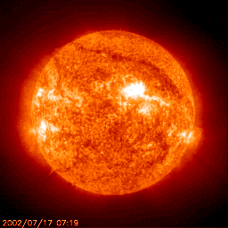
The Sun or Sol, is the star at the centre of our solar system and is responsible for the Earth’s climate and weather. The Sun is an almost perfect sphere with a difference of just 10km in diameter between the poles and the equator. The average radius of the Sun is 695,508 km (109.2 x that of the Earth) of which 20–25% is the core.
Star Profile
Age: 4.6 Billion Years
Type: Yellow Dwarf (G2V)
Diameter: 1,392,684 km
Circumference at Equator: 4,370,005.6 km
Mass: 1,989,100,000,000,000,000,000 billion kg (333,060 x Earth)
Surface Temperature: 5500 °C
Type: Yellow Dwarf (G2V)
Diameter: 1,392,684 km
Circumference at Equator: 4,370,005.6 km
Mass: 1,989,100,000,000,000,000,000 billion kg (333,060 x Earth)
Surface Temperature: 5500 °C
Size Of The Sun

Facts About The Sun
One million Earths could fit inside the Sun:
If a hollow Sun was filled up with spherical Earths then around 960,000 would fit inside. On the other hand if these Earths were squished inside with no wasted space then around 1,300,000 would fit inside. The Sun’s surface area is 11,990 times that of the Earth’s.
If a hollow Sun was filled up with spherical Earths then around 960,000 would fit inside. On the other hand if these Earths were squished inside with no wasted space then around 1,300,000 would fit inside. The Sun’s surface area is 11,990 times that of the Earth’s.
Eventually, the Sun will consume the Earth:
When all the Hydrogen has been burned, the Sun will continue for about 130 million more years, burning Helium, during which time it will expand to the point that it will engulf Mercury and Venus and the Earth. At this stage it will have become a red giant
When all the Hydrogen has been burned, the Sun will continue for about 130 million more years, burning Helium, during which time it will expand to the point that it will engulf Mercury and Venus and the Earth. At this stage it will have become a red giant
The Sun will one day be about the size of Earth:
After its red giant phase, the Sun will collapse, retaining its enormous mass, but containing the approximate volume of our planet. When this happens, it will be called a white dwarf.
After its red giant phase, the Sun will collapse, retaining its enormous mass, but containing the approximate volume of our planet. When this happens, it will be called a white dwarf.
The Sun contains 99.86% of the mass in the Solar System:
The mass of the Sun is approximately 330,000 times greater than that of Earth. It is almost three quarters Hydrogen, whilst most of the remaining mass is Helium.
The mass of the Sun is approximately 330,000 times greater than that of Earth. It is almost three quarters Hydrogen, whilst most of the remaining mass is Helium.
The Sun is an almost perfect sphere:
There is only a 10 kilometre difference in its polar diameter compared to its equatorial diameter. Considering the vast expanse of the Sun, this means it is the closest thing to a perfect sphere that has been observed in nature.
There is only a 10 kilometre difference in its polar diameter compared to its equatorial diameter. Considering the vast expanse of the Sun, this means it is the closest thing to a perfect sphere that has been observed in nature.
Light from the Sun takes eight minutes to reach Earth:
With a mean average distance of 150 million kilometres from Earth and with light travelling at 300,000 kilometres per second, dividing one by the other gives us an approximate time of 500 seconds, or eight minutes and 20 seconds. Although this energy reaches Earth in a few minutes, it will already have taken millions of years to travel from the Sun’s core to its surface.
With a mean average distance of 150 million kilometres from Earth and with light travelling at 300,000 kilometres per second, dividing one by the other gives us an approximate time of 500 seconds, or eight minutes and 20 seconds. Although this energy reaches Earth in a few minutes, it will already have taken millions of years to travel from the Sun’s core to its surface.
The Sun travels at 220 kilometres per second:
The Sun is 24,000-26,000 light years from the galactic centre and it takes the Sun 225-250 million years to complete an orbit of the centre of the Milky Way.
The Sun is 24,000-26,000 light years from the galactic centre and it takes the Sun 225-250 million years to complete an orbit of the centre of the Milky Way.
The distance from the Sun to Earth changes throughout the year:
Because the Earth travels on an elliptical orbit around the Sun, the distance between the two bodies varies from 147 to 152 million kilometres. The distance between the Earth and the Sun is called an Astronomical Unit (AU).
Because the Earth travels on an elliptical orbit around the Sun, the distance between the two bodies varies from 147 to 152 million kilometres. The distance between the Earth and the Sun is called an Astronomical Unit (AU).
The Sun is middle-aged:
At around 4.5 billion years old, the Sun has already burned off about half of its store of Hydrogen. It has enough left to continue to burn Hydrogen for approximately another 5 billion years. The Sun is currently a type of star known as a Yellow Dwarf
At around 4.5 billion years old, the Sun has already burned off about half of its store of Hydrogen. It has enough left to continue to burn Hydrogen for approximately another 5 billion years. The Sun is currently a type of star known as a Yellow Dwarf
The Sun has a very strong magnetic field:
Solar flares occur when magnetic energy is released by the Sun during magnetic storms, which we see as sunspots. In sunspots, the magnetic lines are twisted and they spin, much like a tornado would on Earth.
Solar flares occur when magnetic energy is released by the Sun during magnetic storms, which we see as sunspots. In sunspots, the magnetic lines are twisted and they spin, much like a tornado would on Earth.
The temperature inside the Sun can reach 15 million degrees Celsius:
At the Sun’s core, energy is generated by nuclear fusion, as Hydrogen converts to Helium. Because hot objects generally expand, the Sun would explode like a giant bomb if it weren’t for its enormous gravitational force.
At the Sun’s core, energy is generated by nuclear fusion, as Hydrogen converts to Helium. Because hot objects generally expand, the Sun would explode like a giant bomb if it weren’t for its enormous gravitational force.
The Sun generates solar wind:
This is a stream of charged particles, which travels through the Solar System at approximately 450 kilometres per second. Solar wind occurs where the magnetic field of the Sun extends into space instead of following its surface.
This is a stream of charged particles, which travels through the Solar System at approximately 450 kilometres per second. Solar wind occurs where the magnetic field of the Sun extends into space instead of following its surface.
Satellites
Name  Distance from Sun  Type
Mercury  57,909,227 km (0.39 AU)  Planet
Venus  108,209,475 km (0.73 AU) Planet
Earth  149,598,262 km (1 AU)  Planet
Mars  227,943,824 km (1.38 AU) Planet
Ceres  413,700,000 km (2.77 AU) Dwarf Planet
Jupiter  778,340,821 km (5.20 AU) Planet
Saturn  1,426,666,422 km (9.58 AU) Planet
Uranus  2,870,658,186 km (19.22 AU) Planet
Neptune  4,498,396,441 km (30.10 AU) Planet
Pluto  5,874,000,000 km (39.26 AU) Dwarf Planet
Haumea  6,452,000,000 km (43.13 AU) Dwarf Planet
Makemake 6,850,000,000 km (45.79 AU) Dwarf Planet
Eris  10,120,000,000 km (68.01 AU) Dwarf Planet
ASTEROID BELT

What Is The Asteroid Belt?
The vast majority of asteroids in the solar system are found in a region of the solar system out beyond Mars. They form the Asteroid Belt. Others orbit in near-Earth space and a few migrate or are thrown out to the outer solar system by gravitational interactions. The four largest asteroids in the belt are Ceres, Vesta, Pallas, and Hygiea. They contain half the mass of the entire belt. The rest of the mass is contained in countless smaller bodies. There was a theory once that if you combined all the asteroids they would make up the missing “Fifth” rocky planet. Planetary scientists estimate that if you could put all that material together that exists there today, it would make a tiny world smaller than Earth’s moon.
Where Is The Asteroid Belt Located?
The Asteroid Belt is located in an area of space between the orbits of Mars and Jupiter. That places it between 2.2 and 3.2 astronomical units (AU) from the Sun. The belt is about 1 AU thick. The average distance between objects in the Asteroid Belt is quite large. If you could stand on an asteroid and look around, the next one would be too far away to see very well.

Various Asteroids – www.nasa.gov/centers/jpl/news/dawn20110718.html
Asteroid Mining
The solar system contains many different types of asteroids, grouped by the minerals they contain. The abundances of precious metals such as nickel, iron, and titanium (to name a few), and water make asteroids an attractive target for mining operations when humans decide to expand their presence through interplanetary space. For example, water from asteroids could serve colonies in space, while the minerals and metals would be used to build habitats and grow food for future space colony inhabitants. Beginning 2013, companies interested in asteroid mining began announcing their plans for future operations on distant planetoids. In addition, NASA is looking into similar missions. The biggest obstacles to asteroid mining are the need to develop affordable spaceflight technology that would allow humans to get to the asteroids of interest.
Facts About The Asteroid Belt
What other fascinating things do we know about the Asteroid Belt?
- Asteroid Belt objects are made of rock and stone. Some are solid objects, while others are orbiting “rubble piles”.
- The Asteroid Belt contains billions and billions of asteroids.
- Some asteroids in the Belt are quite large, but most range in size down to pebbles.
- The asteroid 1/Ceres is also designated as a dwarf planet, the largest one in the inner solar system.
- We know of at least 7,000 asteroids.
- The Asteroid Belt may contain many objects, but they are spread out over a huge area of space. This has allowed spacecraft to move through this region without hitting anything.
- Asteroids get their names from suggestions by their discoverers and are also given a number.
- The formation of Jupiter disrupted the formation of any worlds in the Asteroid Belt region by scattering asteroids away. This caused them to collide and break into smaller pieces.
- Gravitational influences can move asteroids out of the Belt.
- The Asteroid Belt is often referred to as the “Main Belt” to distinguish it from other groups of asteroids such as the Lagrangians and Centaurs.
OORT CLOUD FACTS

Oort Cloud Illustration – laurinemoreau.com
What Is The Oort Cloud?
The Oort Cloud is an extended shell of icy objects that exist in the outermost reaches of the solar system. It is named after astronomer Jan Oort, who first theorized its existence. The Oort Cloud is roughly spherical, and is the origin of most of the long-period comets that have been observed.
This cloud of particles is theorized to be the remains of the disc of material that formed the Sun andplanets. Astronomers now refer to those primeval objects as a protoplanetary disk. The most likely theory is that the material now in the Oort Cloud probably formed closer to the young Sun in the earliest epochs of solar system formation. As the planets grew, and in particular as Jupiter coalesced and migrated to its present position, its gravitational influence is thought to have scattered many icy objects out to their present position in the Oort cloud.
The Oort Cloud is very distant from the Sun and it can be disrupted by the nearby passage of a star, nebula, or by actions in the disk of the Milky Way. Those actions knock cometary nuclei out of their orbits, and send them on a headlong rush toward the Sun.
Oort Cloud Location
The inner limits of the Oort Cloud begin at about 2,000 AU from the Sun. The cloud itself stretches out almost a quarter of the way to the nearest star, Proxima Centauri. It is spherically shaped and consists of an outer cloud and a torus (doughnut-shaped) inner cloud.
Facts About The Oort Cloud
- Objects in the Oort Cloud are also referred to as Trans-Neptunian objects. This name also applies to objects in the Kuiper Belt.
- Some astronomers theorize that the Sun may have captured Oort Cloud cometary material from the outer disks of other stars that were forming in the same nebula as our star.
- The Oort Cloud is a reserve of cometary nuclei that contain ices dating back to the origin of the solar system.
- No one knows for sure how many objects exist in the Oort Cloud, but most estimates put it at around 2 trillion.
- The planetoid Sedna, discovered in 2003, is thought to be a member of the inner Oort Cloud.
- Astronomers think that long-period comets (those with orbital periods longer than 200 years) have their origins in the Oort Cloud.
METEORITE FACTS

Chondrit Meteorite – http://commons.wikimedia.org/wiki/File:Chondrite_H5.JPG
What Is A Meteorite?
Earth is bombarded with millions of tons of space material each day. Most of the objects vaporize in our atmosphere, but some of the larger pieces (from pebbles to boulder-sized rocks) actually fall to the ground. Most of the objects come from asteroids, which are objects made of various types of rock and have existed since the origin of the solar system. A small rocky or metallic chunk of material that travels through space is called a meteoroid. Very small meteoroids (the size of dust) are often referred to as micrometeoroids or space dust. These fragments may also be leftover comet debris, or were ejected in collisions between other solar system bodies such as the Moon or Mars.
As a meteoroid travels through our atmosphere, it is heated by friction. That causes it to glow, and if this happens at night, we see a long streak of light known as a meteor.
If the object survives the trip and falls to Earth’s surface, it is known as a meteorite. Many of these fall into the ocean (since about 71% of Earth’s surface is covered by water). The rest fall on land, where they await discovery by meteorite hunters.
Types Of Meteorites
Meteorites are fragments of asteroids that fall to ground on Earth. Scientists classify these objects according to their chemical makeup (what chemicals exist in them), their isotopic compositions (the types of each chemical element they contain), and their mineralogy (the minerals they contain).
Beyond those classifications, meteorites are also sorted as stony (made of rocky material), metallic (whether they contain iron), and mixtures (stony-irons). Those three classes can be divided even further. For example, pallasite meteorites are a class of stony-iron meteorites that are made mostly of nickel and iron, but also contain olivine crystals (a commonly found crystal on Earth).
Famous Meteorites
Over the course of Earth’s history, many meteorites (large and small) have fallen to our planet’s surface. The most famous are the Allende, the Fukang, Hoba, and the Willamette Meteorite.
The Allende Meteorite fell to Earth in a fireball on February 8, 1969. It was originally about the size of a car, and pieces were strewn across the Mexican state of Chihuahua. It has become one of the most-studied meteorites of all time, and is an excellent example of a carbonaceous chondrite. These types of meteorites date back to the formation of the Sun and Planets, and are among the most primitive solar system materials around. They are made mostly of silicates, oxides, sulfides, water, organic compounds and various minerals.
The Fukang Meteorite is one of the best examples of a pallasite, a type of stony-iron meteorite. Because of its large gem-like olivine crystals, pieces of this meteorite are much in demand by collectors.
The Hoba Meteorite was found in Namibia (in Africa). It is a very large, 60-tone rock, which makes it nearly impossible to move. It has been declared a National Monument in Namibia, and is one of the rare meteorites that is also part of a tourist site. Meteorite experts think Hoban fell about 80,000 years ago. It is mostly iron, with some nickel and traces of other elements.
The Willamette Meteorite weighs 15.5 tons and is the largest ever found in the United States.
Facts About Meteorites
- Millions of meteoroids travel through Earth’s atmosphere each day.
- When a meteor encounters our atmosphere and is vaporized, it leaves behind a trail. That “burning” meteoroid is called a meteor.
- The appearance of a number of meteors occurring in the same part of the sky over a period of time is called “meteor shower”.
- Many meteor showers are associated with comets, which leave behind debris as they orbit through the solar system. Showers occur when Earth’s orbit crosses the path of a comet’s orbit.
- Most meteorites are one of three types: stony, stony-iron, or iron. These compositions tell us where the meteoroid existed in its parent body. An iron or stony iron was close to the core of an asteroid, while a stony object was closer to the surface.
METEOR SHOWER FACTs

Geminid Meteor Shower – http://apod.nasa.gov/apod/ap131213.html
What Is A Meteor Shower?
A meteor shower occurs when a number of meteors flash seem to radiate (or shoot out from) the same point in the sky. They are usually named for the constellation in which their radiant appears. The meteoroids in a shower usually come from the trail of debris left behind by a comet. In the case of the Geminids and Quadrantids, those meteor showers come from the debris scatted by orbiting asteroids. When Earth’s orbit intersects the dust trail, we see more meteors flaring as the cometary debris encounters our planet’s atmosphere.
Famous Meteor Showers
There are several famous and easy-to-observe meteor showers. The Perseids occur in mid-August when Earth encounters the debris trail from Comet Swift-Tuttle. They appear to radiate from a point in the constellation Perseus. The shower lasts from mid-July to late August, with a peak around August 12th each year.
The Leonid meteor shower can be a very busy one. It occurs each year in mid-November, and rains debris from Comet 55P/Tempel-Tuttle. In 1833, observers estimated that hundreds of thousands of meteors flared through the sky. Observers wait for it each year, hoping for another spectacular show, emanating from the direction of the constellation Leo.
The Geminid meteor shower occurs in December, when Earth crosses the path of the asteroid 3200 Phaethon. The meteors appear to come from the direction of the constellation Gemini, and observers have noted that they move more slowly than other meteors.
In late April, the Lyrids bring pieces of comet C/1861 G1/Thatcher back to Earth, which seem to radiate from the constellation Lyra. The peak of this storm is around April 22. Every 60 years or so this shower becomes more intense.
When Is The Next Meteor Shower?
There are 21 meteor showers throughout the year. They occur mostly between April and December. Forecasts about meteor showers can be found at:
- The American Meteor Society – amsmeteors.org
- EarthSky – earthsky.org
- TimeAndDate.com – timeanddate.com
Facts About Meteor Showers
- Most meteor showers are caused by debris from comets. When Earth moves through those debris trails, we see increased numbers of comets.
- Two meteor showers are caused by debris shed by asteroids. The Quadrantids are very likely caused by debris from the minor planet 2003 EH1. The Geminid meteor shower comes from debris shed by asteroid 3200 Phaethon.
- The Orionid Meteor shower (which occurs in late October each year) is created by dust and debris left behind by the passage of Comet 1P/Halley.
- Meteors fall to Earth during the day, although we can’t see them.
- It is very rare that a meteorite will strike a human being. It’s more likely that it will fall into the ocean.
- The best time to view a meteor shower is in the early morning hours, preferably on a dark, moonless night.
- The earliest record of the Perseids meteor shower is found in Chinese annals from 36 AD.
ANDROMEDA FACTS

The Andromeda Galaxy (M31) is the closest large galaxy to the Milky Way and is one only ten galaxies that can be seen unaided from the Earth. In approximately 4.5 billion years the Andromeda Galaxy and the Milky Way are expected to collide. It is accompanied by at least 10 satellite galaxies the most notable of which is the Triangulum Galaxy.
Galaxy Profile
- Type: Spiral
- Distance from Milky Way: 2.5 million light-years
- Diameter: 260,000 light-years
- Mass: 400 billion solar masses
- Number of Stars: 1 trillion
Facts About Andromeda
- While Andromeda is the largest galaxy in the Local Cluster it is not thought to be the most massive as the Milky May is thought to contain more dark matter making it the most massive
- The Andromeda Galaxy is approaching the Milky Way at approximately 100 to 140 kilometres per second
Earth Systems
Earth System Science – study of earth as a system, rather than separate studies of geology,
atmosphere science, chemistry.
Open System- most natural systems are open; both energy & matter flow into and out of
the system.
Closed System- energy moves in and out, but matter does not enter or leave.
Subsystems
-Hydrologic Cycle – connects hydrosphere, atmosphere, biosphere, geosphere.
-Rock Cycle – rock type changed to another rock type.
-Carbon Cycle – carbon moves through the 4 spheres
The area near the surface of the earth can be divided up into four inter-connected "geo-spheres:" the lithosphere, hydrosphere, biosphere, and atmosphere. Scientists can classify life and material on or near the surface of the earth to be in any of these four spheres.
The names of the four spheres are derived from the Greek words for stone (litho), air (atmo), water (hydro), and life (bio).
Hydrosphere – a dynamic mass of water.
-Ocean covers 71% of earth’s surface
-Ocean is 97% of earth’s water
Atmosphere – gaseous envelope.
-A relatively thin layer; 90% is within 10 miles of Earth’s surface.
- Protects us from Sun’s radiation
Biosphere – life on earth.
-Within a relatively narrow zone at or near the Earth’s surface.
Geosphere – solid earth.
-The largest of the Earth’s spheres.
The Earth's Atmosphere
The present atmosphere of the Earth is probably not its original atmosphere. Our current atmosphere is what chemists would call an oxidizing atmosphere, while the original atmosphere was what chemists would call a reducing atmosphere. In particular, it probably did not contain oxygen.
Composition of the Atmosphere
The original atmosphere may have been similar to the composition of the solar nebula and close to the present composition of the Gas Giant planets, though this depends on the details of how the planets condensed from the solar nebula. That atmosphere was lost to space, and replaced by compounds outgassed from the crust or (in some more recent theories) much of the atmosphere may have come instead from the impacts of comets and other planetesimals rich in volatile materials.The oxygen so characteristic of our atmosphere was almost all produced by plants (cyanobacteria or, more colloquially, blue-green algae). Thus, the present composition of the atmosphere is 79% nitrogen, 20% oxygen, and 1% other gases.Layers of the Atmosphere
The atmosphere of the Earth may be divided into several distinct layers, as the following figure indicates.
The Troposphere
The troposphere is where all weather takes place; it is the region of rising and falling packets of air. The air pressure at the top of the troposphere is only 10% of that at sea level (0.1 atmospheres). There is a thin buffer zone between the troposphere and the next layer called the tropopause.The Stratosphere and Ozone Layer
Above the troposphere is the stratosphere, where air flow is mostly horizontal. The thin ozone layer in the upper stratosphere has a high concentration of ozone, a particularly reactive form of oxygen. This layer is primarily responsible for absorbing the ultraviolet radiation from the Sun. The formation of this layer is a delicate matter, since only when oxygen is produced in the atmosphere can an ozone layer form and prevent an intense flux of ultraviolet radiation from reaching the surface, where it is quite hazardous to the evolution of life. There is considerable recent concern that manmade flourocarbon compounds may be depleting the ozone layer, with dire future consequences for life on the Earth.The Mesosphere and Ionosphere
Above the stratosphere is the mesosphere and above that is the ionosphere (or thermosphere), where many atoms are ionized (have gained or lost electrons so they have a net electrical charge). The ionosphere is very thin, but it is where aurora take place, and is also responsible for absorbing the most energetic photons from the Sun, and for reflecting radio waves, thereby making long-distance radio communication possible.The structure of the ionosphere is strongly influenced by the charged particle wind from the Sun (solar wind), which is in turn governed by the level of Solar activity. One measure of the structure of the ionosphere is the free electron density, which is an indicator of the degree of ionization. Here are electron density contour maps of the ionosphere for months in 1957 to the present.What is the HYDROSPHERE?The hydrosphere is the liquid water component of the Earth. It includes the oceans, seas, lakes, ponds, rivers and streams. The hydrosphere covers about 70% of the surface of the Earth and is the home for many plants and animals. (U.S. Fish and Wildlife Service/Craig Blacklock)
 (NOAA Photo Collection) |


BIOSPHERE
The biosphere is simply the home of all known life that has ever existed in the entire universe.
Photograph by Rosanne Atencio Sevilla, MyShotBiosphere 2
In 1991, a team of eight scientists moved into a huge, self-contained research facility called Biosphere 2 in Oracle, Arizona. Inside an enormous, greenhouse-like structure, Biosphere 2 created five distinct biomes and a working agricultural facility. Scientists planned to live in Biosphere 2 with little contact with the outside world. The experiments carried out in Biosphere 2 were designed to study the relationship between living things and their environmentand to see whether humans might be able to live in space one day.
The mission was supposed to last 100 years, with two teams of scientists spending 50 years each in the facility. Instead, two teams made it just four years, and the scientists moved out in 1994. Though the live-in phase is over, research is still taking place in Biosphere 2, with a main focus on global warming.The biosphere is made up of the parts of Earth where life exists. The biosphere extends from the deepest root systems of trees, to the dark environment of ocean trenches, to lush rain forests and high mountaintops.
Scientists describe the Earth in terms of spheres. The solid surface layer of the Earth is the lithosphere. Theatmosphere is the layer of air that stretches above the lithosphere. The Earth’s water—on the surface, in the ground, and in the air—makes up the hydrosphere.
Since life exists on the ground, in the air, and in the water, the biosphere overlaps all these spheres. Although the biosphere measures about 20 kilometers (12 miles) from top to bottom, almost all life exists between about 500 meters (1,640 feet) below the ocean’s surface to about 6 kilometers (3.75 miles) above sea level.
Origin of the Biosphere
The biosphere has existed for about 3.5 billion years. The biosphere’s earliest life-forms, called prokaryotes, survived without oxygen. Ancient prokaryotes included single-celled organisms such as bacteria and archaea.
Some prokaryotes developed a unique chemical process. They were able to use sunlight to make simplesugars and oxygen out of water and carbon dioxide, a process called photosynthesis. These photosynthetic organisms were so plentiful that they changed the biosphere. Over a long period of time, the atmosphere developed a mix of oxygen and other gases that could sustain new forms of life.
The addition of oxygen to the biosphere allowed more complex life-forms to evolve. Millions of different plants and other photosynthetic species developed. Animals, which consume plants (and other animals) evolved. Bacteria and other organisms evolved to decompose, or break down, dead animals and plants.
The biosphere benefits from this food web. The remains of dead plants and animals release nutrients into the soiland ocean. These nutrients are re-absorbed by growing plants. This exchange of food and energy makes the biosphere a self-supporting and self-regulating system.
The biosphere is sometimes thought of as one largeecosystem—a complex community of living and nonliving things functioning as a single unit. More often, however, the biosphere is described as having many ecosystems.
Biosphere Reserves
People play an important part in maintaining the flow of energy in the biosphere. Sometimes, however, peopledisrupt the flow. For example, in the atmosphere, oxygen levels decrease and carbon dioxide levels increase when people clear forests or burn fossil fuels such as coal andoil. Oil spills and industrial wastes threaten life in the hydrosphere. The future of the biosphere will depend on how people interact with other living things within the zone of life.
In the early 1970s, the United Nations established a project called Man and the Biosphere Programme (MAB), which promotes sustainable development. A network of biosphere reserves exists to establish a working, balanced relationship between people and the natural world.
Currently, there are 563 biosphere reserves all over the world. The first biosphere reserve was established in Yangambi, Democratic Republic of Congo. Yangambi, in the fertile Congo River Basin, has 32,000 species of trees and such endemic species as forest elephants and red river hogs. The biosphere reserve at Yangambi supports activities such as sustainable agriculture, hunting, and mining.
One of the newest biosphere reserves is in Yayu, Ethiopia. The area is developed for agriculture. Crops such as honey, timber, and fruit are regularly cultivated. However, Yayu’s most profitable and valuable resourceis an indigenous species of plant, Coffea arabica. Thisshrub is the source of coffee. Yayu has the largest source of wild Coffea arabica in the world.

---------------------------------------------------------------------------------------------------------------------
LITHOSPHERE
Layers of the Earth
Here are the most main information you should know about the "layers", there are 4 layers in the earth, the crust, the massive mantle, outer core and the solid inner core. The Crust is the thinnest layer in the earth. The Mantle is very massive (huge) if you don't get huge imagine it takes up 80% of the earth now that is huge. The outer core is made of iron and nickel. The inner core is the most inner layer it is very solid. I bet you need more information if you do just scroll down and you'll find non-confusing information.
Crust

The crust is the most outer layer of the Earth. The crust is very rigid (Hard). The crust is made of granite and basalt. The ocean basically takes up 70% of the crust. The thin rocky crust is made out of silicon, aluminum, calcium, sodium and potassium. The crust is divided into continental plates that drift slowly every year (about a few centimeters). Just a few kilometers below your feet, its molten rock, extending to for thousands of kilometers down to the planet's super heated iron core. The entire earth's crust occupies just 1% of the earth's volume. The Earth's crust thickness is 30 km thick. The temperature of the crust is 2oo degrees Celsius (392 Fahrenheit) to 400 degrees Celsius (752 Fahrenheit).
Mantle

The Mantle is the second layer of the earth, it takes up 80% of the Earth. The mantle has two sections (Lithosphere and the
Asthenosphere). The temperature of the lithosphere and asthenosphere is 300 to 500 degrees celsius. The mantles temperature 4500 degrees celsius and made of 100% magma. In the mantle, convection currents occur. The convection currents occurs in the lithosphere and the asthenosphere. The mantle is very deep it is 1800- 2900 kilometers deep. A very interesting fact is that the mantle grows about a meter every year.
Asthenosphere). The temperature of the lithosphere and asthenosphere is 300 to 500 degrees celsius. The mantles temperature 4500 degrees celsius and made of 100% magma. In the mantle, convection currents occur. The convection currents occurs in the lithosphere and the asthenosphere. The mantle is very deep it is 1800- 2900 kilometers deep. A very interesting fact is that the mantle grows about a meter every year.
Lithosphere

The lithosphere is the upper part of the mantle. The Lithospheres temperature is about 400 degrees celsius. The lithosphere (lower mantle) is rigid part of the mantle. The lithosphere is not only part of the mantle it is the crust and the upper part of the mantle together. The depth of the lithosphere is 50-100 km thick.
Asthenosphere

The asthenosphere is the lower part of the mantle. The asthenosphere temperature is 300-500 degrees Celsius. The asthenosphere is ductile and can be pushed and deformed like silly putty in response to the warmth of the Earth. These rocks actually flow, moving in response to the stresses placed upon them by the motions of the deep interior of the Earth. The flowing asthenosphere carries the lithosphere of the Earth, including the continents, on its back.
Convection Currents

In the mantle are "convection currents" ,which make the mantle move. The lower mantle heats up and rises and cools down then gets pushed down because it is heavier. The currents keeps on going round and round. Convection currents occur because of density of a fluid is related to its temperature. Hot rocks lower in the mantle are less dense than their cooler counterparts below. The hot rock rises and the cooler rock sinks due to gravity.
Outer Core

The outer core is the third layer of the earth. The outer core surrounds the inner core. The outer core is the only liquid layer of the Earth. You could say that the outer core is basically a sea of iron and nickel. The outer core is 2100 miles and also is in an range of 200-300 kilometres thick. 7,200 to 9,000 degrees Fahrenheit (4,000 to 5,000 degrees Celsius).
Inner Core

The inner core is the most inner layer of the earth. The inner core contains iron, the iron in the inner core is not pure (so not just iron) scientists believe it contains sulfur and nickel and also smaller amount of other elements. The inner core is extremely hot it is somewhere between 9000 and 13000 degrees Fahrenheit (5000 and 7000 degrees Celsius).
Interior of the Earth: Crust, Mantle and Core, their composition based on Seismic evidences
Compositional Layers
The Earth is a sphere of radius 6371km which is stratified or layered. Compositional layers differ in chemical composition. The Earth has three compositional layers:
- The crust: low density silicate rock, 5-70 km thick. There are two distinct types of crust.
- Continental crust is variable in thickness and composition. Thickness ranges from 5-70 km. The composition ranges from mafic to felsic.
- Oceanic crust is uniform in thickness and composition. It is 5-6 km thick and is mafic in composition.
- The differences in thickness and density between continental and oceanic are responsible for the existence of ocean basins due to isostatic balance as the crust floats on the more dense mantle.
- The mantle: high density, ultramafic silicate rock which can flow when subjected to long duration stresses. The mantle is over 2900 km thick and makes up over 80% of the volume of the Earth. The mantle is not molten!
- The core: iron and nickel, liquid outer region with a solid center. The core is just over half the diameter of the Earth.
These compositional layers have sharp or abrupt boundaries between them.
Whole earth composition is estimated from unbiased samples of meteorites. Earth structure is obtained by combining this with seismic data.
Motion of liquid iron and nickel in the outer core gives the Earth a dipole magnetic field, nearly aligned with the rotational axis. The magnetic field of the Earth reverses spontaneously at random times. Over the last several million years, the average time between reversals has been about 200,000 years. The last reversal was 730,000 years ago. Reversals probably take less that 5,000 years. Reversals of the field probably involve a period of time where the field weakens substantially and becomes disorganized (non-dipole), then reorganizes in the opposite polarity. People should wear lead underwear during a reversal, as the Earth's surface will be bombarded with a higher than normal amount of cosmic radiation!
- Continental crust is variable in thickness and composition. Thickness ranges from 5-70 km. The composition ranges from mafic to felsic.
- Oceanic crust is uniform in thickness and composition. It is 5-6 km thick and is mafic in composition.
- The differences in thickness and density between continental and oceanic are responsible for the existence of ocean basins due to isostatic balance as the crust floats on the more dense mantle.
Mechanical Layers
In addition to the compositional layers, the Earth has mechanical layers. Mechanical layers differ in their strength or rigidity. These layers do not correspond on a one-to-one basis with the compositional layers. The Earth has five mechanic layers:
- The lithosphere is the outermost mechanical layer and is the most rigid layer of the Earth. The lithosphere consists of the crust, and some of the uppermost mantle. The lithosphere averages about 100 km thick. It is somewhat thicker beneath continents, and dramatically thinner under mid-ocean ridges.
- The asthenosphere lies beneath the lithosphere. It is a part of the mantle, approximately 100 km thick, with very little strength. The asthenosphere flows relatively easily and accomodates the movement of the overlying lithosphere. The upper and lower boundaries of the asthenosphere are diffuse as they involve gradual changes in the rigidity of the mantle, not a change in composition.
- The lower mantle or mesosphere consists of most of the mantle. This part of the mantle flows, but at much slower rates than the asthenosphere.
- The outer core is liquid iron (with some nickel and other elements). This is the only internal layer of the Earth that is a true liquid. The core-mantle boundary is the one mechanical boundary that is also a compositional boundary. Movement of the electically conductive fluid in the outer core generates the Earth's magnetic field.
- The inner core is solid. It has the same composition as the outer core, and is about half the diameter of the core.
EVIDENCES FOR THE COMPOSITION OF INTERIOR OF THE AERTH
 |
Introduction
| Three centuries ago, the English scientist Isaac Newton calculated, from his studies of planets and the force of gravity, that the average density of the Earth is twice that of surface rocks and therefore that the Earth's interior must be composed of much denser material. Our knowledge of what's inside the Earth has improved immensely since Newton's time, but his estimate of the density remains essentially unchanged. Our current information comes from studies of the paths and characteristics of earthquake waves travelling through the Earth, as well as from laboratory experiments on surface minerals and rocks at high pressure and temperature. Other important data on the Earth's interior come from geological observation of surface rocks and studies of the Earth's motions in the Solar System, its gravity and magnetic fields, and the flow of heat from inside the Earth. The planet Earth is made up of three main shells: the very thin, brittle crust, the mantle, and the core; the mantle and core are each divided into two parts. All parts are drawn to scale on the cover of this publication, and a table at the end lists the thicknesses of the parts. Although the core and mantle are about equal in thickness, the core actually forms only 15 percent of the Earth's volume, whereas the mantle occupies 84 percent. The crust makes up the remaining 1 percent. Our knowledge of the layering and chemical composition of the Earth is steadily being improved by earth scientists doing laboratory experiments on rocks at high pressure and analyzing earthquake records on computers. |
The Crust
Because the crust is accessible to us, its geology has been extensively studied, and therefore much more information is known about its structure and composition than about the structure and composition of the mantle and core. Within the crust, intricate patterns are created when rocks are redistributed and deposited in layers through the geologic processes of eruption and intrusion of lava, erosion, and consolidation of rock particles, and solidification and recrystallization of porous rock.
 Figure 1. The oceanic crust at the island of Hawaii is about 5 kilometers thick. The thickness of the continental crust under eastern California ranges from 25 kilometers under the Great Valley to 60 kilometers under the Sierra Nevada.
By the large-scale process of plate tectonics, about twelve plates, which contain combinations of continents and ocean basins, have moved around on the Earth's surface through much of geologic time. The edges of the plates are marked by concentrations of earthquakes and volcanoes. Collisions of plates can produce mountains like the Himalayas, the tallest range in the world. The plates include the crust and part of the upper mantle, and they move over a hot, yielding upper mantle zone at very slow rates of a few centimeters per year, slower than the rate at which fingernails grow. The crust is much thinner under the oceans than under continents (see figure above).
The boundary between the crust and mantle is called the Mohorovicic discontinuity (or Moho); it is named in honor of the man who discovered it, the Croatian scientist Andrija Mohorovicic. No one has ever seen this boundary, but it can be detected by a sharp increase downward in the speed of earthquake waves there. The explanation for the increase at the Moho is presumed to be a change in rock types. Drill holes to penetrate the Moho have been proposed, and a Soviet hole on the Kola Peninsula has been drilled to a depth of 12 kilometers, but drilling expense increases enormously with depth, and Moho penetration is not likely very soon.
| Figure 1. The oceanic crust at the island of Hawaii is about 5 kilometers thick. The thickness of the continental crust under eastern California ranges from 25 kilometers under the Great Valley to 60 kilometers under the Sierra Nevada. |
The Mantle
Our knowledge of the upper mantle, including the tectonic plates, is derived from analyses of earthquake waves (see figure for paths); heat flow, magnetic, and gravity studies; and laboratory experiments on rocks and minerals. Between 100 and 200 kilometers below the Earth's surface, the temperature of the rock is near the melting point; molten rock erupted by some volcanoes originates in this region of the mantle. This zone of extremely yielding rock has a slightly lower velocity of earthquake waves and is presumed to be the layer on which the tectonic plates ride. Below this low-velocity zone is a transition zone in the upper mantle; it contains two discontinuities caused by changes from less dense to more dense minerals. The chemical composition and crystal forms of these minerals have been identified by laboratory experiments at high pressure and temperature. The lower mantle, below the transition zone, is made up of relatively simple iron and magnesium silicate minerals, which change gradually with depth to very dense forms. Going from mantle to core, there is a marked decrease (about 30 percent) in earthquake wave velocity and a marked increase (about 30 percent) in density.
The Core
| The core was the first internal structural element to be identified. It was discovered in 1906 by R.D. Oldham, from his study of earthquake records, and it helped to explain Newton's calculation of the Earth's density. The outer core is presumed to be liquid because it does not transmit shear (S) waves and because the velocity of compressional (P) waves that pass through it is sharply reduced. The inner core is considered to be solid because of the behavior of P and S waves passing through it.Cross section of the whole Earth, showing the complexity of paths of earthquake waves. The paths curve because the different rock types found at different depths change the speed at which the waves travel. Solid lines marked P are compressional waves; dashed lines marked S are shear waves. S waves do not travel through the core but may be converted to compressional waves (marked K) on entering the core (PKP, SKS). Waves may be reflected at the surface (PP, PPP, SS). Data from earthquake waves, rotations and inertia of the whole Earth, magnetic-field dynamo theory, and laboratory experiments on melting and alloying of iron all contribute to the identification of the composition of the inner and outer core. The core is presumed to be composed principally of iron, with about 10 percent alloy of oxygen or sulfur or nickel, or perhaps some combination of these three elements. |

 This table of depths, densities, and composition is derived mostly from information in a textbook by Don L. Anderson (see Suggested Reading). Scientists are continuing to refine the chemical and mineral composition of the Earth's interior by laboratory experiments, by using pressures 2 million times the pressure of the atmosphere at the surface and temperatures as high as 20000C. This table of depths, densities, and composition is derived mostly from information in a textbook by Don L. Anderson (see Suggested Reading). Scientists are continuing to refine the chemical and mineral composition of the Earth's interior by laboratory experiments, by using pressures 2 million times the pressure of the atmosphere at the surface and temperatures as high as 20000C.SUMMARY |
The Geologic Earth
Knowledge of the earth's interior has been gathered by three methods: by the analysis of earthquake waves passing through the earth (see seismology), by analogy with the composition of meteorites, and by consideration of the earth's size, shape, and density. Research by these methods indicates that the earth has a zoned interior, consisting of concentric shells differing from one another by size, chemical makeup, and density. The earth is undoubtedly much denser near the center than it is at the surface, because the average density of rocks near the surface is c.2.8 g/cc, while the average density of the entire earth is c.5.5 g/cc.
The Earth's Crust and the Moho
The outer shell, or crust, varies from 5 to 25 mi (8 to 40 km) in thickness, and consists of the continents and ocean basins at the surface. The continents are composed of rock types collectively called sial, a classification based on their densities and composition. Beneath the ocean basins and the sial of continents lie denser rock types called sima. The sial and sima together form the crust, beneath which lies a shell called the mantle. The boundary between the crust and the mantle is marked by a sharp alteration in the velocity of earthquake waves passing through that region. This boundary layer is called the Mohorovičić discontinuity, or Moho.
The Earth's Mantle
Extending to a depth of c.1,800 mi (2,900 km), the mantle probably consists of very dense (average c.3.9 g/cc) rock rich in iron and magnesium minerals. Although temperatures increase with depth, the melting point of the rock is not reached because the melting temperature is raised by the great confining pressure. At depths between c.60 mi and c.125 mi (100 and 200 km) in the mantle, a plastic zone, called the asthenosphere, is found to occur. Presumably the rocks in this region are very close to melting, and the zone represents a fundamental boundary between the moving crustal plates of the earth's surface and the interior regions. The molten magma that intrudes upward into crustal rocks or issues from a volcano in the form of lava may owe its origin to radioactive heating or to the relief of pressure in the lower crust and upper mantle caused by earthquake faulting of the overlying crustal rock. Similarly, it is thought that the heat energy released in the upper part of the mantle has broken the earth's crust into vast plates that slide around on the plastic zone, setting up stresses along the plate margins that result in the formation of folds and faults (see plate tectonics).
The Earth's Core
Thought to be composed mainly of iron and nickel, the dense (c.11.0 g/cc) core of the earth lies below the mantle. The abrupt disappearance of direct compressional earthquake waves, which cannot travel through liquids, at depths below c.1,800 mi (2,900 km) indicates that the outer 1,380 mi (2,200 km) of the core are molten. The inner 780 mi (1,260 km) of the core are solid, and the innermost 190 mi (300 km) of that may be almost pure iron. The outer core is thought to be the source of the earth's magnetic field: In the "dynamo theory" advanced by W. M. Elasser and E. Bullard, tidal energy or heat is converted to mechanical energy in the form of currents in the liquid core; this mechanical energy is then converted to electromagnetic energy, which we see as the magnetic field. The magnetic field undergoes periodic reversals of its polarity on a timescale that ranges from a few thousand years to 35 million years. The last reversal occurred some 780,000 years ago.
Knowledge of the earth's interior has been gathered by three methods: by the analysis of earthquake waves passing through the earth (see seismology), by analogy with the composition of meteorites, and by consideration of the earth's size, shape, and density. Research by these methods indicates that the earth has a zoned interior, consisting of concentric shells differing from one another by size, chemical makeup, and density. The earth is undoubtedly much denser near the center than it is at the surface, because the average density of rocks near the surface is c.2.8 g/cc, while the average density of the entire earth is c.5.5 g/cc.
The Earth's Crust and the Moho
The outer shell, or crust, varies from 5 to 25 mi (8 to 40 km) in thickness, and consists of the continents and ocean basins at the surface. The continents are composed of rock types collectively called sial, a classification based on their densities and composition. Beneath the ocean basins and the sial of continents lie denser rock types called sima. The sial and sima together form the crust, beneath which lies a shell called the mantle. The boundary between the crust and the mantle is marked by a sharp alteration in the velocity of earthquake waves passing through that region. This boundary layer is called the Mohorovičić discontinuity, or Moho.
Extending to a depth of c.1,800 mi (2,900 km), the mantle probably consists of very dense (average c.3.9 g/cc) rock rich in iron and magnesium minerals. Although temperatures increase with depth, the melting point of the rock is not reached because the melting temperature is raised by the great confining pressure. At depths between c.60 mi and c.125 mi (100 and 200 km) in the mantle, a plastic zone, called the asthenosphere, is found to occur. Presumably the rocks in this region are very close to melting, and the zone represents a fundamental boundary between the moving crustal plates of the earth's surface and the interior regions. The molten magma that intrudes upward into crustal rocks or issues from a volcano in the form of lava may owe its origin to radioactive heating or to the relief of pressure in the lower crust and upper mantle caused by earthquake faulting of the overlying crustal rock. Similarly, it is thought that the heat energy released in the upper part of the mantle has broken the earth's crust into vast plates that slide around on the plastic zone, setting up stresses along the plate margins that result in the formation of folds and faults (see plate tectonics).
Thought to be composed mainly of iron and nickel, the dense (c.11.0 g/cc) core of the earth lies below the mantle. The abrupt disappearance of direct compressional earthquake waves, which cannot travel through liquids, at depths below c.1,800 mi (2,900 km) indicates that the outer 1,380 mi (2,200 km) of the core are molten. The inner 780 mi (1,260 km) of the core are solid, and the innermost 190 mi (300 km) of that may be almost pure iron. The outer core is thought to be the source of the earth's magnetic field: In the "dynamo theory" advanced by W. M. Elasser and E. Bullard, tidal energy or heat is converted to mechanical energy in the form of currents in the liquid core; this mechanical energy is then converted to electromagnetic energy, which we see as the magnetic field. The magnetic field undergoes periodic reversals of its polarity on a timescale that ranges from a few thousand years to 35 million years. The last reversal occurred some 780,000 years ago.
|
Origin of Earth: Nebular, Planetesimal, tidal, twin star & meteoritic hypothesis
The origin of the planets and their moons is a complex and as yet incompletely solved puzzle, although the basic outlines of the process are quite well understood. Most of our knowledge of the solar system's formative stages has emerged from studies of interstellar gas clouds, fallen meteorites, and Earth's Moon, as well as from the various planets observed with ground-based telescopes and planetary space probes. Ironically, studies of Earth itself do not help much because information about our planet's early stages eroded away long ago. Meteorites and comets provide perhaps the most useful information, for nearly all have preserved within them traces of solid and gaseous matter from the earliest times.
Despite the recent widely publicized discoveries of planets orbiting other stars (see Interlude 15-1), astronomers still have little detailed information on their properties, and so far there is no firm evidence for planets like Earth anywhere beyond our solar system. For that reason, our theories of planet formation still concentrate on the planetary system in which we live. Bear in mind, however, that no part of the scenario we will describe in the paragraphs that follow is in any way unique to our own system. The same basic processes could have occurred—and, many astronomers believe, probably did occur—during the formative stages of most of the stars in our galaxy. It is part of the job of the planetary scientist to distinguish between those properties of the solar system that are inherent—that is, that were imposed at formation—and those that must have evolved since the solar system formed. In this chapter we draw together all the planetary data we have amassed and show how the regularities—and the irregularities—of the solar system can be explained by a single comprehensive theory.
| The origin of the planets and their moons is a complex and as yet incompletely solved puzzle, although the basic outlines of the process are quite well understood. Most of our knowledge of the solar system's formative stages has emerged from studies of interstellar gas clouds, fallen meteorites, and Earth's Moon, as well as from the various planets observed with ground-based telescopes and planetary space probes. Ironically, studies of Earth itself do not help much because information about our planet's early stages eroded away long ago. Meteorites and comets provide perhaps the most useful information, for nearly all have preserved within them traces of solid and gaseous matter from the earliest times. Despite the recent widely publicized discoveries of planets orbiting other stars (see Interlude 15-1), astronomers still have little detailed information on their properties, and so far there is no firm evidence for planets like Earth anywhere beyond our solar system. For that reason, our theories of planet formation still concentrate on the planetary system in which we live. Bear in mind, however, that no part of the scenario we will describe in the paragraphs that follow is in any way unique to our own system. The same basic processes could have occurred—and, many astronomers believe, probably did occur—during the formative stages of most of the stars in our galaxy. It is part of the job of the planetary scientist to distinguish between those properties of the solar system that are inherent—that is, that were imposed at formation—and those that must have evolved since the solar system formed. In this chapter we draw together all the planetary data we have amassed and show how the regularities—and the irregularities—of the solar system can be explained by a single comprehensive theory. |
MODEL REQUIREMENTS
 Any theory of the origin and architecture of our planetary system must adhere to the known facts. We know of nine outstanding properties of our solar system as a whole. They may be summarized as follows.
ADDITIONAL CONSIDERATIONS
It is equally important to recognize what our theory of the solar system does not have to explain. There is plenty of scope for planets to evolve after their formation, so circumstances that have developed since the initial state of the solar system was established need not be included in our list. Examples are Mercury's 3:2 spin—orbit coupling, Venus's runaway greenhouse effect, the Moon's synchronous rotation, the emergence of life on Earth and its absence on Mars, the Kirkwood gaps in the asteroid belt, and the rings and atmospheric appearance of the jovian planets. There are many more. Indeed, all the properties of the planets for which we have already provided an evolutionary explanation need not be included as items that our theory must account for at the outset.
In addition to its many regularities, our solar system also has many notable irregularities, some of which we have already mentioned. Far from threatening our theory, however, these irregularities are important facts for us to consider in shaping our explanations. For example, it is necessary that the explanation for the solar system not insist that all planets rotate in the same sense or have only prograde moons, because that is not what we observe. Instead, the theory of the solar system should provide strong reasons for the observed planetary characteristics yet be flexible enough to allow for and explain the deviations, too. And, of course, the existence of the asteroids and comets that tell us so much about our past must be an integral part of the picture. That's quite a tall order, yet many researchers now believe that we are close to that level of understanding.
| It is equally important to recognize what our theory of the solar system does not have to explain. There is plenty of scope for planets to evolve after their formation, so circumstances that have developed since the initial state of the solar system was established need not be included in our list. Examples are Mercury's 3:2 spin—orbit coupling, Venus's runaway greenhouse effect, the Moon's synchronous rotation, the emergence of life on Earth and its absence on Mars, the Kirkwood gaps in the asteroid belt, and the rings and atmospheric appearance of the jovian planets. There are many more. Indeed, all the properties of the planets for which we have already provided an evolutionary explanation need not be included as items that our theory must account for at the outset. In addition to its many regularities, our solar system also has many notable irregularities, some of which we have already mentioned. Far from threatening our theory, however, these irregularities are important facts for us to consider in shaping our explanations. For example, it is necessary that the explanation for the solar system not insist that all planets rotate in the same sense or have only prograde moons, because that is not what we observe. Instead, the theory of the solar system should provide strong reasons for the observed planetary characteristics yet be flexible enough to allow for and explain the deviations, too. And, of course, the existence of the asteroids and comets that tell us so much about our past must be an integral part of the picture. That's quite a tall order, yet many researchers now believe that we are close to that level of understanding. |
FUNDAMENTAL IRREGULARITIES:
1.Sizes and Scales
There are many popular misconceptions concerning the size and scale of objects in the Solar System. These mostly have to do with a failure to realize the relative radii of planets and the Sun, and the failure to appreciate how large the outer solar system is relative to the inner solar system.
The Relative Radii of the Sun and Planets
The Sun and the gas giant planets like Jupiter are by far the largest objects in the Solar System. The other planets are small specks on this scale, as the following figure illustrates.

Indeed, on this scale the smaller planets like Pluto and Mercury are barely visible.
Masses and Densities
The masses of the planets are also concentrated in the Gas Giant planets Jupiter, Saturn, Uranus, and Neptune, as the following graph indicates. However, the large mass of these planets comes from their absolute sizes, not their densities. The inner planets are by far the most dense, as the following graph indicates:
 This distribution of masses and densities in the Solar System is a key observation that a theory of the origin of the Solar System must explain.
Here is an astrophysical calculator that will display basic astronomical constants and solar system data at the touch of a button, and also allow calculations using these quantities.2.Revolution and Rotation
of the Planets
As discovered by Kepler, the planets orbit on ellipses with the Sun at one focus. In addition, the planets all revolve in the same direction on their orbits (direct orbital motion). Let's now consider the orbits of the planets in more detail.
The Inner Solar System
Here is the inner solar system constructed with the Solar System Live software.
The sizes and shapes of the orbits are realistic, as is the relative positions of the planets for the date in the Fall, 1996, when the plot was constructed. The sizes of the planetary symbols are not to scale; the planets would be too small to see at this scale as more than dots of light. Notice the eccentricity of the orbits for Mercury and, to a lesser degree, Mars. From this perspective (which corresponds to looking down on the Northern hemisphere of the Earth), the planets all revolve in a counter-clockwise sense, as indicated by the arrow.
Here are the present positions (to scale) of planets in the inner solar system. In this plot, the portion of orbit in blue is above and the portion in green is below the plane of the ecliptic. As noted in conjunction with Kepler's Third Law, motion of the innermost planets is much faster than that of the outermost; this animation illustrates realistic motion of the inner solar system.The preceding views represent a "top" or North perspective. Here is a side perspective of the inner Solar System showing the tilt of the planetary orbits with respect to the plane of the ecliptic.

In this figure the white portion of the orbit is above the ecliptic plane and the yellow portion is below. Notice that the orbits of the inner planets are nearly, but not quite, in the same plane. The orbit of Mercury, in addition to being the most eccentric, has the largest tilt (7 degrees) with respect to the ecliptic plane.
The Entire Solar System
Here is the entire Solar System to scale for the orbits, also in the Fall, 1996: Notice the enormous amount of empty space in the outer Solar System. To show the entire Solar System to scale, the inner Solar System becomes so compressed that the planet orbits almost appear to run together. The very large eccentricity of Pluto's orbit is also obvious.
Here are the present positions (top view, to scale) of all planets in the Solar System. As above, the portion of orbit in blue is above the plane of the ecliptic; portion in green is below the plane of the ecliptic.
The following figure shows the full Solar System to scale from a side view to illustrate the tilt of the orbits.

3.Conservation of Angular
Momentum
Our theory for the origin of the Solar System is a very old one with some modern innovations called the Nebular Hypothesis. A crucial ingredient in the nebular hypothesis is the conservation of angular momentum.
Angular Momentum
 Objects executing motion around a point possess a quantity called angular momentum. This is an important physical quantity because all experimental evidence indicates that angular momentum is rigorously conserved in our Universe: it can be transferred, but it cannot be created or destroyed. For the simple case of a small mass executing uniform circular motion around a much larger mass (so that we can neglect the effect of the center of mass) the amount of angular momentum takes a simple form. As the adjacent figure illustrates the magnitude of the angular momentum in this case is L = mvr, where L is the angular momentum, m is the mass of the small object, v is the magnitude of its velocity, and r is the separation between the objects.
Ice Skaters and Angular Momentum
This formula indicates one important physical consequence of angular momentum: because the above formula can be rearranged to give v = L/(mr) and L is a constant for an isolated system, the velocity v and the separation r are inversely correlated. Thus, conservation of angular momentum demands that a decrease in the separation r be accompanied by an increase in the velocity v, and vice versa. This important concept carries over to more complicated systems: generally, for rotating bodies, if their radii decrease they must spin faster in order to conserve angular momentum. This concept is familiar intuitively to the ice skater who spins faster when the arms are drawn in, and slower when the arms are extended; although most ice skaters don't think about it explictly, this method of spin control is nothing but an invocation of the law of angular momentum conservation.THEORIES OF ORIGIN
1.The Nebular Hypothesis in its original form was proposed by Kant and Laplace in the 18th century. The initial steps are indicated in the following figures.
Collapsing Clouds of Gas and Dust
A great cloud of gas and dust (called a nebula) begins to collapse because the gravitational forces that would like to collapse it overcome the forces associated with gas pressure that would like to expand it (the initial collapse might be triggered by a variety of perturbations---a supernova blast wave, density waves in spiral galaxies, etc.).


In the Nebular Hypothesis, a cloud of gas and dust collapsed by gravity begins to spin faster because of angular momentum conservation
It is unlikely that such a nebula would be created with no angular momentum, so it is probably initially spinning slowly. Because of conservation of angular momentum, the cloud spins faster as it contracts.
It is unlikely that such a nebula would be created with no angular momentum, so it is probably initially spinning slowly. Because of conservation of angular momentum, the cloud spins faster as it contracts. | ||||
The Spinning Nebula Flattens
Because of the competing forces associated with gravity, gas pressure, and rotation, the contracting nebula begins to flatten into a spinning pancake shape with a bulge at the center, as illustrated in the following figure.

The collapsing, spinning nebula begins to flatten into a rotating pancake
|
Condensation of Protosun and Protoplanets
As the nebula collapses further, instabilities in the collapsing, rotating cloud cause local regions to begin to contract gravitationally. These local regions of condensation will become the Sun and the planets, as well as their moons and other debris in the Solar System.

As the nebula collapses further, local regions begin to contract gravitationally on their own because of instabilities in the collapsing, rotating cloud
While they are still condensing, the incipient Sun and planets are called the protosun and protoplanets, respectively.
While they are still condensing, the incipient Sun and planets are called the protosun and protoplanets, respectively. |
Evidence for the Nebular Hypothesis
Because of the original angular momentum and subsequent evolution of the collapsing nebula, this hypothesis provides a natural explanation for some basic facts about the Solar System: the orbits of the planets lie nearly in a plane with the sun at the center (let's neglect the slight eccentricity of the planetary orbits to simplify the discussion), the planets all revolve in the same direction, and the planets mostly rotate in the same direction with rotation axes nearly perpindicular to the orbital plane.
The nebular hypothesis explains many of the basic features of the Solar System, but we still do not understand fully how all the details are accounted for by this hypothesis. As we discuss in the next section, we now have some direct observational evidence in support of the nebular hypothesis.
|
2.Jeans-Jeffreys tidal hypothesis
| Schematic representation of the Jeans-Jeffreys tidal hypothesis. (a) A tidal bulge is induced. (b) A filament of material is drawn out in which condensations form. (c) The produced protoplanets orbit the Sun with high eccentricities |
As a result of a detailed mathematical analysis, Jeans concluded in 1916 that the tidal interaction between the Sun and a passing star would raise tides on the Sun resulting in the loss of a single cigar-shaped filament of hot gas, rather than separate streams of gas as in the Chamberlin and Moulton scenario. This hot gas would then condense directly into the planets instead of going through a planetesimal stage. The central section of the "cigar" would give rise to the largest planets – Jupiter and Saturn – while the tapering ends would provide the substance for the smaller worlds.
This model had important repercussions for the possibility of life elsewhere in the universe because if planetary systems came about only as a result of freak stellar encounters, there would be relatively few extrasolar worlds to provide biological platforms. In his 1923 lecture "The Nebular Hypothesis and Modern Cosmogony, Jeans said:
Astronomy does not know whether or not life is important in the scheme of things, but she begins to whisper that life must necessarily be somewhat rare.By the late 1920s, this opinion was shared by many astronomers. However, in 1935, Henry Norris Russell raised what would become fatal objections to the Jeans-Jeffreys hypothesis. He pointed out that it was hard to see how a close stellar encounter could leave the Sun, which is a thousand times more massive than the planets, with such a tiny share of the solar system's angular momentum. Furthermore, he could not understand how the planets could condense out of hot material ejected from the Sun. The former objection was put into stronger form by Russell himself in 1943, while the latter was strengthened by Russell's student, Lyman Spitzer, in 1939.
3.THE GAS-DUST CLOUD HYPOTHESIS
Weizsacker's Dust-gas Cloud Theory
Carl Van Weizsacker, the German physicist propounded the dust-gas cloud theory in 1943. This theory is more or less akin to the Nebular Hypothesis of Kant and Laplace,. This theory argues that the old objections against the nebular hypothesis can be easily removed.
Weizsacker was convinced of doing so on the basis of new knowledge about the chemical composition of the cosmic matter. It showed that the chemical composition of the earth was different from that of the stars.
The earth possessed a very small proportion of light gases like helium and hydrogen. On the contrary, the sun was composed mostly of hydrogen and helium and the common constituents of the earth were only 1% of the total mass of the sun.
The space contains extremely diffuse and fine gas and dust particles at the rate of about one milligram per four million cubic kilometer of .001 millimeters. The stars and the sun are chemically constituted by this matter.
The dust particles with a diameter of .001 millimeter form about 1% of the inter-stellar matter, the remaining part being mostly hydrogen and helium.
This inference about the cosmic matter is drawn from the selective absorption of light from stars. It is to be noted that the light from distant stars has taken thousands of light years.
In Weizsacker's opinion, at the time of the formation of original sun from the condensation of cosmic matter, an envelope of such matter, about hundred times the total mass of planets remained outside the sun as a rotating envelope which had a diameter as large as that of solar system.
The disc was about 300 to 500 million kilometers thick. It consisted of hydrogen and helium and such dust particles as iron oxides, compounds of silicon, water droplets and ice crystals.
The dust particles collided and accumulated into larger aggregates. This resulted into planets. Collisions that took place between larger and smaller particles would lead to the growing together of the smaller particles into larger ones.
At a later stage the gravitational attraction of the larger bodies on the smaller ones would cause further aggregation.
The time of the formation of planets from the fine cosmic dust was about 100 million years. During the accretion of the cosmic matter the planets were hot, but later the cooling caused the formation of solid crust.
The planets were so arranged that the distance of a planet from the sun in roughly twice the distance of the next inner planet.
This is also applicable in case of the nine planets - Mercury, Venus, Earth, Mars, Asteroids, Jupiter, Saturn, Uranus and Neptune. Pluto is an exception because its distance from the sun is about one third as that of Neptune from the sun. The same rule is found regarding the distance of satellites from their planets,.
It is to be noted that gases formed about 99% of the envelope surrounding the sun. The dust particles were aggregated into larger lumps which formed the planets and their satellites and the asteroids. The gases, however, escaped into the interstellar space in about 100 million years.
According to Weizsacker, what happened with the sun must have occurred in the case of other stars (suns) and a large number of planets and satellites. Thus, there is the probability of millions of planets in the galactic system. It is, therefore, quite possible that life existed in other planets of our galaxy.
Mars and Venus are the most inhabitable planets of our solar system. In future the space ship might be able to explore in detail the prospects of inhabitability in these two planets.
To summarize, Weizsacker somewhat revised the 'Nebular Hypothesis' of Laplace, though it differed in details.
He considered that the sun was surrounded by solar nebula containing mostly the hydrogen and helium along with cosmic dust. The friction and collision of particles led to the formation of a disc-shaped cloud and the planets were formed through the process of accretion.
Criticism:
Weizsacker's theory presented a model of the origin of the solar system, but its details have not been accepted. The turbulent eddies presumed to be the cause for the formation of planets is not as regular in size and arrangement as considered by him.
However, there are other points which go in favour of this theory. For example, the passing of the sun into a cloud of dust and gas, or diffuse nebula in the constellation Orion is a conspicuous nebula.
In the galaxy there are innumerable luminous as well as dark nebulae. The nebulae are very extensive, so that if the sun plunges into one of them, it would probably remain there for several hundred thousands of years.
There is little doubt that the gravitational power of the sun would gather an envelope of inter-stellar matter. This theory also accounts satisfactorily for the present distances of the planets from the sun.
The Interstellar Dust Hypothesis of Otto Schmidt
The Soviet scientist Otto Schmidt propounded an altogether new hypothesis in 1943 to explain the origin of the solar system which was based on the nebular hypothesis of Kant and Laplace.
According to this new hypothesis large quantities of gas and dust particles were found scattered in the universe which are known as gas and dust cloud. The sun was able to capture some gases and dust particles by the force of its gravitation.
The cloud of gas and dust started revolving around the sun. They were revolving around the sun in an irregular way. At a later stage, the heavier particle of gas cloud and dust particles were combined and collected near the cloud heap and the cloud cover took the form of a vast flat saucer.
The particles after their collision started consolidating by condensation. Later on, they took the form of asteroids. These asteroids began to revolve round the sun within the disk of dust particles.
The asteroids increased their size by absorbing the remaining scattered gas and dust particles by their gravitational force. In fact, these asteroids subsequently were turned into planets.
After the planets were formed, there was a lot of material still remaining in space in attenuated form. These materials started revolving around the planets and ultimately condensed to form satellites.
According to Schmidt, the planets were formed out of clouds of gas and dust particles and not from the sun. It is, therefore, natural to find a marked difference in the angular velocity of the planets and the sun.
This difference in the angular velocities of the sun and the planets is due to the difference in the angular velocities of gas and dust particles at the time of their condensation.
Further, the inner planets of the solar system are composed of heavier elements such as, silicon, iron, aluminum etc., while the outer planets contain lighter elements, i.e. hydrogen, helium and methane etc,.
The reasons given for this is as follows. The inner side of the saucer as referred to above was hotter, here the planets composed of heavier elements were formed. Since the temperature on the outer side of the saucer was lower, the lighter gases condensed to form planets because of cold.
As regards the distances between different planets of the solar system, Schmidt is of the opinion that they are in accordance with statistical laws, because bodies of unequal size and speed will consolidate at certain fixed distances while revolving round the sun.
The reason given for the circular orbit of all the planets of the solar system is that the different particles after their mutual collision will attain their average motion, so that the orbits of the planets would be similar and they will move in the same direction.
It is true; the interstellar dust hypothesis has been able to solve a number of problems such as, the shape of the orbits of the planets, distribution by mass and densities.
However, there are certain controversial points in this hypothesis. The inadequacy of the gravitational force of the sun to capture the gas and dust particle scattered in the universe is the chief objection.
It is also not correct to assume that planets were formed out of asteroids. On the contrary, asteroids are believed to have been formed due to the disintegration of planets.
Hoyle's Magnetic Theory
In 1958 Fred Hoyle propounded his hypothesis, according to which the protoplanetary cloud was created in the process of differentiation of the Sun from an original nebular matter that had been undergoing contraction.
The differentiation of the nebular matter into the Sun and the gaseous cloud was due to fast rotation of the nebular mass. The process of differentiation, however, came to an end due to magnetic coupling between the Sun and the gaseous cloud.
The aggregates of the particles in the gaseous cloud, gave rise to planets.
But this hypothesis did not find much acceptance.
Age of the Earth, Radiometric methods (Rb-Sr, U-Pb, Tm-Nd, Pb-Pb)
A.OLD METHODS
Catastrophism:


In 1654, Archbishop Usher (Ireland), based on genealogy in Bible, determined that Earth was created October 26, 4004 BC, 9:00am (PST). Therefore, the Earth was 6000 years old.
During the late 18th and early 19th century, a German mineralogist, Abraham Gottlob Werner, proposed that all of the Earth's rocks were formed by rapid chemical precipitation from a "world ocean," which he then summarily disposed of in catastrophic fashion.
Though not directed toward the genesis of landforms in any coherent fashion, his catastrophic philosophy of changes of the Earth had two major consequences of geomorphic significance.
- First, it indirectly led to the formulation of an opposing, less extreme view by the Scottish scientist James Hutton in 1785.
- Second, it was in some measure correct: catastrophes do occur on the Earth and they do change its landforms. Asteroid impacts, Krakatoa-type volcanic explosions, hurricanes, floods, and tectonic erosion of mountain systems all occur, may be catastrophic, and can create and destroy landforms. Yet, not all change is catastrophic.
Uniformitarianism:
A French scholar, Bernard Palissy who lived from 1510-1589 believed the Earth was much older based on his observations that rain, wind, and tides were the cause for much of the present-day appearance of the Earth. He wrote that, these forces could not work over such a short period of time to produce the changes. He was burned at the stake in 1589. A bad time for scientific inquiry.
In 1770's, James Hutton, Father of Geology (Scotland, 1726-1797) published `Theory of the Earth' in 1785. Demonstrated that Hadrian's Wall was built by Romans and that after 1500 years there was no change. Thus, he suspected that Earth was much older than 6000 years.
This is the theory of uniformitarianism, that slow processes shape earth. Mountains arise continuously as a balance against erosion and weathering. "Present is key to the past". The physical and chemical laws that govern nature are uniform.
In the mid 1800's, Scottish geoglist Sir Charles Lyell expanded on uniformitarianism to develop gradualism, the view that all features of the Earth's surface are produced by physical, chemical, and biological processes through long periods of geological time.
His system was based on two propositions: the causes of geologic change operating include all the causes that have acted from the earliest time; and these causes have always operated at the same average levels of energy. These two propositions add up to a "steady-state" theory of the Earth. Changes in climate have fluctuated around a mean, reflecting changes in the position of land and sea.
Lyell's position suggested that the world had always been (roughly) similar to its current state. In particular, Lyell believed that the species composition of the world remained unchanged, with at least some members of all classes of organisms existing throughout the history of the earth.
How old is Earth? (scientific methods)
- In 1897, Lord Kelvin assumed that the Earth was originally molten and calculated a date based on cooling through conduction and radiation. The age of Earth was calculated to be about 24-40 million years based on the laws of thermodynamics.Unknown at the time was that the Earth has an internal heat source (radioactive decay)
- In 1899, John Joly (Irish) calculated the rate of delivery of salt to the ocean. River water has only a small concentration of salts. Rivers flow to the sea, therefore, evaporative concentration of salts can be calculated.By this method, the age of oceans will equal the total salt in oceans (in grams) divided by rate of salt added (grams per year)
Age of Earth was calculated to be 90-100 million years.
Problems: no way to account for recycled salt, salt incorporated into clay minerals, salt deposits.
- In 1860, the thickness of total sedimentary record is divided by average sedimentation rates (in mm/yr) and calculated to be about 3 million years old. In 1910, the same measurement yields about 1.6 billion years old.Early measurements of maximum thickness of sediment ranged from 25,000 m to 112,000 m. With more recent mapping, thickness of fossiliferous rocks is at least 150,000 m. The average sedimentation rates are about 0.3 m/1000 years. At this rate, the age of the first fossiliferous rocks is about 500 million years.
Problems: This calculation does not account for past erosion or differences in sedimentation rates; also ancient sedimentary rocks are metamorphosed or melted.
- Charles Lyell (1800's) compared amount of evolution shown by marine mollusks in the various series of the Tertiary System with the amount that had occurred since the beginning of the Pleistocene. He estimated about 80 million years for the Cenozoic Era alone.
- Radioactivity is discovered by Henri Becquerel in 1896. In 1905, Rutherford and Boltwood used radioactive decay to measure the age of rocks and minerals. Uranium decay produces He, leading to a date of 500 million years for the oldest rocks.In 1907, Boltwood suspected that lead was the stable end product of the decay of uranium and published the age of a sample of urananite based on Uranium-Lead dating to be 1.64 billion years.
Mass spectrograph was used after WWI (1918). Led to the discovery of over 200 isotopes. Many radioactive elements can be used as geologic clocks since each element decays at its own nearly constant rate. Once this decay rate is known, geologists can estimate the length of time over which decay has been occurring by measuring the amount of radioactive parent and the amount of stable daughter elements.
Most of the evidence for an ancient Earth is contained in the rocks that form the Earth's crust. The rock layers themselves -- like pages in a long and complicated history -- record the surface-shaping events of the past, and buried within them are traces of life --the plants and animals that evolved from organic structures that existed perhaps 3 billion years ago.
Thus, the results of studies of rock layers (stratigraphy), and of fossils (paleontology), coupled with the ages of certain rocks as measured by atomic clocks (geochronology), attest to a very old Earth.
Why is the Earth younger than the moon and meteorites?:
Current estimages of the age of the Solar System are 4.5 billion years, but the oldest rocks on the Earth are only 3.6 billion years old. This is younger than the oldest rocks from other solar system objects, why?
- Earth is geologically active.
- Earth has a hot, molten interior.
- Rocks are remelted and their internal clocks are reset.
- Also, rocks on Earth's surface are acted on by erosion and weathering. Rocks on Earth surface are not as old as the Earth, they are "recycled" rock materials. Rocks are broken down into sediment (gravel, sand, silt, clay). Sediment will turn into sedimentary rock over time. Older rocks are buried deeply under younger rocks.
NEW METHODS
RADIOMETRIC DATING
Spontaneous breakdown or decay of atomic nuclei is termed radioactive decay that is
the basis for all radiometric dating methods. Radioactivity was discovered in 1896 by
French physicist Henri Becquerel. By 1907 study of the decay products of uranium (lead
and intermediate radioactive elements that decay to lead) demonstrated to B. B. Boltwood
that the lead/uranium ratio in uranium minerals increased with geologic age and might
provide a geological dating tool.
As radioactive Parent atoms decay to stable daughter atoms (as uranium decays to
lead) each disintegration results in one more atom of the daughter than was initially present
and one less atom of the parent. The probability of a parent atom decaying in a fixed period
of time is always the same for all atoms of that type regardless of temperature, pressure, or
chemical conditions. This probability of decay is the decay constant. The time required for
one-half of any original number of parent atoms to decay is the half-life, which is related to
the decay constant by a simple mathematical formula.
All rocks and minerals contain long-lived radioactive elements that were incorporated
into Earth when the Solar System formed. These radioactive elements constitute independent
clocks that allow geologists to determine the age of the rocks in which they occur.
Radiometric dating using the naturally-occurring radioactive elements is simple in
concept even though technically complex. If we know the number of radioactive parent
atoms present when a rock formed and the number present now, we can calculate the age of
the rock using the decay constant. The number of parent atoms originally present is simply
the number present now plus the number of daughter atoms formed by the decay, both of
which are quantities that can be measured. Samples for dating are selected carefully to avoid
those that are altered, contaminated, or disturbed by later heating or chemical events.
In addition to the ages of Earth, Moon, and meteorites, radiometric dating has been
used to determine ages of fossils, including early man, timing of glaciations, ages of mineral
deposits, recurrence rates of earthquakes and volcanic eruptions, the history of reversals of
Earth's magnetic field, and the age and duration of a wide variety of other geological events
and processes
Principles of Radiometric Dating Radioactive decay is described in terms of the probability that a constituent particle of the nucleus of an atom will escape through the potential (Energy) barrier which bonds them to the nucleus. The energies involved are so large, and the nucleus is so small that physical conditions in the Earth (i.e. T and P) cannot affect the rate of decay. The rate of decay or rate of change of the number N of particles is proportional to the number present at any time, i.e. The proportionality constant is l, the decay constant. So, we can write 
ln(N/No) = -l(t - to)
|
If we let to = 0, i.e. the time the process started, thenWe next define the half-life, t1/2, the time necessary for 1/2 of the atoms present to decay. This is where N = No/2. Thus,
-ln 2 = -lt,
so that |
| The half-life is the amount of time it takes for one half of the initial amount of the parent, radioactive isotope, to decay to the daughter isotope. Thus, if we start out with 1 gram of the parent isotope, after the passage of 1 half-life there will be 0.5 gram of the parent isotope left.After the passage of two half-lives only 0.25 gram will remain, and after 3 half lives only 0.125 will remain etc. |  |
| Knowledge of t1/2 or l would then allow us to calculate the age of the material if we knew the amount of original isotope and its amount today. This can only be done for 14C, since we know N0 from the atmospheric ratio, assumed to be constant through time. For other systems we have to proceed further. | |
| Some examples of isotope systems used to date geologic materials. |
Parent
|
Daughter
|
t1/2
|
Useful Range
| Type of Material |
238U
|
206Pb
|
4.47 b.y
|
>10 million years
| Igneous & sometimes metamorphic rocks and minerals |
235U
|
207Pb
|
707 m.y
| ||
232Th
|
208Pb
|
14 b.y
| ||
40K
|
40Ar & 40Ca
|
1.28 b.y
|
>10,000 years
| |
87Rb
|
87Sr
|
48 b.y
|
>10 million years
| |
| 147Sm | 143Nd | 106 b.y. | ||
14C
|
14N
|
5,730 y
|
100 - 70,000 years
| Organic Material |
| To see how we actually use this information to date rocks, consider the following: Usually, we know the amount, N, of an isotope present today, and the amount of a daughter element produced by decay, D*. By definition,
D* = N0 - N
from equation (1)
D* = Nelt-N = N(elt-1) (2)
Now we can calculate the age if we know the number of daughter atoms produced by decay, D* and the number of parent atoms now present, N. The only problem is that we only know the number of daughter atoms now present, and some of those may have been present prior to the start of our clock.We can see how do deal with this if we take a particular case. First we'll look at the Rb/Sr system. |
| The Rb/Sr System For this decay reaction, l = 1.42 x 10⁻¹¹ /yr, t1/2 = 4.8 x 10¹⁰ yr at present, 27.85% of natural Rb is 87Rb. If we use this system to plug into equation (2), then
87Sr* = 87Rb (elt-1) (3)
but,
87Srt = 87Sr0 + 87Sr*
or
87Sr* = 87Srt - 87Sr0
Plugging this into equation (3)
87Srt = 87Sr0 + 87Rb (4)
We still don't know 87Sr0 , the amount of 87Sr daughter element initially present.To account for this, we first note that there is an isotope of Sr, 86Sr, that is: (1) non-radiogenic (not produced by another radioactive decay process),Thus, 86Sr is a stable isotope, and the amount of 86Sr does not change through time |
| If we divide equation (4) through by the amount of 86Sr, then we get: | |
| (5) | |
| This is known as the isochron equation. | |

| We can measure the present ratios of (87Sr/86Sr)t and (87Rb/86Sr)t with a mass spectrometer, thus these quantities are known. The only unknowns are thus (87Sr/86Sr)0 and t.Note also that equation (5) has the form of a linear equation, i.e.
y = mx +b
where b, the y intercept, is(87Sr/86Sr)0 and m, the slope is (elt - 1).How can we use this? |
| First note that the time t=0 is the time when Sr was isotopically homogeneous, i.e. 87Sr/86Sr was the same in every mineral in the rock (such as at the time of crystallization of an igneous rock). In nature, however, each mineral in the rock is likely to have a different amount of 87Rb. So that each mineral will also have a different 87Rb/86Sr ratio at the time of crystallization. Thus, once the rock has cooled to the point where diffusion of elements does not occur, the 87Rb in each mineral will decay to 87Sr, and each mineral will have a different 87Rb and 87Sr after passage of time. |  |
| We can simplify our isochron equation somewhat by noting that if x is small, |
| So, applying this simplification, | |
| (6) | |

and solving for t For example the amount of Rb in mantle rocks is generally low, i.e. less than 0.1 ppm. The mantle thus has a low 87Rb/86Sr ratio and would not change its 87Sr/86Sr ratio very much with time. Crustal rocks, on the other hand generally have higher amounts of Rb, usually greater than 20 ppm, and thus start out with a relatively high 87Rb/86Sr ratio. Over time, this results in crustal rocks having a much higher 87Sr/86Sr ratio than mantle rocks. Thus if the mantle has a 87Sr/86Sr of say 0.7025, melting of the mantle would produce a magma with a 87Sr/86Sr ratio of 0.7025, and all rocks derived from that mantle would have an initial 87Sr/86Sr ratio of 0.7025. On the other hand, if the crust with a 87Sr/86Sr of 0.710 melts, then the resulting magma would have a 87Sr/86Sr of 0.710 and rocks derived from that magma would have an initial 87Sr/86Sr ratio of 0.710. Thus we could tell whether the rock was derived from the mantle or crust be determining its initial Sr isotopic ratio as we discussed previously in the section on igneous rocks. |
| The U, Th, Pb System Two isotopes of Uranium and one isotope of Th are radioactive and decay to produce various isotopes of Pb. The decay schemes are as follows 1.232Th has such along half life that it is generally not used in dating. 204Pb is a stable non-radiogenic isotope of Pb, so we can write two isochron equations and get two independent dates from the U - Pb system. | |
| (7) and | |
| (8) | |
If these two independent dates are the same, we say they are concordant. We can also construct a Concordia diagram, which shows the values of Pb isotopes that would give concordant dates. The Concordia curve can be calculated by defining the following:  (9) (9) (10) (10) | |


 |
| The Concordia is particularly useful in dating of the mineral Zircon (ZrSiO4). Zircon has a high hardness (7.5) which makes it resistant to mechanical weathering, and it is also very resistant to chemical weathering. Zircon can also survive metamorphism. Chemically, zircon usually contains high amounts of U and low amounts of Pb, so that large amounts of radiogenic Pb are produced. Other minerals that also show these properties, but are less commonly used in radiometric dating are Apatite and sphene. If a zircon crystal originally crystallizes from a magma and remains a closed system (no loss or gain of U or Pb) from the time of crystallization to the present, then the 206Pb*/238U and207Pb*/235U ratios in the zircon will plot on the Concordia and the age of the zircon can be determined from its position on the plot. |
| Discordant dates will not fall on the Concordia curve. Sometimes, however, numerous discordant dates from the same rock will plot along a line representing a chord on the Concordia diagram. Such a chord is called a discordia. |  |
| The discordia is often interpreted by extrapolating both ends to intersect the Concordia. The older date, t0 is then interpreted to be the date that the system became closed, and the younger date, t*, the age of an event (such as metamorphism) that was responsible for Pb leakage. Pb leakage is the most likely cause of discordant dates, since Pb will be occupying a site in the crystal that has suffered radiation damage as a result of U decay. U would have been stable in the crystallographic site, but the site is now occupied by by Pb. An event like metamorphism could heat the crystal to the point where Pb will become mobile. |
| Another possible scenario involves U leakage, again possibly as a result of a metamorphic event. U leakage would cause discordant points to plot above the cocordia. But, again, exptrapolation of the discordia back to the two points where it intersects the Concordia, would give two ages - t* representing the possible metamorphic event and t0 representing the initial crystallization age of the zircon. |  |
We can also define what are called Pb-Pb Isochrons by combining the two isochron equations (7) and (8). (11) (11)  , , |
 |
The Age of the Earth
we can write or and solve for t . The answer is about 6 billion years.
|
 |
Is this the age of the Earth? |
Other Dating Methods
Sm - Nd Dating147Sm ® 143Nd l = 6.54 x 10⁻¹² /yr, t1/2 = 1.06 x 10¹¹ yr 144Nd is stable and non-radiogenic, so we can write the isochron equation as:  The initial ratio has particular importance for studying the chemical evolution of the Earth's mantle and crust, as we discussed in the section on igneous rocks. |
| K-Ar Dating40K is the radioactive isotope of K, and makes up 0.119% of natural K. Since K is one of the 10 most abundant elements in the Earth's crust, the decay of 40K is important in dating rocks. 40K decays in two ways: But this scheme is not used because 40Ca can be present as both radiogenic and non-radiogenic Ca. 40K ® 40Arby electron capture For the combined process, l = 5.305 x 10⁻¹⁰/ yr, t1/2 = 1.31 x 10⁹ yr and for the Ar branch of the decay scheme le = 0.585 x 10⁻¹⁰/ yr Since Ar is a noble gas, it can escape from a magma or liquid easily, and it is thus assumed that no 40Ar is present initially. Note that this is not always true. If a magma cools quickly on the surface of the Earth, some of the Ar may be trapped. If this happens, then the date obtained will be older than the date at which the magma erupted. For example lavas dated by K-Ar that are historic in age, usually show 1 to 2 my old ages due to trapped Ar. Such trapped Ar is not problematical when the age of the rock is in hundreds of millions of years. The dating equation used for K-Ar is:
where
|
Some of the problems associated with K-Ar dating are
|
14Carbon DatingRadiocarbon dating is different than the other methods of dating because it cannot be used to directly date rocks, but can only be used to date organic material produced by once living organisms.
|
Other Uses of Isotopes
|
Concept of Isostasy.
What is isostasy?

Figure 2 Airy (left) and Pratt (right) models of isostasy [Source - Wikipedia]
Models of isostasy were proposed more than a century ago to explain unusual gravity measurements (what is gravity? how is it measured?) made in various parts of the Earth. The concept of isostasy is that mountains are compensated by masses of smaller density under the mountains while oceans are compensated by masses of higher density under the water.
Viewed in this way, isostasy is simply based on Archimedes' principle --- an immersed object experiences a buoyant force equal to the weight of the displaced fluid.
What are the models of isostasy?
There are several models based on different assumptions regarding the compensation mentioned under the first question above. The two most commonly mentioned models are:-
(a) Airy's model --- the crust is of variable thickness but of constant density and is thicker under elevated terrain than under depressions such as oceans. The depth of the underlying 'roots' is related to the height of the overlying topography.
(b) Pratt's model --- the crust is of variable density but its base is at a constant depth below sea level. Topographic height is related to the crustal density at that point.
Figure 2 presents schematic diagrams for the two models.
Figure 2 Airy (left) and Pratt (right) models of isostasy [Source - Wikipedia]
While both models are based on assumptions that are not too realistic, they describe amazingly well the gravity observed over regions of variable terrain, which indicates that the isostasy concept is obeyed over much of the world.
Unit 2
EXTERNAL DYNAMICS OF THE EARTH: SHAPING THE LANDSCAPE
A.GEOLOGICAL ACTION OF ATMOSPHERE(ROCK WEATHERING)
A.GEOLOGICAL ACTION OF ATMOSPHERE(ROCK WEATHERING)
The mountains, valleys, cliffs and beaches that we see in some parts of the planet have not always looked as they do now. They will also look different in a thousand or a million years time.
The external processes model land relief and they have been in constant activity ever since the beginning of time.
The external processes need agents and sources of energy in order to act.
The main sources of energy that contribute to the external changes of the Earth are solar radiation and gravity. Solar radiation causes evaporation and air currents (as a result of the unequal heating of the Earth). Gravity makes objects move continuously from high positions to low positions (rivers flow from their source to the their estuaries).
The first step in this process is called weathering.
- WEATHERING
- Factors
- Types of weathering
Weathering is the process which causes rocks and minerals to break down and disintegrate into smaller pieces. It is mainly due to the actions of atmospheric agents, such us water, wind, ice and ocean movements
There are two climatic factors that which also affect the processes of weathering, These are
Temperature: High temperature may facilitate chemical reactions, which help to disintegrate some type of rocks. for example.
Humidity. Humidity may also facilitate chemical reactions for example in forest areas. In dry desert areas these types of reaction cannot take place.
There are three types of weathering.
Chemical weathering. Is the decomposition of rocks trough chemical reactions.This process changes the mineral composition of rocks. It is mainly cause by water.
Biological weathering. Is the breakdown of rocks trough the activity of living beings, for example, plants. The roots push into the rocks and break them apart. They act like wedges. Little animals also help by burrowing and digging through the ground.
Mechanical weathering is the breakdown of rocks and minerals into small-sizes particles trough physical forces. Mechanical weathering is mainly caused by changes in temperature
- freezing and thawing That process occurs when the water inside of rocks freezes and expands. That expansion cracks the rocks from the inside and eventually breaks them apart. The freeze-thaw cycle happens over and over again and the break finally happens
The cool nights and hot days always cause things to expand and contract. That movement can cause rocks to crack and break apart.
Weathered rock fragments are either moved away by water or wind, or they become a part of the soil.
- SHAPING THE LANDSCAPE
- Processes: erosion , transportation, sedimentation
- Agents: wind, glaciers, rivers, rainwater, groundwater, oceans
Erosion. Erosion moves small pieces of weathered rocks to another place: For millions of years erosion has shaped the landscape. Rocks can be more resistant or less resistant to erosion. The amount of energy of the agent affects the intensity of erosion.
Transportation. This process moves rock material which has been eroded.
Deposition. Moving rock materials are deposited. This process occurs when there is a decrease in the energy of the transporting agent.
The agents wich shape the landscape are, wind, ice( glaciers), water ( wild waters, rivers, ground water) and ocean movement.
Weathering
Rocks gradually wear away. This is called weathering. There are three types of weathering:
- physical weathering
- chemical weathering
- biological weathering
Remember, when you answer questions about weathering, mention what is causing the weathering and what it does to the rock.
Factors affecting weathering
1. Nature of the rock
Rocks vary in physical composition and chemical constitution. Some rocks are easily weathered in a particular environment whereas others may get only slightly affected and still others may remain totally unaffected.
2. Climate
The process of weathering is closely related to the climatic conditions. Some types of rocks exposed in 3 or more types of climates show entirely different trends of weathering.
3. Physical environment
The topography of the area where the rocks are directly exposed to the atmosphere greatly affect the weathering process. Rocks forming bare cliffs, mountain slopes and valley slides are more prone to the same rocks in level lands in similar climates.
Physical weathering
Physical weathering is caused by physical changes such as changes in temperature, freezing and thawing, and the effects of wind, rain and waves.
Temperature changes
When a rock gets hot it expands a little, and when a rock gets cold itcontracts a little. If a rock is heated and cooled many times, cracks form and pieces of rock fall away. This type of physical weathering happens a lot in deserts, because it is very hot during the day but very cold at night.
Wind, rain and waves
Wind, rain and waves can all cause weathering. The wind can blow tiny grains of sand against a rock. These wear the rock away and weather it. Rain and waves can also wear away rock over long periods of time.
Freeze-thaw
Water expands slightly when it freezes into ice. This is why water pipes sometimes burst in the winter. You might have seen a demonstration of this sort of thing at school - a jar filled to the brim with water eventually shatters after it is put into a freezer.
The formation of ice can also break rocks. If water gets into a crack in a rock and then freezes, it expands and pushes the crack further apart. When the ice melts later, water can get further into the crack. When the rock freezes again, it expands and makes the crack even bigger.
This process of freezing and thawing can continue until the crack becomes so big that a piece of rock falls off.


Physical weathering takes place by a variety of processes. Among them are:
- Development of Joints - Joints are regularly spaced fractures or cracks in rocks that show no offset across the fracture (fractures that show an offset are called faults).
- Joints form as a result of expansion due to cooling or relief of pressure as overlying rocks are removed by erosion.
- Joints form free space in rock by which other agents of chemical or physical weathering can enter.
- Crystal Growth - As water percolates through fractures and pore spaces it may contain ions that precipitate to form crystals. As these crystals grow they may exert an outward force that can expand or weaken rocks.
- Heat - Although daily heating and cooling of rocks do not seem to have an effect, sudden exposure to high temperature, such as in a forest or grass fire may cause expansion and eventual breakage of rock. Campfire example.
- Plant and Animal Activities -
- Plant roots can extend into fractures and grow, causing expansion of the fracture. Growth of plants can break rock - look at the sidewalks of New Orleans for example.
- Animals burrowing or moving through cracks can break rock.
- Joints form as a result of expansion due to cooling or relief of pressure as overlying rocks are removed by erosion.
- Joints form free space in rock by which other agents of chemical or physical weathering can enter.
- Plant roots can extend into fractures and grow, causing expansion of the fracture. Growth of plants can break rock - look at the sidewalks of New Orleans for example.
- Animals burrowing or moving through cracks can break rock.
***Insolation:A type of physical weathering which involves repeated heating and cooling of rock over daily cycles, progressively breaking apart the grains of rock.
Biological weathering

Animals and plants can wear away rocks. This is called biological weathering. For example, burrowing animals such as rabbits can burrow into a crack in a rock, making it bigger and splitting the rock.
You may have seen weeds growing through cracks in the pavement. If you have gone for a walk in the countryside, you may even have seen bushes or trees growing from cracks in rocks or disused buildings. This is because plant roots can grow in cracks. As they grow bigger, the roots push open the cracks and make them wider and deeper. Eventually pieces of rock may fall away.
People can even cause biological weathering just by walking. Over time, paths in the countryside become damaged because of all the boots and shoes wearing them away.
Chemical weathering

The weathering of rocks by chemicals is called chemical weathering. Rainwater is naturally slightly acidic because carbon dioxide from the air dissolves in it. Minerals in rocks may react with the rainwater, causing the rock to be weathered.
Some types of rock are easily weathered by chemicals. For example, limestoneand chalk are made of a mineral called calcium carbonate. When acidic rainwater falls on limestone or chalk, a chemical reaction happens. New soluble substances are formed in the reaction. These are washed away and the rock is weathered.

Chemical weathering can hollow out caves form and make cliffs fall away.
Some types of rock are not easily weathered by chemicals. For example,granite and gabbro are hard rocks that are weathered only slowly. Still some of their minerals do react with the acids in rainwater to form new, weaker substances that crumble and fall away.
VARIOUS PROCESSES INVOLVED IN CHEMICAL WEATHERING ARE:
A.Solution - removal of rock in solution by acidic rainwater. In particular, limestone is weathered by rainwater containing dissolved CO2, (this process is sometimes called carbonation).
B.Hydrolysis and hydration -
Hydration
The term ‘hydration’ refers to the absorption of water. The H+ and OH- ions of water incorporate themselves into the atomic structure of a mineral to form a new version of it called a hydrate. If the original mineral had a chemical formula of X, the new suite of minerals will have chemical formulas of X . nH2O. For example, anhydrite (CaSO4) exposed to water hydrates into gypsum (CaSO4 . 2H2O).
Hydrolysis, silicate and carbonate minerals transform into new minerals, principally clay minerals which have a sheetlike structure similar to mica. Both the chemical composition and crystalline structure become completely different.

C.
- Oxidation - Since free oxygen (O2) is more common near the Earth's surface, it may react with minerals to change the oxidation state of an ion. This is more common in Fe (iron) bearing minerals, since Fe can have several oxidation states, Fe, Fe+2, Fe+3. Deep in the Earth the most common oxidation state of Fe is Fe+2.
Acid rain

When fossil fuels such as coal, oil and natural gas are burned, carbon dioxideand sulphur dioxide escape into the air. These dissolve in the water in the clouds and make the rainwater more acidic than normal. When this happens, we call the rain 'acid rain'.
Acid rain makes chemical weathering happen more quickly. Buildings and statues made from rock are damaged as a result. This is worse when the rock is limestone rather than granite. Acid rain also kills trees and fish.
Erosion and transport
Erosion
Weathering and erosion are often confused, so be careful when answering questions about them.
Weathering is the wearing away of rocks.
Erosion is the movement of the broken pieces away from the site of weathering.

For example, a basalt cliff may be weathered by freeze-thaw, a type of physical weathering. This means that pieces of the cliff may break away.
Erosion happens when these pieces of rock fall away down the cliff.
In the photograph you can see a basalt cliff. At the bottom there are heaps of rocks, caused by weathering then erosion.
Transportation
Rivers and streams can move pieces of rock. This is called transport. Fast flowing rivers can transport large rocks, but slow moving rivers can only transport tiny pieces of rock.
As the pieces of rock are carried along by the water, they bash against each other and the river bed. They gradually wear away because of this. They become smaller and more rounded.
Deposition
The erosional transport of material through the landscape is rarely continuous. Instead, we find that particles may undergo repeated cycles ofentrainment, transport, and deposition. Transport depends on an appropriate balance of forces within the transporting medium. A reduction in the velocity of the medium, or an increase in the resistance of the particles may upset this balance and cause deposition. Reductions in competence can occur in a variety of ways. Velocity can be reduced locally by the sheltering effect of large rocks, hills, stands of vegetation or other obstructions. Normally, competence changes occur because of large scale reductions in the velocity of flowing medium. For wind, reductions in velocity can be related to variations in spatial heating and cooling which create pressure gradients and wind. In water, lower velocities can be caused by reductions in discharge or a change in the grade of the stream. Glacial flows of ice can become slower if precipitation input is reduced or when the ice encounters melting. Deposition can also be caused by particle precipitation and flocculation. Both of these processes are active only in water. Precipitation is a process where dissolved ions become solid because of changes in the temperature or chemistry of the water. Flocculation is a chemical process where salt causes the aggregation of minute clay particles into larger masses that are too heavy to remain suspended.
Weathering Rinds, Exfoliation, and Spheroidal Weathering
When rock weathers, it usually does so by working inward from a surface that is exposed to the weathering process. This may result in:
When rock weathers, it usually does so by working inward from a surface that is exposed to the weathering process. This may result in:
- Weathering Rinds - a rock may show an outer weathered zone and an inner unweathered zone in the initial stages of weathering. The outer zone is known as a weathering rind. As weathering continues the thickness of the weathering rind increases, and thus can sometimes be used as an indicator of the amount of time the rock has been exposed to the weathering process.
- Exfoliation - Concentrated shells of weathering may form on the outside of a rock and may become separated from the rock. These thin shells of weathered rock are separated by stresses that result from changes in volume of the minerals that occur as a result of the formation of new minerals.
- Spheroidal Weathering - If joints and fractures in rock beneath the surface form a 3-dimensional network, the rock will be broken into cube like pieces separated by the fractures. Water can penetrate more easily along these fractures, and each of the cube-like pieces will begin to weather inward. The rate of weathering will be greatest along the corners of each cube, followed by the edges, and finally the faces of the cubes. As a result the cube will weather into a spherical shape, with unweathered rock in the center and weathered rock toward the outside. Such progression of weathering is referred to as spheroidal weathering.
Products of weathering

Soil profile
Weathering products can be classified into 2 types:
1. Eluvium: It is the end product of weathering that lie over and above the parent rock. It may be fragmentary material or fine powdered material.
2. Deluvium: It is the end product of weathering that has been moved to some distance after its formation due to weathering process. It is associated with weathering of slopes and forms heaps of various thickness at the base of slope.
Regolith: It is used to express all weathered material, eluvium or deluvium that covers the parent rock or lying close to it. Weathering of rocks become slow after the formation of weathered layers on the top.This is because atmospheric agencies can not penetrate easily.
Soil Profile: It is defined as the record of behaviour of material with depth below the surface up to which the effects of weathering can be easily established. Soil profile has 4 weathering zones.
Zone A: It is made up of completely weathered soil that may be supporting a vegetative cover.
Zone B: Mixed composition, partly of soil and partly of weathered rock.
Zone C: Practically soil free zone and has evidence that rocks at this level are already under the attack of weathering.
Zone D: Parent rock or intact rock.
What is climate?
Climate is the average weather usually taken over a 30-year time period for a particular region and time period. Climate is not the same as weather, but rather, it is the average pattern of weather for a particular region. Weather describes the short-term state of the atmosphere.
What is weather?
The weather is just the state of the atmosphere at any time, including things such as temperature, precipitation, air pressure and cloud cover. Daily changes in the weather are due to winds and storms. Seasonal changes are due to the Earth revolving around the sun.

What causes weather?
Because the Earth is round and not flat, the Sun's rays don't fall evenly on the land and oceans. The Sun shines more directly near the equator bringing these areas more warmth. However, the polar regions are at such an angle to the Sun that they get little or no sunlight during the winter, causing colder temperatures. These differences in temperature create a restless movement of air and water in great swirling currents to distribute heat energy from the Sun across the planet. When air in one region is warmer than the surrounding air, it becomes less dense and begins to rise, drawing more air in underneath. Elsewhere, cooler denser air sinks, pushing air outward to flow along the surface and complete the cycle.
The weather is just the state of the atmosphere at any time, including things such as temperature, precipitation, air pressure and cloud cover. Daily changes in the weather are due to winds and storms. Seasonal changes are due to the Earth revolving around the sun.
What causes weather?
Because the Earth is round and not flat, the Sun's rays don't fall evenly on the land and oceans. The Sun shines more directly near the equator bringing these areas more warmth. However, the polar regions are at such an angle to the Sun that they get little or no sunlight during the winter, causing colder temperatures. These differences in temperature create a restless movement of air and water in great swirling currents to distribute heat energy from the Sun across the planet. When air in one region is warmer than the surrounding air, it becomes less dense and begins to rise, drawing more air in underneath. Elsewhere, cooler denser air sinks, pushing air outward to flow along the surface and complete the cycle.
A.GEOLOGICAL ACTION OF WIND
Introduction
Wind is one of the major agents of the change on the surface of the earth, other two being river and glacier.The changes are mainly brought due to their movement and during such movement it ma causes temporary or permanent changes.These changes manifest themselves in the form of surface features ,their exact nature depending on the velocity of the wind, its volume, nature of the surface and its duration of time for which it blows and so on. Thus, strong winds blowing over loose surface, dry soil and over desert may create temporary new features.
Wind acts as an agent of erosion, as a carrier of transporting particles and grains so eroded from one place and also for depositing huge quantities of such wind-blown material at different places.
The three principle modes of activity, i.e.…, erosion, transportation, and deposition by wind are briefly discussed below.
Methods of erosion
Wind alone can do little to erode solid rock exposed at the surface, but it is capable of transporting loose unconsolidated material. For wind to be an effective agent of erosion, chemical and mechanical weathering must disintegrate solid rock into small loose fragments that can be picked up and transported. A dry climate is also necessary; in a humid climate vegetation usually covers the surface and holds loose particles togetherIn addition, wet material is usually cohesive because water tends to hold loose fragments together. On a small scale, wind can also abrade and polish solid rock surfaces.
1) Deflation
The most significant type of wind erosion is deflation, a process in which loose are lifted from the surface and blown away. The process of removal of particles of sand and dust by strong wind is termed as deflation. It is main process of wind erosion in desert regions. Deflation may cause enough depression sometimes with its base touching water table to quite depth and it is called blowout when develop on a small scale and oasis when it intersect with the water table and gets partially fill with water. Deflation basins also commonly develop where calcium carbonate cement, in sandstone formations, is dissolved by groundwater, leaving loose sand grains that are picked up and transported by the wind .Large deflation basins, covering areas of several hundred square kilometers, are associated with the greteast desert areas of the world, particularly in North America near river nil

2 WIND ABRASION
Wind becomes more powerful agent for rubbing and abrading the rock surfaces when equipped with
sand and dust particles. The load is acquired by the strong winds quite easily when blowing over sand
dunes and over dry ploughed field. This type of erosion involving rubbing, grinding, polishing and
abrading a rock surfaces by a natural agent (wind, water or ice) with the help of its load while travelling
over the rocks is termed as abrasion. Wind abrasion is responsible for numerous features of erosion on
land surface.
3.ATTRITION BY WIND
The Sand grains and other particles lifted by the winds from the different places are carried away by to
considerable distance. During this journey, the particles are not moved in straight lines for the simple
reason that all particles are not of same weight and the wind velocity also varies from base to top of the
current. The grains are there for move in zig-zag paths that often cross each other and suffered repeated
mutual collision. The wear and tear of load sediments suffered by them due to mutual impacts during
the transporting process is termed as attrition and primarily responsible for reduction in size of load
particles.
Features formed due to the erosion by wind.
1. Yardangs .
A yardang is a streamlined hill carved from bedrock or any consolidated or semiconsolidated material by
the dual action of wind abrasion, dust and sand, and deflation. Yardangs become elongated features
typically three or more times longer than wide, and when viewed from above, resemble the hull of a
boat. Yardangs are formed by wind erosion, typically of an originally flat surface formed from areas of
harder and softer material. The soft material is eroded and removed by the wind, and the harder
material remains. Depending upon the winds and the composition of the weakly indurated deposits of
silt and sand from which they are carved, yardangs may form very unusual shapes. Yardangs form in
environments where water is scarce and the prevailing winds are strong, uni-directional, and carry an abrasive sediment load. The wind cuts down low lying areas into parallel ridges which gradually erode
into separate hills that take on the unique shape of a yardang.
They are more commonly created from softer rock types like siltstone, sandstone, shale and limestone,
but have also been observed in crystalline rocks such as schist and gneiss.

2. Pedestal rock


A mushroom rock, also called rock pedestal or a pedestal rock, is a naturally occurring rock whose shape,
as its name implies, strikingly resembles a mushroom. The rocks are deformed in a number of different
ways: the processing of erosion and weathering, glacial action or from a sudden disturbance. Mushroom
rocks are related, but different to yardang.
Usually found in desert areas, these rocks are formed over thousands of years when wind erosion of an isolated rocky outcrop progresses at a different rate at its bottom to that at its top. Abrasion by wind.borne grains of sand is most prevalent within the first 3 feet of the ground, causing the bases of outcrops to erode more rapidly than their tops. Occasionally the chemical composition of the rocks can be an important factor; if the upper part of the rock is more resistant to erosion and weathering, it will erode more slowly than the base.
Ventifacts are rocks that have been abraded, pitted, etched, grooved, or polished by wind-driven sand.
These geomorphic features are most typically found in arid environments where there is little
vegetation to interfere with aeolian particle transport, where there are frequently strong winds, and
where there is a steady but not overwhelming supply of sand.
Ventifacts can be abraded to eye-catching natural sculptures. In moderately tall, isolated rock outcrops,
mushroom shaped pillars of rock may form as the outcrop is eroded by saltating sand grains. This occurs
because, even in strong winds, sand grains can't be continuously held in the air. Instead, the particles
bounce along the ground, rarely reaching higher than a few feet above the earth. Over time bouncing
sand grains can erode the lower portions of a ventifact, while leaving a larger less eroded cap. The
results can be fantastic stone mushroom
Sediments transported by wind.
Sediment transported by the wind is an important aspect of geological works of the wind. Wind is an
active agent of sediment transport in nature. Material of fine size such as clay, silt and sand occurring on
surface of the earth are transported in huge volumes from one place to another. A great part of the
wind load is is contributed by dry incoherent regions like sand deserts and freshly ploughed fields.
METHODS OF TRANSPORT
1.Suspension: The light density clay and silt particles may be lifted by the wind from the ground and
carried high up to upper layers of the wind where these moves along the winds. This is called
suspension because the particles once lifted are not allowed t rest on the ground again till the velocity
of wind in those upper layers is checked.
2 Saltation: The heavier and coarse sediments such as sand grains, pebbles and gravels etc. are lifted
periodically during high velocity and only for short distance and that too are for smaller heights from
above the ground. The movement takes place close to the surface and may be dropped and picked up
again and again during transport process. On falling the lifted particles transmit an impact to another
stationary particle resting on the ground there by making that particle to be available for transport. The
height and distance to which these sediment are transported in one cycle depends on the size and shape
of the grains. Therefore saltation process involves series of jump.
The transporting power of the wind.
The transporting power of the wind depends on the velocity as also on size, shape and density of the
particles. The amount of already present in the wind at a given point of time will also determine its
capacity to take up any further load from area that happens to lie in course. Thus, at a point the wind
may be under loaded, fully loaded or over loaded.
Deposition by wind.
Sediment and particles once picked by the wind from any source on the surface are carried forw
ard for
varying distance depending on the carrying capacity of the wind.whenever and wherever the velocity of
wind suffers a check for one reason or another,a part of or whole of sediments are deposited at that
palce.
Factors that commonly result in the check of the velocity of the wind include prominent obstructions
such as hills, mountains, forest belts and also precipitation (rainfall and snowfall).Load dropped by wind
in a particular region may be very small or of considerable volume. These wind made deposits may
ultimately take the shape of landforms that are commonly referred as Aeolian deposits.
Features formed by the deposition of wind.
1.Sand dunes.
A sand dune is a mount, hill or ridge of sand that lies behind the part of the beach affected by tides.
They are formed over many years when windblown sand istrapped by beach grass or other stationary
objects. Dune grasses anchor the dunes with their roots, holding them temporarily in place, while their
leaves trap sand promoting dune expansion. Without vegetation, wind and waves regularly change the
form and location of dunes. Dunes are not permanent structures. Sand dunes provide sand storage and
supply for adjacent beaches. They also protect inland areas from storm surges, hurricanes, flood-water,
and wind and wave action that can damage property.
Sand dunes support an array of organisms by providing nesting habitat for coastal bird species
including migratory birds. Sand dunes are also habitat for coastal plants. The Seabrook dunes
are home to 141 species of plants, including nine rare, threatened and endangered species.
Construction of beachfront homes and hotels can encroach on sand dune habitat. Increased
tourism, foot traffic, and removal of plant species can cause severe erosion. Beach litter is
aesthetically unpleasing, and can be harmful to shorebirds and other animals.
These are variously shaped deposits of sand grade particles accumulated by wind. A typical sand dune is
defined as a broadly conical shape of sand characterized with two slopes on either side of a medial ridge
or crest. A dune is normally developed when a sand laden wind comes across some obstruction as I
discussed earlier. When the process of deposition of sendiments due to obstruction is continued for a
long time, the accumulating sand take shape of mound or a ridge meeting the definition of dune as
shown in the figure given below,
Types of Dunes;
A. Crescentic dunes.
The most common dune form on Earth and on Mars is the crescentic. Crescent-shaped mounds
generally are wider than long. The slip face is on the dune's concave side. These dunes form under winds
that blow from one direction, and they also are known as barchans, or transverse dunes. Some types of
crescentic dunes move faster over desert surfaces than any other type of dune. A group of dunes moved
more than 100 meters per year between 1954 and 1959 in China's Ningxia Province;
similar rates have been recorded in the Western Desert of Egypt. The largest crescentic dunes on Earth,
with mean crest-to-crest widths of more than 3 kilometers, are in China's Taklimakan Desert.
B. Linear dunes.
Straight or slightly sinuous sand ridges typically much longer than they are wide are known as linear
dunes. They may be more than 160 kilometers long. Linear dunes may occur as isolated ridges, but they
generally form sets of parallel ridges separated by miles of sand, gravel, or rocky interdune corridors. Some linear dunes merge to form Y-shaped compound dunes. Many form in bidirectional wind regimes.
The long axes of these dunes extend in the resultant direction of sand movement.

Wind blows sand into ripples and dunes. Ripples are low ridges of sand. They are usually only a few centimetres high. The ridge crests may be straight or wavy.

Wind blows sand into ripples and dunes. Ripples are low ridges of sand. They are usually only a few centimetres high. The ridge crests may be straight or wavy.
Dunes are much larger. Some dunes can grow up to 400 m (1300 feet) high. There are many different shapes of dunes.

Wind carries and bounces sand grains over the ground surface. Small depressions or obstacles slow the wind down and it drops its load of sand. The growing mound forms a bigger and bigger barrier to the wind. Over time a crest develops at the top of the mound. Eventually the crest collapses and sand grains fall down a slipface.
Star dunes form where the wind comes from different directions.

Transverse dunes form where there is a lot of sand and the wind blows in one direction.

Barchan dunes form where there isn't very much sand and the wind blows in one direction. These dunes are also called crescent dunes. The tips of the crescents point downwind.

The Action of Rivers
I- Introduction:
Water resulting from precipitation on land,
represented mainly by rain water, follows several paths before reaching oceans
or seas, or before being recycled back to the atmosphere. Therefore, the equation:
Rain water = Running water (in streams and rivers) +
underground water + water absorbed by plants + water in lakes (part of which
returns to the atmosphere by evaporation)
is a reasonable representation of what happens to
running water. Among these different venues for water, it is clear that running
water, or that in rivers and streams, has the greatest effects on landscape,
with its strong erosional and depositional powers. A river or a stream is
defined as a form of channelized flow of water on the surface of the earth. The
erosional and depositional powers of a river depend on a number of factors, the
most important of which are the amount of available water, the topography, and
the nature, size and amount of "sediments" or load this river can
carry.
II- River processes:
River processes are known as "fluvial" (e.g. fluvial deposits
for deposits related to running waters, ..etc.). Like winds, rivers are capable
of a number of processes
(1) Weathering/erosion: Which includes the breaking
up of rocks into particles of different sizes before their transportation over
variable distances. Weathering (+ erosion)
by the action of running water is known as corrasion;
erosion by running water that leads to the deepening of the river channel is
termed vertical corrasion, whereas
that which leads to the widening of the channel is known as lateral corrasion.
(2) Transportation: Transportation takes
place by traction, saltation, suspension or dissolution.
(3) Deposition: Material transported by a
river and deposited in a place different from where it formed is termed alluvium.
In order to better understand these processes, and the
geomorphological features that they produce, we must first examine the factors
that affect stream erosion and deposition.
Types of erosion
The energy in a river causes erosion. The bed and banks can be eroded making it wider, deeper and longer.
Headward erosion makes a river longer. This erosion happens near its source. Surface run-off and and throughflow causes erosion at the point where the water enters the valley head.
Vertical erosion makes a river channel deeper. This happens more in the upper stages of a river (the V of vertical erosion should help you remember the v-shaped valleys that are created in the upper stages).
Lateral erosion makes a river wider. This occurs mostly in the middle and lower stages of a river.
There are four main processes of erosion that occur in rivers. These are:
- hydraulic action
- abrasion / corrasion
- attrition
- corrosion
Hydraulic action
The pressure of water breaks away rock particles from the river bed and banks. The force of the water hits river banks, and then pushes water into cracks. Air becomes compressed, pressure increases and the riverbank may, in time collapse. Where velocity is high e.g. the outer bend of meaner, hydraulic action can remove material from the banks which may lead to undercutting and and river bank collapse. Near waterfalls and and rapids, the force may be strong enough to work on lines of weakness in joints and bedding planes until they are eroded.
Abrasion / Corrasion
The sediment carried by a river scours the bed and banks. Where depressions exist in the channel floor the river can cause pebbles to spin around and turn hollows into potholes.

A pothole created by abrasion. Notice the pebble in the pothole responsible for enlarging the hollow.
Attrition
Eroded rocks collide and break into smaller fragments. The edges of these rocks become smoother and more rounded. Attrition makes the particles of rock smaller. It does not erode the bed and bank. Pieces of river sediment become smaller and more rounded as they move downstream.
Corrosion / Solution
Carbon dioxide dissolves in the river to form a weak acid. This dissolves rock by chemical processes. This process is common where carbonate rocks such as limestone and chalk are evident in a channel.
The pressure of water breaks away rock particles from the river bed and banks. The force of the water hits river banks, and then pushes water into cracks. Air becomes compressed, pressure increases and the riverbank may, in time collapse. Where velocity is high e.g. the outer bend of meaner, hydraulic action can remove material from the banks which may lead to undercutting and and river bank collapse. Near waterfalls and and rapids, the force may be strong enough to work on lines of weakness in joints and bedding planes until they are eroded.
The sediment carried by a river scours the bed and banks. Where depressions exist in the channel floor the river can cause pebbles to spin around and turn hollows into potholes.

A pothole created by abrasion. Notice the pebble in the pothole responsible for enlarging the hollow.
Eroded rocks collide and break into smaller fragments. The edges of these rocks become smoother and more rounded. Attrition makes the particles of rock smaller. It does not erode the bed and bank. Pieces of river sediment become smaller and more rounded as they move downstream.
Carbon dioxide dissolves in the river to form a weak acid. This dissolves rock by chemical processes. This process is common where carbonate rocks such as limestone and chalk are evident in a channel.
Transportation
Transportation of material in a river begins when friction is overcome. Material that has been loosened by erosion may be then transported along the river. There are four main processes of transportation. These are:
- suspension / suspended load
- solution / solution load
- saltation
- traction
Suspension is when material made up of very fine particles such as clay and silt is lifted as the result of turbulence and transported by the river. Faster-flowing, turbulent rivers carry more suspended material. This is why river appear muddy as they are approaching bankfull discharge and towards the mouth of the river (where velocity is greater as is the occurrence of finer sediment).

Image of suspension
Solution is when dissolved material is carried by a river. This often happens in areas where the geology is limestone and is dissolved by slightly acidic water.
Saltation is when material such as pebbles and gravel that is too heavy to be carried in suspension is bounced along the river by the force of the water.
Traction is when large materials such as boulders are rolled and pushed along the river bed by the force of the river.
The video below shows transportation in a river in the form of traction, saltation and suspension.
The capacity of a river is the total load a river can transport at a given point.
Deposition

Image of suspension
Deposition is the process of eroded material being dropped. This happens when a river loses energy. A river can lose its energy when rainfall reduces, evaporation increases, friction close to river banks and shallow areas which leads to the speed of the river reducing and therefore the energy reduces, when a river has to slow down it reduces its speed (and ability to transport material) and when a river meets the sea.
The Hjulström Curve
When discussing transportation you need to know the difference between the competence and capacity of a river. The competence is the maximum size of load a river is able to carry whereas capacity is the total volume of material a river can transport. The competence of a river is the maximum particle size that a river can transport at a particular point. The Hjulström curve shows the relationship between river velocity and and competence. It shows the velocities at which sediment will normally be eroded, transported or deposited. The critical erosion velocity curve shows the minimum velocity needed to for the river to erode (pick up) and transport material of different sizes (e.g. as bedload or in suspension). A greater velocity is required to erode material compared to just transporting it. The mean settling velocity curve shows the velocities at which different sized particles are deposited.


III- Factors affecting the
erosional and depositional powers of a stream:
(1) Velocity: The velocity of a river or a
stream affects the way it flows. In general, fluid flow is either laminar
(where flow lines remain parallel) or turbulent (where such lines cross each
other, Fig. 1). Higher velocities result in turbulent flow, whereas slow moving
rivers are characterized by laminar flow. Clearly, the type of flow has a
strong effect on the interaction between water and bedrock, and hence on the
erosional and depositional powers of a stream. However, keep in mind that
velocity is not the only factor affecting the type of flow. Other factors
include the roughness of the stream
bottom and the depth of the stream
channel.
(2) Discharge: The discharge of a stream is
the volume of water that flows past a certain point in a specified unit of
time.
Discharge (m3/second) = Cross-sectional area of stream (m2) x Stream velocity (m/sec.)
The discharge controls the nature and amount of load
of a stream; a stream with a large discharge can carry a greater amount of
particles, as well as larger-sized particles compared to a stream with a low
discharge. Discharge affects the competence
and capacity of a stream. Competence
is the ability of a stream to carry large particles, whereas capacity is a measure of the number of
particles that a stream can carry (Fig. 2).
(3) Size and shape of the channel: Streams
with narrow channels that are V-shaped in cross section are those in which
erosion prevails, whereas those characterized by wider channels that are U-
shaped in cross section are ones with a significant amount of deposits.
(4) Stream gradient: One of the most
important factors. Steep gradients result in fast flowing streams with strong
erosional capabilities, whereas gentle gradients result in slower streams which
may have depositional features.
IV- Types of river load:
Rivers carry particles in a number of ways, many of
which are similar to the transporting processes of wind. Accordingly, river
load is of three types:
(i) Load in solution: which includes
dissolved salts, the most impotant of which are CaCO3, MgCO3, NaCl, KCl and CaSO4.
(ii) Suspended load: Clay and silt sized
particles carried by the flowing water through the action of water eddies. Such eddies result from the
slower water velocities closer to the stream floors than in the center of the
channel.
(ii) Bed load: Which includes particles
moving downstream by saltation or traction. Figure 3 shows some of these
modes of particle movement.
V- The Longitudinal profile
of a river:
Rivers flow from higher altitudes to lower levels. At
higher altitudes, rivers or streams receive their supply of water from
rainfall. Such areas are known as the headwaters
of a river, and are characterized by steeper gradients that allow the streams
to flow more rapidly. As the water flows downhill, it erodes the bedrock both
vertically and laterally, deepening and widening its channel. Such a process is
an attempt by the river to erode an area with a high elevation down to the
lowest elevation to which the river flows[1]. This low elevation is known as the base level of erosion. The ultimate base level of erosion is sea
level, but there may be one or more local
base levels represented by an inland lake, or an artificial lake created by
constructing a dam. Figure 4, a longitudinal profile of a river, shows the
effects of building a dam on the change of its base level of erosion. The place
where the river flows into the sea or ocean, dumping all its load, is known as
the "mouth" of that river.
This brief discussion shows that rivers generally have a concave upward
longitudinal profile. If such a profile is smooth (i.e. with no disruptions by
tectonic activity, change in sea level, ... etc.), the stream then has the
right velocities everywhere that it is eventually capable of transporting the
rock waste supplied to it. Such a stream is then described as a graded stream.
A quick examination of the longitudinal profile of a
river reveals that such a river evolves through three main stages: (1) an early
stage where the gradient is steep, and where erosion by the river prevails over
its depositional powers, (2) an intermediate stage, where the river begins to
erode laterally, widening its channel and at the same time depositing material,
thus maintaining some kind of equilibrium between erosion and deposition, and
(3) a late stage close to the river's mouth, where the gradient becomes
shallow, the river loses its energy, thus depositing most or all of its load.
These three stages are known as Youth,
Maturity and Old age, respectively. Although these can indeed be perceived as
stages of evolution of a river, every river posseses all three
"stages" at the same time in different places! Moreover, part of a
river in its mature or old age stages may be "rejuvenated" to the youth stage by uplift or tectonic
movements!
Because each of these three stages has its own
depositional and erosional features, they will be discussed separately.
VI- Erosional and
Depositional features of Rivers:
A- The Youth stage:
The youth stage is one in which vertical corrasion
prevails over lateral corrasion, thus resulting in an overall deepening of the
river channel. The most important erosional features of this stage include:
(1) Potholes:
Are deep rounded or elliptical grooves in the river
bed. These develop when the flowing water "plucks" out fragments and
debris from the bedrock where such rock is weaker (i.e. along planes of
weakness as joints, faults or bedding planes). The bed load and the suspended
load then act on such a groove by abrasion, deepening and enlarging it. Some
particles belonging to this bed load may then fall into these potholes (Fig.
5).
(2) Cataracts (rapids):
Result from the differential erosion of the bedrock
along the river channel, where soft layers are eroded more easily than hard
ones. As the harder layers remain, often sticking out as little
"islands" in the middle of the river, the gradient of that river
becomes locally steeper, and the river flows faster (Fig. 6).
(3) Waterfalls:
Result from the differential erosion of a series of
horizontal (or nearly horizontal) layers. When an outcrop of resistant rock is
underlain downstream by a weaker layer, the latter is more easily eroded,
leaving the overlying resistant layer "sticking out" and forming a
steep ledge. A small ledge forms rapids, but once the resistant face becomes
vertical, the stream water plunges over the newly formed cliff to form a
waterfall. If the units dip gently in the upstream direction, continued
upstream erosion may then form a new set of rapids. Figures 7 and 8 show the
stages of evolution of a waterfall and its relationship to rapids.
(4) Captured or pirated streams:
Commonly, an area may have two streams flowing in
different directions, and separated by a land mass known as a "continental divide". If those two
streams are at different stages in their erosional cycle, (i.e. one is more
youthful than the other), then the more youthful will erode upstream at a
faster rate, decreasing the area of that continental divide. Eventually, the
youthful stream reaches the channel of the more mature (or less eroding) stream
through continued erosion, and ends up diverting its waters to its own channel,
leaving the channel of the more mature stream dry. This process is known as
river capture or river piracy. Figures 9a & b show the stages of river
capture.
B- Mature Stage:
The mature stage of evolution of a river is
characterized by some sort of a balance between erosion and deposition, where
the gradient generally becomes shallower compared to the youth stage. Mature
streams are also characterized by lateral corrasion and widening of the river
channel, rather than the vertical erosion or downcutting which characterize the
youth stage. This widening may be viewed as the result of several tributaries of
the youth stage joining each other into one channel. During this stage, stream
water, taking the least resistant path, may develop a winding channel (known as
a meander, see below), with deposition taking place on one side of that channel
and erosion on the opposite side. As the water level changes seasonally, the
energy of the stream changes, and so does its capability to carry its load.
When the water level drops, and its energy decreases, the stream drops some of
its sediments either in the middle or on one side of its channel, forming a point bar. Figure 10 shows a bar in the
middle of a stream channel, and its effect on diverting the flow of such a
channel. Note that point bars become more abundant during the old age of
a stream where they may cause a stream to become braided (Fig. 10b).
C- The Old Age:
In this stage, the stream has lost most of its energy,
and the gradient becomes gentle. Streams at this stage are characterized by the
predominance of depositional features, and the near absence of vertical
erosion; erosional processes working mostly towards widening the river channel.
Features characteristic of this stage include meanders, flood plains and
deltas.
(i) Meanders and associated features:
1- Meanders:
As the energy of the river decreases during this stage, it attempts to follow
the path of least resistance. Accordingly, if the water flowing in this channel
meets an obstacle, its channel is deflected slightly to avoid this obstacle.
This causes the stream to develop a bend, which in turn disturbs the flow
pattern of that river. Under normal conditions, a stream attains its maximum
velocity at the center of the channel, but in the presence of an obstacle, the
maximum velocity occurs closer to the outer bend of that channel, whereas
closest to the obstacle that caused the channel to bend, the stream velocity is
lowest (Fig. 11). This causes the stream to erode on the outside of each bend
where the decrease of the stream velocity causes the stream to deposit
sediments (close to the obstacle) in the form of a point bar (see above; Figs.
10 & 15). Erosion on the outside of the bend results in deepening and
widening the stream channel in those areas, forming a cut bank (Fig. 12), whereas deposition on the inside of the bend
has the opposite effect, and the stream floor develops a slip off slope close to the point bar (Figs. 12 & 15). The net
effect of these two processes is the migration of the river bends to the
outside (laterally) as well as dowstream (due to vertical erosion; Figs. 13
& 14).
2- Cutoffs:
As the meanders grow laterally, and the loops become longer and longer, and as
erosion on the outside bends of a meader continues, the stream may finally
choose a shorter straight path known as a "cutoff" (Fig. 14). It
should be noted that the formation of a cutoff, which leads to the isolation of
part of the former stream into an oxbow
lake (Fig. 14), is not an eternal feature, as the river will begin winding
again, creating new meanders.
3- Oxbows and
oxbow lakes (bayous): An oxbow lake is that portion of the stream that was
cut off from the channel (Fig. 14). Such lakes have a characteristic shape,
with their concave sides facing the stream channel. When oxbow lakes dry up,
they are known as oxbows.
4- Flood plains:
Quite often, during the mature and old age stages, and following periods of
very heavy and/or continuous rainfall, the discharge of a river increases to a
point where the channel can no longer hold all its water. At this point, water
rises over the banks of the river, and covers the adjacent low-lying land. This
process is known as "flooding",
and could be disastrous to human activity or property in such areas. Floods
occur periodically, and can be to some extent predicted on statistical basis.
The flat areas covered by water during floods are known as the flood plains of the river (Figs. 16
& 18).
5- Natural
levees: Each time a flood occurs, sediment is deposited on the flood plain,
particularly on the banks of the river. Whereas silt and clay are deposited
some distance from the main channel on the flood plain, the coarser load is
dropped on the banks of the river, piling up to form natural levees, that are
left behind after the flood is over and when the water level drops. These
natural levees are then broken each time a new flood occurs. Figure 17 shows
the stages of formation of natural levees.
6- River
terraces: River terraces develop as a result of "rejuvenation" of
a mature or old river, where the gradient of that river suddenly increases due
to rapid uplift or some tectonic activity. As a result of this rejuvenation,
the river acquires more energy and downcuts its own channel or flood plain by
increased vertcial erosion. Repeated rejuvenation results in the formation of
several river terraces, the oldest of which is the highest (Fig. 18). When the
terraces on both sides of a river channel are of the same elevation, they are
termed "paired terraces".
Unpaired terraces are those that do not match across the river channel, and
form by simultaneous downcutting and lateral erosion.
(ii) Deltas:
Deltas form when rivers deposit their load in lakes,
seas or oceans. However, for deltas to form, the rate of sediment deposition or
accumulation has to exceed its rate of removal by waves and currents,
otherwise, only an estuary forms at
the river mouth. As the river loses its energy, it drops its load, and the
coarse-grained particles are deposited on the sloping surface leading to the
sea. These deposits grow towards the sea, and the sediments there are deposited
as inclined layers known as the foreset
beds. Finer-grained sediments are deposited farther away from the shore and
deeper in the sea to form the bottomset
beds, whereas the thin layer of fine-grained sediments deposited on top of the
foreset beds is known as topset beds
(Fig. 19).
Types of deltas:
There are three types of deltas:
1-
Arcuate deltas: These form when the river water has about the same density as
that of the ocean or sea. Accordingly, the sediments are deposited slowly to
form foreset, bottomset and topset beds. Such deltas are usually shaped like an
inverted , with the Nile delta being the classical
example (Fig. 20).
2-
Bird's leg deltas: Form when the river water is less dense than that of the sea
or ocean. As a result, the river develops several channels beyond its mouth
along which it drops its load, leading to an overall shape similar to that of a
bird's leg. It should be noted that these channels, and hence the deltas
themselves are constantly modified by the prevailing waves and currents in the
ocean or sea. Examples of this type include the Mississippi River delta.
3-
Elongated deltas: These form where the river water is denser (because of its
load) than the water in the lake, sea, or ocean in which it is flowing. As a
result, the river water flows along the bottom of the sea as a turbidity
current, depositing sediment in an elongated delta. Figure 20 shows the
different types of deltas.
(iii) Other features associated with the old age stage:
1- Alluvial fans: When a stream experiences a sudden
change in its gradient, such as across a fault scarp, it loses its energy and
deposits its load at that point, forming a conical fan shaped accumulation of
sediments or alluvial deposits.
2- Braided streams: These develop on flood plains
where large amounts of debris are deposited, obstructing the flow of water and
causing the stream to develop a large number of entangled and crossing channels
(Fig. 10).
[1]In the meantime, deposition in the ocean or sea is an attempt to
fill that "basin" of water with sediments so that it reaches the
level of land. At that point, when "equilibrium" is maintained with
all mountains eroded, and all seas filled, erosion and deposition cease.
Naturally, such an "equilibrium" will never be attained, as isostasy
acts in such a way that erosion is followed by uplift (isostatic rebound), and
deposition by subsidence. Thus the battle between erosion and deposition
continues!!
3 Stages of a River
YOUTHFUL STAGE (UPPER COURSE)
– V- Shaped Valley > Erosion
– Interlocking Spurs > Erosion
– Waterfalls > Erosion
– Potholes > Erosion
MATURE STAGE (MIDDLE COURSE)
– Meanders > Erosion and Deposition
OLD AGE STAGE (LOWER COURSE)
– Floodplains > Deposition
– Ox-Bow Lakes > Erosion and Deposition
– Deltas > Deposition
– Levees > Deposition
The Young Stage
The river is usually small and flows down steep slopes with lots of energy. The features found in the youthful stage of a river are all formed by the processes of Erosion.
V-Shaped Valley
The river will erode downwards in its youthful stage. This is called vertical erosion. This leaves steep sides which are exposed to weathering which in turn loosens and eventually breaks up the rock and soil. This loose material will then fall into the river and be transported downstream. The result is a valley with steep sides and very narrow floors which looks like a “V”.

A V-Shaped Valley by Naiomi Mc Glynn
EXAMPLE: Upper course of the River Finn at Glenfin, Co. Donegal.
Interlocking Spurs
In its youthful stage the river has very little power to erode. As a result, when it meets with obstacles of hard rock it is unable to cut through them and so has to flow around them. This leaves interlocking spurs of high ground jutting out on both sides of the valley.
EXAMPLE: Upper course of River Finn at Glenfin, Co. Donegal.

Interlocking spurs
Waterfalls
Waterfalls are found where there are different types of bedrock i.e. where soft and hard rock lie side by side. While the river is able to erode the soft rock, it is unable to erode the hard rock. As a result of this a difference in height begins to form and a waterfall is created as the water drops from one level to the other. The force of the water and the debris carried by the river down the slope creates what is known as a plunge pool at the base of the waterfall.

Waterfalls by Aisling Grieve
EXAMPLE: Glencar Waterfall, Co. Leitrim.

(Glencar Waterfall, Co. Leitrim)
Potholes
Potholes are formed from hollows in a rivers bed. Water and its load (pebbles) flow into the hollow and the force of the current and the swirling action of the pebbles causes the hollow to become wider and deeper to form a pothole.
Eg. Upper course of River Finn, near Glenfin.
The Mature Stage
In the mature stage of a river the slope becomes gentler and the river becomes much wider as it is joined by many tributaries. The river is also carrying a load now that has been eroded from further upstream.
Meanders
Meanders are bends or curves which are found in the mature stage (middle course) of a river. As the land is much flatter than it was in the youthful stage the river tends to swing from side to side. As it does so the current will be stronger on the outside of the bend and so Erosion will take place, while on the inside of the bend the current flows more slowly so Deposition will take place.

Meanders by Eilish Mc Nulty
EXAMPLE: Middle course of River Finn at Ballybofey, Co.Donegal.

A Meander on the River Finn
The Old Stage
At the Old age stage the river is usually at it’s widest. The land is also at its flattest. This means that the river has to work very hard to make its way to the sea. The main agent at work now is Deposition.
Ox-Bow Lakes
Ox-Bow lakes are Horse-Shoe shaped lakes which are found near the end of a rivers course (Old Age Stage). During times of flooding there will be an increase in the speed and volume of a river. Therefore when a river comes to a tight meander that it cannot go around it simply bursts its banks and cuts through the bend. The water which flows around the bend will now be flowing slowly and so deposition will take place. Over time the meander will become cut off from the main river because of deposition. The cut off meander is then called an Ox-Bow lake.

Ox-Bow lakes by Calum Thompson
EXAMPLE: River Moy, near Foxford, Co.Mayo.
Floodplains
Floodplains are almost flat plains of land which lie at the sides of rivers that are in their old stage. During times of heavy rain the river may rise until it breaks its banks and floods the surrounding flat land. When the floods eventually subside, thin layers of Alluviumare deposited on the land. When the river has flooded many times the layers build up into a thick fertile covering over the floodplain.

The River Finn flooding at Dreenan, Ballybofey
Levees
Levees are long narrow ridges of Alluvium which are found along the banks of many old rivers. They are formed as a result of flooding. Each time the river floods it will carry its load out to the floodplain as it has a great deal of energy. However, when the flood subsides it does not have the energy to carry the load back into the channel and so deposits it. After numerous floodings these deposits build up to form Levees.
EXAMPLE: The old age stage of the River Finn outside Ballybofey.
Deltas
A Delta is a triangular area of land which has been formed by a river depositing its load as it enters the sea or a lake. A delta will only form if a river has been carrying a large load of Alluvium and the alluvium is being dropped off at a faster rate than the tides/currents can carry it away.
The streams that a river divides up into to make its way around the deposited material are called Distributaries.

Deltas by Kevin Patton
EXAMPLE: The Mouth of the River Nile, Egypt.
Uses and Advantages of Rivers
- Dams may be built on rivers to produce Hydro-Electric Power HEP ( A cheap, renewable source of electricity
- Leisure/Sport/Recreation……… Fishing, Canoeing, cruising. Fishing attracts tourists, freshwater cruising on the Shannon.
- Irrigation (Artificial watering of crops) eg: Plain of Lombardy, Italy. Very important for agriculture. River Po and its tributaries used to water crops.
Advantages
- Scenic Attraction.
- Defence.
- Boundaries between Countries and Counties.
- Provides Fertile land
Dangers
- Flooding – Damage to property, land, animals and homes. Valuable crops destroyed, Loss of Life, Famine or food shortage.
- Carry pollutants. From factories and farmland which can harm livestock fish and other animals.
- Carry diseases. Helps to spread deadly diseases in Third World countries.
Dam building in Ireland
Hydro-Electric power stations which use rushing water to generate electricity have been built on the rivers throughout Ireland. As part of the schemes a dam is built across the river valley. Behind the dam, trapped water rises to form an artificial lake.
Advantages
- They enable Hydro-Electric Power to be generated.
- Artificial Lakes can be used as reservoirs for Urban water supplies.
- Artificial Lakes can be used for Fishing and other water sports.
Disadvantages
- Artificial Lakes flood settlements and valuable farmland.
- The survival of Salmon and other river creatures may be threatened.
- It is difficult and expensive to dam a river.

Cathleen’s Falls H.E.P. station in Ballyshannon.
Oceans, Seas and Gulfs
The Earth has been described as the blue planet - a blue dot in space. That's because while there is a lot of land here, there is far more water. Seventy-one percent of the Earth's surface is covered by water, and it is vital for all life on Earth. Without water, we wouldn't exist. Neither would the plants or the animals. Maybe somewhere in the universe life exists that doesn't need water, but right now, we can't imagine how that would be possible.
Water is everything, and water on Earth is mostly found in the oceans, seas and gulfs. But what are oceans, seas and gulfs?
An ocean is a very large expanse of seawater, especially between continents. A sea, on the other hand, is any expanse of salt water. But why do we call some things oceans and some things seas? Well, that's usually determined by the land. If the water is partially enclosed by land, it's usually called a sea, and if it isn't very enclosed, it's considered an ocean. A gulf is a deep inlet of the sea almost surrounded by land, with a narrow mouth. A gulf is mostly enclosed by land, but a sea is not quite so enclosed. However, unfortunately, this isn't an exact science - there area seas, like the Black Sea, for example, that are completely enclosed. As usual, humans aren't always very consistent.
General topography of ocean floor: This has been worked out by echo sounding and gravitational anomaly techniques, and is best expressed by schematic profiles.- A passive margin: We recognize five general regions:
- Continental shelf - down to ~120 m. The bedrock of the shelf is continental crust. Remember, in the distant past, when the ocean basin was new, the shelf would have stood up above sea level, but has subsided as the crust cools.
- Continental slope - up to 4 deg.: The major topographic break between the continental and oceanic crust. Not a precipitous slope, but enough that, were it feasible, you could coast downhill on a bicycle.
- Continental rise: The region characterized by lower angle slope in which the continental slope grades into the abyssal plain.
- Abyssal plain: The true ocean bottom. The flattest and arguably dullest place on Earth.
- Mid-ocean ridges: The topographic expression of sea floor spreading centers and divergent plate boundaries. They rise above the abyssal plain because they are made of rock that is still relatively warm. The top of the ridge bears a rift valley - the site of spreading.
- Seamounts: The ocean floor is punctuated by hot-spot volcanoes. When these rise above sea level they are islands. It they don't they are seamounts.
- An active margin: Similar to passive, with these contrasts:
- Continental shelf: Narrow, uneven, or downright nonexistent. Instead the continental slope begins directly off shore.
- Trench: The topographic expression of a convergent margin and subduction zone. The lowest elevations on Earth occur in oceanic trenches.


In oceanography and marine biology, the idea of the littoral zone is extended roughly to the edge of the continental shelf. Starting from the shoreline, the littoral zone begins at the spray region just above the high tide mark. From here, it moves to the intertidal region between the high and low water marks, and then out as far as the edge of thecontinental shelf. These three subregions are called, in order, the supralittoral zone, the eulittoral zone and the sublittoral zone.
Supralittoral zone
The supralittoral zone (also called the splash, spray or supratidal zone) is the area above the spring high tide line that is regularly splashed, but not submerged by ocean water. Seawater penetrates these elevated areas only during storms with high tides. Organisms here must cope also with exposure to fresh water from rain, cold, heat andpredation by land animals and seabirds. At the top of this area, patches of dark lichens can appear as crusts on rocks. Some types of periwinkles, Neritidae and detritus feeding Isopoda commonly inhabit the lower supralittoral
Eulittoral zone
The eulittoral zone (also called the midlittoral or mediolittoral zone) is the intertidal zone also known as the foreshore. It extends from the spring high tide line, which is rarely inundated, to the spring low tide line, which is rarely not inundated. The wave action and turbulence of recurring tides shapes and reforms cliffs, gaps, and caves, offering a huge range of habitats for sedentary organisms. Protected rocky shorelines usually show a narrow almost homogenous eulittoral strip, often marked by the presence ofbarnacles. Exposed sites show a wider extension and are often divided into further zones. For more on this, see intertidal ecology.
Sublittoral zone
The sublittoral zone starts immediately below the eulittoral zone. This zone is permanently covered with seawater and is approximately equivalent to the neritic zone.
In physical oceanography, the sublittoral zone refers to coastal regions with significant tidal flows and energy dissipation, including non-linear flows, internal waves, river outflows and oceanic fronts. In practice, this typically extends to the edge of the continental shelf, with depths around 200 meters.
In marine biology, the sublittoral refers to the areas where sunlight reaches the ocean floor, that is, where the water is never so deep as to take it out of the photic zone. This results in high primary production and makes the sublittoral zone the location of the majority of sea life. As in physical oceanography, this zone typically extends to the edge of the continental shelf. The benthic zone in the sublittoral is much more stable than in the intertidal zone; temperature, water pressure, and the amount of sunlight remain fairly constant. Sublittoral corals do not have to deal with as much change as intertidal corals. Corals can live in both zones, but they are more common in the sublittoral zone.
Within the sublittoral, marine biologists also identify the following:
- The infralittoral zone is the algal dominated zone to maybe five metres below the low water mark.
- The circalittoral zone is the region beyond the infralittoral, that is, below the algal zone and dominated by sessile animals such as oysters.
Shallower regions of the sublittoral zone, extending not far from the shore, are sometimes referred to as the subtidal zone.
Currents, Waves, and Tides: The Ocean in Motion

At the entrance of most beaches, there is a bulletin board with notices about water conditions: maybe a faded sign warning about rip currents and a list of this week's tide tables. Most people pass them by without a second thought, but if you want to enter the ocean, it is important to know its movements, whether to avoid being caught in a riptide or to figure out when the waves will be at their best.
Current Affairs
A large movement of water in one direction is a current. Currents can be temporary or long-lasting; they can be near the surface or in the deep ocean. The largest ones shape the Earth’s global climate patterns (and even local weather conditions) by moving heat around the world.

Many large currents are driven by differences in temperature and salinity. In the Arctic, cold salty water is left behind when ice freezes, and this denser water sinks towards the seafloor. This starts off a planetary current pattern called the global conveyor belt that slowly moves around the world, taking 1000 years to make a complete circuit. Scientists worry that the melting ice caused by global warming may weaken the global conveyer belt by adding extra fresh water in the Arctic. Ironically, despite an overall increase in global temperatures, many places in North America and Europe may get colder as a result. Other large currents at the surface of the ocean are affected by global wind patterns and the Earth’s rotation, such as the Gulf Stream off the eastern United States and the Kuroshio Current off the east coast of Japan.

Not all currents occur at such a large scale. Individual beaches may have rip currents that are dangerous to swimmers. Rip currents are narrow channels of water that form when waves of different intensities break on the shoreline and generate currents that try to keep the water level even by pulling the large amount of water brought to shore by the waves back into the ocean. These rip currents can move faster than an Olympic swimmer, at speeds as fast as eight feet (2.4 meters) per second. At these speeds, a rip current can easily overpower a swimmer trying to return to shore. Instead of attempting to swim against the current, experts suggest not to fight it and to swim parallel to shore. For more safety tips visit NOAA’s guide to rip current safety.
Wild Waves
Sculpting seawater into crested shapes, waves move water and energy from one area to another. Waves located on the ocean’s surface are commonly caused by wind transferring its energy to the water, and big waves, or swells, can travel over long distances. A wave's size depends on wind speed, wind duration, and the area over which the wind is blowing (the fetch). This variability leads to waves of all shapes and sizes. The smallest categories of waves are ripples, growing less than one foot (.3 m) high. The largest waves occur where there are big expanses of open water that wind can affect. Places famous for big waves include Waimea Bay, Hawaii; Jaws, Maui; Mavericks, California; Mullaghmore Head, Ireland; and Teahupoo, Tahiti. These large wave sites attract surfers, although occasionally, waves get just too big to surf.

Giant waves don’t just occur near land. ‘Rogue waves,' which can form during storms, are especially big—there are reports of 112ft (34m) and 70ft (21m) waves—and can be extremely unpredictable. To sailors, they look like walls of water. No one knows for sure what causes a rogue wave to appear, but some scientists think that they tend to form when different ocean swells reinforce one another.
Wind is not the only cause of wild waves. A tsunami is a wave created by a disturbance that displaces a large amount of water, like an earthquake or a landslide, and they often occur in clusters, or sets. Tsumami waves are capable of destroying seaside communities with wave heights that sometimes surpass 20m (around 66ft). Tsunamis have caused over 420,000 deaths since 1850: over 230,000 people were killed by the giant earthquake off Indonesia in 2004, and the damage caused to the Fukushima nuclear reactor in Japan by a tsunami in 2011 continues to wreak havoc. Although tsunamis cannot be predicted in advance, when an earthquake occurs, tsunami warning are broadcast and any waves can be tracked by a global network of buoys – this early warning system is essential because tsunamis can travel at over 400 miles per hour.
Reliable Tides
Tides are actually waves, the biggest waves on the planet, and they cause the sea to rise and fall along the shore around the world. Tides exist thanks to the gravitational pull of the moon and the sun, but vary depending on where the moon and sun are in relation to the ocean as the earth rotates on its axis. The moon and sun’s pull cause two bulges or high tides in the ocean on opposite sides of the earth. The moon, being so much closer, has more power to pull the tides than the sun and therefore is the primary force creating the tides. However, when the sun and moon reinforce each other’s gravitational pulls, they create larger-than-normal tides called spring tides. The opposite of this—when the gravitational forces of the sun and moon pull from opposite sides of the earth and cancel each other out—is called a neap tide and results in a smaller-than-usual tidal range.

Tidal movements are tracked using networks of shore-based water level gauges, and many countries provide real-time information with tidal listings and tidal charts. Tides can be tracked for specific locations in order to predict the height of a tide and when low and high tide will occur in the future. The Bay of Fundy in Nova Scotia, Canada has the highest tidal range of any place on the planet. The tides there range from 3.5m (11ft) to 16m (53ft) and cause erosion, creating massive cliffs. This erosion also releases nutrients into the water that help support marine life. Currents associated with the tides are called flood currents (incoming tide) and ebb currents (outgoing tide). Having reliable knowledge about the tides isimportant for navigating ships safely, and for engineering projects such as tidal and wave energy, as well as for planning trips to the seashore.
What are the Geological Activities of the Sea & Oceans?
It is well known that about 71 % of the surface of the earth is
covered by the oceans and seas. The oceans and seas cover an area of about 361
million square kilometre out of 510 million square kilometre of the surface of
the entire globe.
About 1.4 billion cubic kilometres of water is concentrated in
oceans and seas. The greatest known depth in the ocean is 11022 metres at the
Mariana Trench in the Pacific. Land is concentrated mainly in the northern
hemisphere and the water bodies in the southern hemisphere.
Nearly 61 per cent of the area in the former and 81 per cent in
the latter are covered by water. The four recognized oceans in the world are -
the Pacific, the Atlantic, the Indian and the Arctic ocean. The Pacific Ocean
covers about 49% of the earth surface, the Atlantic Ocean-26%, Indian ocean-21%
and Arctic ocean - 4% of the world ocean.
The geological activity of seas and oceans, like other
geological agents, comprises the processes of erosion, transportation and
deposition, which depend on a large number of factors such as :
(i) Relief of the floor.
(ii) Chemical composition of the sea water.
(iii) Temperature, pressure and density of sea water.
(iv) Gas regime of seas and oceans.
(v) Movement of sea water.
vi) Work of sea organisms etc.
(i) Relief of the floor
It has been established that the floor of the oceans exhibits an
uneven topography with prominent elevation and depressions.
On the basis of available bathymetric maps, the ocean is divided
into definite regions as indicated below:
(a) Continental shelf
The ocean floor gradually slopes down wards away from the shore.
The shallow-water zone adjoining the land, with average depth down to 200
metres constitutes the continental shelf.
It varies in width from a few kilometres to several hundred
kilometres. The continental shelves cover about 7.6 per cent of the total area
of the oceans and 18 per cent of the land. About 20% of the world production of
oil and gas comes from them.
(b) Continental slope
From the edge of the continental shelf, the sea floor commonly
descends to the ocean basin, with an average gradient of 3.5° to 7.5° and is
known as continental slope.
Its depth ranges between 200-2500 metres and covers about 15% of
the total area of the ocean. It has an average width of 16 to 32 Kilometres.
(c) Continental rise
It extends from the bottom of the continental slope to the
floor of the ocean basins. The rise has a slope of 1° to 6°. Its width varies
from a few kilometres to a few hundred kilometres. The material of the rise has
been derived from the shelf and slope.
(d) Ocean floor
It begins at a depth of 2000 metres and goes down to 6000
metres. It covers 76 per cent of the total area of the oceans and has a very
gentle gradient, being measured in minutes.
It contains a number of distinctive topographic units such as
abyssal plains, seamounts and guyots, mid-ocean canyons, and hills and rises
that project somewhat above the general level of the ocean basins.
Apart from these features, the most significant feature of the
ocean floor is the occurrence of mid-oceanic ridges and deep-oceanic trenches.
(ii) Chemical composition of sea
water
The oceanic water contains a large number of dissolved salts
and have almost a uniform composition. These salts result in the property of
salinity. The average salinity of sea water is 35 parts per thousand i.e. one
litre of sea water contains 35 grams of various dissolved salt.
But the value is small where large rivers meet the sea and the
value is higher within the zone of hot and dry climate. In the Mediterranean
Sea, for example, the sea level. is lowered by evaporation and the salinity as
well as the density of the water increases.
Sea water of normal salinity contains mostly chlorides which
aggregate above 88% followed by sulphates more than 10% and small amounts of
carbonates and other compounds.
Sodium chloride constitute the bulk of the dissolved salts in
sea water, followed by Magnesium-chloride, Magnesium sulphate, Calcium
sulphate, Potassium-sulphate.
Apart from these salts, there are also elements like iodine,
fluorine, zinc, lead, phosphorous etc. in sea water.
Salinity determines features like compressibility, thermal
expansion, temperature, density, absorption of insolation, evaporation,
humidity etc. It also affects the movements of the ocean waters.
(iii) Temperature, pressure and
density of sea water
The temperature of the oceanic waters plays a significant role
in the movement of large masses of oceanic waters and distribution of organisms
at various depths. The temperature of the oceans is not uniform.
The temperature of the water on the surface of oceans and seas
is determined by the climatic conditions. In tropical zones it is usually
higher than in polar regions. Besides the temperature also varies with the
depth of the sea water.
There are two main processes of the heating of oceanic waters,
viz. absorption of radiation from the sun and convection; whereas cooling is
caused by back-radiation of heat from the sea surface, convection and
evaporation. The interplay of heating and cooling results in the
characteristics of temperature.
The pressure in the oceans and seas varies vertically and
increases with depth by 1 atmosphere for each 10 metres of the water column. It
is highest in the oceanic trenches (between 800-1000 atmosphere). At great
pressure the dissolving capacity of sea water increases.
The density of sea water varies with narrow limits between 1.0275
and 1.0220, due mainly to variation of temperature and salinity. It is highest
in higher latitudes and lowest in the tropical areas.
(iv) The gas regime
The sea water contains mostly dissolved oxygen and carbon
dioxide. Sea water derives oxygen from the air and also through photosynthesis
by marine plants. Similarly the content of the carbon dioxide is mainly due to
the atmosphere, river waters, the life activity of marine animals and volcanic
eruptions.
It has been seen experimentally that at a temperature of 0°C,
the sea water can absorb about 50 cubic centimetre of carbon dioxide and 8
cubic centimetre of oxygen. The content of oxygen and carbon dioxide are of
much significance in the processes of marine sedimentation and dissolution of
chemical compounds.
(v) Movement of sea water
The sea is a mobile mass of saline water and the movements of
sea water are of great geological importance as they determine the intensity of
destruction caused by the oceans and seas on the shore and the floor and also
the distribution and differentiation of the sedimentary materials that enter
the seas and oceans.
The waters of oceans and seas are subjected to the action of
wind, the attraction of the sun and the moon, and to changes of temperature,
salinity, density etc. All these factors give rise to three main types of
movements. Such as Waves, Currents and Tides.
Waves
Waves are generated mainly by the wind blowing over the surface
of the ocean and sea water. The friction of wind moving over the water surface
causes the water particles to move along circular or near- circular orbits in a
vertical plane parallel to the direction of wind.
There is almost no forward motion. Thus energy is transferred
from the atmosphere to the water surface by a rather complex mechanism
involving both the friction of the moving air and the direct wind pressure.
The ocean waves are oscillatory waves (or transverse waves) as
they cause an oscillatory wave motion. The waves consist of alternating crests
and troughs. Wave length is horizontal distance from crest to crest or trough
to trough.
Wave height is the vertical distance between trough and crest.
Wave period is the time taken by two consecutive crests to pass any reference
point.
Wave velocity is the ratio between the Wave length and the Wave
period.
The waves of oscillation are characteristic of deep water. As
waves move into shallow water, they are slowed by the friction with the
sea-floor and thus the wavelengths become shorter while the wave height
increases, the paths become elliptical and the wave steepens.
Since the front of the wave is in shallower water than its rear
part, there is an increase of the steepness of its frontal slope and the wave
becomes highly unstable. At this stage, the wave is transformed into a
breaker, which then collapses forward in a curling, frothing zone of surf.
As the wave breaks, its water suddenly becomes turbulent. The
turbulent water mass then moves up the beach as the swash or uprush. Thus, both
water and wave energy move forward against the shore and the wave is called a
Wave of translation.
This energy causes erosion and transports material along the
shore. The return flow which sweeps the sand and gravel sea ward is called
backwash.
Currents
In the currents, there is an actual movement of the water over
great distances, which may be caused by various factors, such as-the differences
in temperature, salinity, action of steady and periodic winds etc.
Tides are periodic movements of the ocean waters due to the
gravitational attraction of the sun and moon on the earth. Twice a day, about
every 12 hours 26 minutes, the sea level rises and it also falls twice a day.
When the sea rises to its highest level, it is known as 'high
tide' and similarly when it falls to the lowest level, it is called 'low tide'.
There are two tides of a special occurrence viz. (a) the spring
tide and (b) the neaptide. The spring tides occur twice every month at new moon
and full moon, whereas in the first and third quarter the attraction of the sun
and moom tends to balance each other and small tides, which are termed 'neap
tides', occur.
The currents caused by high tides in the littoral zone are quite
strong and can carry quite big fragments of rocks to the shore or along it,
eroding the bottom.
(vi) Work of sea organisms Seas and oceans are inhabited by a
large variety of animals and plants. Their development and distribution depends
on the depth of the sea, its temperature, salinity, pressure, penetration of
light and the dynamics of the sea water etc. Marine organisms are divided into
three major groups such as benthos, plankton and nekton.
The benthos group includes organisms both mobile and sessile
which inhabit the bottom of the sea. The plankton group includes organisms
which are passively floating by the waves and currents.
Unicellular organisms (animals) like foraminifers and
radiolarians, and, diatoms (plants) belong to this group. The nekton group
includes all actively swimming animals which comprises all the sea vertebrates
and invertebrate molluscs.
These marine animals are important in producing biogenic
sediments.
The above factors together play significant roles in the
erosion, transportation and deposition by the oceans and seas.
Features of coastal erosion
Cliffs
It can be said that these are the most common and important erosional coastal landform, due to their number and the amount of pressure human activity places upon them.
They result from the interaction of a number of processes:
- Geological.
- Sub-aerial.
- Marine.
- Meteorological.
- Human activity.
Cliffs are steep if removal of material at its base is greater than supply.
Cliffs are shallow if the supply of material is greater than removal.
A direct relationship exists between rock type, erosion rate and cliff morphology.
Hard rock cliffs:
Examples include granite and basalt cliffs. They exhibit a slow rate of erosion and tend to be stable.
Soft rock cliffs:
Examples include cliffs comprised of glacial till and clay, such as those found at Fairlight Cove in Hastings.
These cliffs often erode rapidly. In these cliffs, sub-aerial processes can contribute more to erosion than marine processes, leading to mass movements such as sliding, slumping and falls.
The diagram below illustrates this:
Reasons for cliff erosion at Holderness:
The cliffs at Holderness have an average speed of retreat of 2m per year.
- Cliffs are made of soft glacial till.
- Till is easily eroded at base by waves, resulting in instability.
- Rainwater from above enters the till easily, adding to its weight and instability.
- Massive slumps and slides occur.
A similar situation exists at Baton on sea in Hampshire and Beachy Head.
Headlands and bays
Usually found where less resistant and more resistant rock alternates. The less resistant rock is attacked, first forming bays, and the stronger rock remains as headlands. As wave refraction later occurs, energy becomes concentrated on headlands, leaving them more liable to erosion.
Wave cut platforms
These are gently sloping features, often found extending from the base of a cliff. They consist partly of material removed from the cliff (wave cut notch) as a result of continual undercutting by waves. (See diagram below):
As undercutting increases, the cliff slowly retreats, leaving a platform with an angle of less than 4 degrees. The platform widens to a point, but due to the cliff being attacked less frequently by waves, it is thought that they can only reach a maximum of 0.5km.
Caves, arches, stacks and blowholes
All of the above are secondary features occurring during cliff formation. They originate due to lines of weakness such as joints or faults being attacked and made larger by marine erosion. Caves occur where the weakness is at the base of the cliff, and can become a blowhole if the crack extends all the way to the surface.
- Caves formed on either side of a headland may form an arch if the 2 caves join together.
- Stacks are collapsed arches.
- Stumps are stacks that have been eroded and lost height
Features of marine deposition
Sediment is moved either up or down the beach by swash/backwash or along by long shore drift.
- Clastic sediment: Comes from weathering of rock and varies from very small clay particles to sand/pebbles/boulders.
- Biogenic sediment: Skeletons and sediments of marine organisms.
- Non-cohesive sediment: Larger particles (for example, sand) moved grain by grain.
- Cohesive sediment: Very small clay and mud particles that bond together.
Sources of sediment (load):
- Rivers entering the sea.
- Cliffs.
- Wave erosion.
- Mud, sand, shingle.
It has been found that the movement of sediment close to the coast around the UK occurs in 'cells'. The result is that the movement of sediment in one cell does not impact on beaches in another.

The process whereby material is moved along a stretch of coastline. Waves approach the shore at an angle (usually in line with prevailing wind direction) and swash moves material up the beach in this direction. Backwash pulls material straight down the beach.
The result is that material is transported in a zig-zag fashion.
It is important to remember that longshore drift can act on a beach in more than one direction, depending on the approach of waves and wind direction. For example, Newquay in Cornwall has a southwesterly prevailing wind direction and wave approach, but can also receive winds and waves from other directions, such as the North West.
Feartures of marine deposition
Where sand/shingle is deposited on a beach rather than removed - inputs
are greater than outputs. Narrow, long stretches of sand/shingle that extend out to sea, or
partway across a river estuary. One end is more protected than the other, and
mud flats/salt marshes may develop in sheltered areas behind them. One of the
most famous examples is Chesil Beach in Dorset:
Narrow, long stretches of sand/shingle that extend out to sea, or
partway across a river estuary. One end is more protected than the other, and
mud flats/salt marshes may develop in sheltered areas behind them. One of the
most famous examples is Chesil Beach in Dorset: This is where a spit or bar connects the mainland to an island.
 Sand dune characteristics:


Name:
|
Characteristics:
|
Embryo
dune
|
The first
part of the dune to develop. Stabilisation occurs via marram and lyme grass,
which act as traps for sand. Conditions are dry and plants adapt to this via
long roots, or thorny leaves to reduce evapotranspiration.
|
Yellow
dune
|
Colour is
due to a lack of humus, but with distance inland they become increasingly
grey due to greater amounts of humus. Heights can reach 5m and plants include
sand sedge, sea holly, and red fescue.
|
Fixed grey
dunes
|
Limited
growth due to distance from beach. Far more stable as shown by existence of
thistle, evening primrose, bracken, bramble and heather.
|
Dune
slacks
|
Depressions
between dune ridges, which will be damp in summer and water-filled in winter.
Species include water mint, rushes, and weeping-willow.
|
Blow outs
|
Often
evidence of over use by humans. Large 'holes' that appear in the dunes.
|
Salt marshes and mud flats
The most important component for their development is shelter, usually
provided by estuaries, barriers, and spits. This is followed by fine sediment
in the form of silt and clay grains that is the main input into the system.
Over time, sediment is deposited and is not easily removed, especially as flow
velocities are low, and the length of time the area is not covered by water
increases.
Common vegetation includes algae and Salicornia due to their ability to
withstand both being underwater and high levels of salinity. Eventually,
Spartina grass may dominate.
CORAL REEF
Coral reefs, limestone formations produced by living organisms, found in shallow, tropical marine waters. In most reefs, the predominant organisms are stony corals, colonial cnidarians that secrete an exoskeleton of calcium carbonate (limestone). The accumulation of skeletal material, broken and piled up by wave action, produces a massive calcareous formation that supports the living corals and a great variety of other animal and plant life. Although corals are found both in temperate and tropical waters, reefs are formed only in a zone extending at most from 30°N to 30°S of the equator; the reef-forming corals do not grow at depths of over 100 ft (30 m) or where the water temperature falls below 72°F (22°C). Corals are not the only, and in some cases not even the major, reef-forming organisms. Calcium carbonate is also deposited by coralline algae, the protozoan foraminiferans, some mollusks, echinoderms, and tube-building annelid worms. However, any reef formed by a biological community is usually called a coral reef.
Types of Coral Reefs
Most
reef scientists generally recognize three MAJOR types of coral reefs:Fringing Reefs, Barrier Reefs, and Atolls.
The traditional and most widely recognized basis for differentiating these reef
types is large-scale reef
morphology;
the size and shape of a reef, and its relation to nearby land (if any).
This
is usually (but not always) sufficient to clearly distinguish one type from the
others.
Nonetheless, there is often a great deal of overlap among the
major reef types (within a given biogeographic region) in terms of the dominant
groups ofanimals and plants, as well
as their ecological interactions.
Fringing Reefs (Shore Reefs)
Fringing reefs are reefs that grow directly
from a shore.
While there may be areas of shallow intertidal or sub-tidal
sand bottom lying between the beach and the inshore edge of coral growth, there
is no lagoon between the reef and shore.
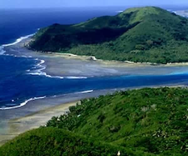
Fringing reefs surrounding Pacific islands
The fringing reef
is by far the most
common of the three major types of coral reefs,
with numerous examples in all major regions of coral reef
development.
Without
an intervening lagoon to effectively buffer freshwater runoff, pollution, and
sedimentation, fringing reefs tend to particularly sensitive to these forms of
human impact.
In is
no surprise then that increasing human populations in coastal areas - and the
accompanying increases in coastal development and intensive agriculture - have
resulted in the decimation of fringing reefs throughout the world in recent
years.
Barrier Reefs
Barrier reefs are extensive
linear reef complexes that parallel a shore, and are separated
from it by lagoon.
WHAT IS A "LAGOON"? - A lagoon - as used in the context of coral reef
typology - refers to a comparatively wide band of water that lies between the
shore and the main area of reef development, and contains at least some deep
portions.
Barrier
reefs are far less common than fringing reefs or atolls, although examples can
be found in the tropical Atlantic as well as the Pacific.

Classic barrier reef morphology
The 1200-mile
long Great
Barrier Reef off the NE coast of Australia is the world's
largest example of this reef type. The GBR is
not actually a single reef as the name implies, but rather a very large complex
consisting of many reefs.
The second largest IndoPacific barrier reef lies offNew Caledonia's NE coast - it is some 400 miles long with a
lagoon 1-8 miles wide. Another large barrier reef extends for nearly 170 miles
to the north of Fiji and Vanua Levu.
This reef type is rare in the Caribbean region, where only 2
true barrier reefsare found. The largest of these runs off the coast of Belize, and the other off the north coast of
the island
of Providencia (east of Nicaragua).
Atolls
An
atoll is a roughly circular (annular) oceanic reef system surrounding a large
(and often deep) central lagoon.

IndoPacific atolls
In the South Pacific, most atolls occur in mid-ocean.
Examples of this reef type are common in French Polynesia, the Caroline and
Marshall Islands, Micronesia, and the Cook Islands.
The
Indian Ocean also contains numerous atoll formations. Examples are found in the
Maldive and Chagos island groups, the Seychelles, and in the Cocos Island
group.
In
contrast, atolls are relatively rare in the Caribbean. Published counts range
from 10-27, depending upon who is doing the classification.
The
far greater number of atolls in the IndoPacific region of coral reef
development - as opposed the Greater Caribbean region - can be mainly
attributed to the far greater size of the former region along with its unique
geomorphology, which is far more conducive to volcanic island formation and
subsequent subsidence (see below).
A Caveat on Reef Typology
Readers
should be aware that identifying major reef types may not always be quite as
simple as the above discussion may suggest. Some reefs seem to be intermediate
versions that defy any simple "either or" classification scheme.
This
is especially true in the Caribbean region, where some of the fringing reefs
are separated from shore by open waters that may reach 6-8m in depth and extend
a kilometer or more from shore. Are these fringing reefs, barrier reefs, or
something else?
The
answers to such questions depend on whom you ask, but don't let that bother
you. Such issues are common in science when our human classification schemes
simply fail to account for the seemingly infinite variability found in nature.
Development Of Major Reef Types
The basic coral reef classification scheme described above
was first proposed byCharles
Darwin, and is still widely used today.
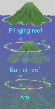
The evolution of main types of coral reefs, as first proposed
by Charles Darwin
Darwin spent most
of his coral reef explorations in theIndoPacific region,
and viewed the three types of coral reefs he described as simply different
stages in the geological 'evolution" of Pacific oceanic islands.
Darwin
theorized that fringing reefs began to grow near the shorelines of new islands
as ecological conditions became ideal for hard coral growth.
Then,
as the island began to gradually subside into the sea, the coral was able to
keep pace in terms of growth and remained in place at the sea surface, but
farther from shore; it was now a barrier reef.
Eventually,
the island disappeared below the sea surface, leaving only the ring of coral
encircling the central lagoon; an atoll had formed (see right).
Darwin's general "reef evolution" theory
was finally verified for IndoPacific reefs in the early 1950s
after analyses of the results of deep core drilling at Bikini and Eniwetok
Atolls.
However,
it has also now become apparent that each of the three major types of coral
reefs (described above) is often also formed by quite different geomorphic
processes as well. The atoll-like Bahama Banks are a prime example of such
alternate forms of reef development.
A Note On Patch Reefs
The
term "patch reef" is commonly used to refer to comparatively small,
isolated outcrops of coral surrounded by sand and/or seagrass (see photo,
below).
Numerous patch reefs form part of the fringing reef system
bordering a tropical island shore. © Fotolia
While patch reefs
have sometimes been described as a fourth "coral reef
type", such comparisons are clearly not appropriate.
Rather, patch reefs are more properly considered regular micro-scale
reef features of all three of themacro-scale reef types first described by Darwin - fringing
reefs, atolls and barrier reefs.
In
the sense that Darwin described coral reefs - the same reef classification
system widely in use today - patch reefs are not remotely comparable to the
major coral reef types, and should not be confused with them.
GLACIERS
Definition of a glacier
Definition of a glacier
A glacier is a permanent (on a human time
scale, because nothing on the Earth is really permanent) body of ice,
consisting largely of recrystallized snow, that shows evidence of downslope or
outward movement due to the pull of gravity.
How Glaciers Develop
Snow into ice. Snow turns into glacial ice because of
the pressure from overlying layers of snow. The increased weight compacts the
delicate snowflakes and collapses pockets of air. The snowflakes become rounded
granules called firn, which are held loosely together by new ice that
acts as a cement. The greater the overlying weight, the greater the amount of
compaction and recrystallization that leads to the development of thick slabs
of glacial ice.
Wasting
and calving. As its
mass increases, a glacier begins to move downslope, or flow, under the
influence of gravity. It commonly picks up loose rock and sediment or breaks
off pieces of the irregular rocky surface. When glacial ice reaches its point
of farthest advance, it iswasted, or ablated, through
melting. A small amount of the ice evaporates directly into the atmosphere from
the warmed surface of the glacier. Large blocks of ice may break off, or calve, from the
glacial face and plunge into the water of a lake or ocean as an iceberg. In extremely cold climates, most
glaciers lose their ice through calving.
Budget. A glacier's budget is defined as the ratio between ice
gained and ice lost. When a glacier gains more volume from new snowfall than it
loses from melting, it has a positive
budget. This
positive growth is reflected by the outward or downslope movement of an advancing glacier because of the increased snow mass at
the top, even if the front of the glacier is melting. A glacier with a negative budget loses more volume than it gains and is
therefore a receding
glacier. A
receding glacier may at times still move downslope but cannot in total overtake
its more rapid rate of uphill recession from melting. A glacier that has a balanced budget neither advances nor recedes.
Zone of accumulation and zone
of wastage. The
upper elevations of a glacier that are perennially covered in snow are called
the zone of accumulation. The lower portion of the glacier where
the ice is lost is called the zone of
wastage. Thesnow line is the irregular boundary between
these two zones. The position of the snow line varies according to climatic
variations and the glacier's budget. A snow line that moves down the glacier
indicates the glacier has a positive budget; a snow line that moves up the
glacier reveals a negative budget.
The terminus. The front of the glacier, or its terminus, moves down
the valley if a glacier has a positive budget; the reverse is true if the
glacier has a negative budget. Colder temperatures are not the only reasons a
glacier extends forward. Other causes could be that conditions are wetter and
more snowfall is accumulating during the winter months or that the summer is
cloudier and cooler. Alternatively, a retreating glacier could mean that the
winter months have been drier but just as cold, resulting in less snowpack, or
that a sunnier summer has resulted in more wastage. Experts guess that a
worldwide decrease in the mean annual temperature of only 4 or 5 degrees
centigrade could trigger the onset of another glacial period.
Glacial
Deposition and Deposits
Since
glaciers are solid they can transport all sizes of sediment, from huge
house-sized boulders to fine-grained clay sized material. The glacier can
carry this material on its surface or embedded within it. Thus, sediment
transportation in a glacier is very much different than that in a stream.
Thus, sediments deposited directly from melting of a glacial can range from
very poorly sorted to better sorted, depending on how much water transport
takes place after the ice melts. All sediment deposited as a result of
glacial erosion is called Glacial Drift.
Ice
Laid Deposits
|
|||||
|
Stratified
Drift - Glacial drift can be picked up and moved by meltwater streams which
can then deposit that material as stratified drift.
|
Surprisingly, most of Earth's liquid freshwater is not where you might think! In this video lesson you will learn about groundwater, as well as the important roles it plays in sustaining life and shaping Earth.
Groundwater
Believe it or not, groundwater, or water below the surface, makes up most of Earth's liquid freshwater. All of the streams, lakes, rivers, and ponds (so all of the Great Lakes, the Mississippi, the Amazon, the Nile, and all of the other fresh surface water) only make up 1.5% of Earth's liquid freshwater. The other 98.5% is underground as groundwater!
Water gets underground because when it precipitates, like with rain or snow, the ground soaks up the falling water like a sponge. Some soils are better at absorbing groundwater than others. Sand, for example, is really good at soaking up water and you've seen this if you've ever been to the beach. Clay, however, is not very good at taking in water, and rocks are even worse.
Where groundwater completely fills any open spaces underground is called the saturated zone; it's literally saturated with water. There is space above this in the soil, where moisture exists, but it doesn't completely fill all of the open spaces. The water here is called soil moisture, and this region where the soil is not saturated is called the unsaturated zone. You can tell where these two meet if you dig a hole. Once the hole hits the saturated zone you will see the bottom fill with water, and this boundary where the saturated and unsaturated zones meet is called the water table.
The Role of Groundwater
Groundwater is an important component of the water cycle, which is the natural cycling of water through phases and locations on Earth. The water that soaks into the ground sometimes comes back out above ground in other locations, feeding the world's rivers, lakes, streams, and oceans.
Much of the world's groundwater is stored in aquifers, which are underground water reservoirs, usually made of rock like limestone. The limestone acts like a giant rock sponge, soaking up the water and holding it for thousands of years. One of the world's largest aquifers is the Ogallala Aquifer in the Great Plains of the U.S. This aquifer is one large connected system, stretching from South Dakota to Texas and from Colorado to Arkansas! Because aquifers hold so much water, they take a very long time to fill, sometimes thousands or even millions of years.
Groundwater also acts like a cementing agent, helping sedimentary rocks form. As it moves, it carries sediments along with it, and then over millions of years the water glues those sediments together into rocks.
Geysers are the result of groundwater; if the water underground is above a near-surface magma source, this magma underneath heats the water. As the water heats, the pressure builds up, sometimes escaping at the surface. When this happens, the result is the same as heating a kettle of water on the stove. Steam escapes through a small opening in the surface and we get a geyser, like Old Faithful.
Natural ecosystems depend on groundwater because, as mentioned before, it's a source of freshwater for surface water systems, like wetlands and rivers. Both plants and animals depend on groundwater because plants take it up through their roots in the soil and animals (like us!) use it as a source of drinking water.
We pump groundwater not only for drinking, but also for things like agricultural irrigation. The problem is that, as mentioned before, it takes a long time to fill or refill an aquifer. So if we pump too much groundwater out, the land can be affected in various ways.
What are the Important Erosional Features of Underground Water?
(a) Lapies
The leaching action of the ground water as it passes through the limestone region, produces a highly rugged topography. Where the limestone is exposed at the surface, water running across the surface gives rise to straight rounded grooves with sharper ridges in between.
These are called rillenk-arren. The ground water may enlarge the joints of the limestone into a conjugate pattern of clefts and ridges. This surface is called lapis-surface or limestone-pavement. The clefts in such a pavement are called grikes and the ridges clints.
(b) Sink
It is a large solution cavity, may be several metres in diametre, open to the sky. These are also known as dolines, sink-holes ox swallow-holes. Sometime the sink-holes become so numerous that the sides begin to touch one another.
Surface drainage becomes limited to short sinking creeks, those that disappear in to the ground. Along such streams there are small holes where water swirls into small openings leading into caverns.
(c) Caverns
These are interconnected subterranean cavities in limestone, formed by the solution action of ground water. These cavities are always having roofs intact.
Cavems always vary considerably in size within wide limits and are sometimes of exceptionally large dimensions and are commonly interlinked. The horizontal linking passages are known as galleries and the inclined or vertical ones as shafts.
(d) Solution Valleys
Sometimes the roof of a cavern may collapse, enlarging it in an upward direction. With continued solutions, the collapse may reach the surface and a hollow, usually elongated and narrow, may be produced and form a solution valley.
These valleys are normally developed on limestones and are also known as dry-valleys. They resemble the channels formed by running water on the surface. Many such valleys are also called blind-valleys as the water from their streams is lost to subsur face channels.
In case of partial failure of the roof on top of a cavern, there occurs a natural bridge of limestone over-arching the solution valley. These natural bridges are, thus, the remnants of the roof of a cavern.
(e) Polje
These are large depressions, occurring mainly due to the roof collapse over great Karst chambers. They are characterized by their extensive size, flat bottom and the shape of a closed basin with steep sides. They are often filled with water forming polje lakes. Small residual hills found on the floor of poljes are called Hums or pepino-hills.
(f) Stylolite
It is an irregular suture like boundary developed at the junction of two consecutive soluble rocks, where the less soluble portions of the consecutive beds projects into each other.
Groundwater Erosion and Deposition
Not all water that falls on the land flows through rivers and streams. When it rains, much of the water sinks into the ground and moves through pore spaces in soil and cracks and fractures in rock. This water necessarily moves slowly, mostly under the influence of gravity. Yet groundwater is still a strong erosional force, as this water works to dissolve away solid rock. If you have ever explored a cave or seen a sinkhole, you have some experience with the work of groundwater (Figure 10.8).


As groundwater moves through spaces between mineral grains, it works to dissolve and carry away different elements. Some types of minerals are easily dissolved by groundwater. Rainwater absorbs carbon dioxide (CO2) as it falls through the air. The carbon dioxide combines with water to form carbonic acid. This naturally occurring weak acid readily dissolves many types of rock, including limestone. If you have ever watched an antacid tablet dissolve in water, you have seen an example of just how quickly this type of rock is eroded away. Caves are one of nature's most spectacular demonstrations of erosion (Figure 10.9). Working slowly over many years, groundwater dissolves and carries away elements of once solid rock in solution. First it travels along small cracks and fractures, gradually enlarging them. In time, caverns many football fields long and as high as many meters tall can form.
A sinkhole could form if the roof of an underground cave collapses. Some sinkholes are large enough to swallow up a home or several homes in a neighborhood (Figure 10.10). As groundwater dissolves away solid rock, it carries those minerals in solution as it travels. As groundwater drips through openings, several interesting types of formations occur. Stalactites are icicle like deposits of calcium carbonate which form as layer on layer of calcite drips from the ceiling, coating the 'icicle' (Figure 10.11). As mineral rich material drips to the floor of a cave, stalagmites form rounded deposits of calcium carbonate on the floor of the cave. The word stalactite has a 'C', so you can remember it forms from the ceiling, while the 'G' in stalagmite reminds you it forms on the ground. If a stalactite and stalagmite join together, they form a column. One of the wonders of visiting a cave is to witness the beauty of these amazing and strangely captivating structures. Caves also produce a beautiful type of rock, formed from calcium carbonate called travertine. This happens when groundwater saturated with calcium carbonate suddenly precipitates out as the mineral calcite or aragonite. Mineral springs that produce travertine can be hot springs or the water may just be warm or could even be cold (Figure 10.12).
When lots of calcium carbonate is carried by groundwater, we call the water 'hard'. If the water in your area is hard, it might be difficult to get soap to lather or make soapsuds. Hard water might also have a taste to it, perhaps one that some people don't like as much as pure water. If your water is 'hard', you may treat your water with a filter before you drink it. Zeolites are minerals that help to absorb ions from the water as it passes through the filter. When the water passes through the filter, it comes out tasting good!


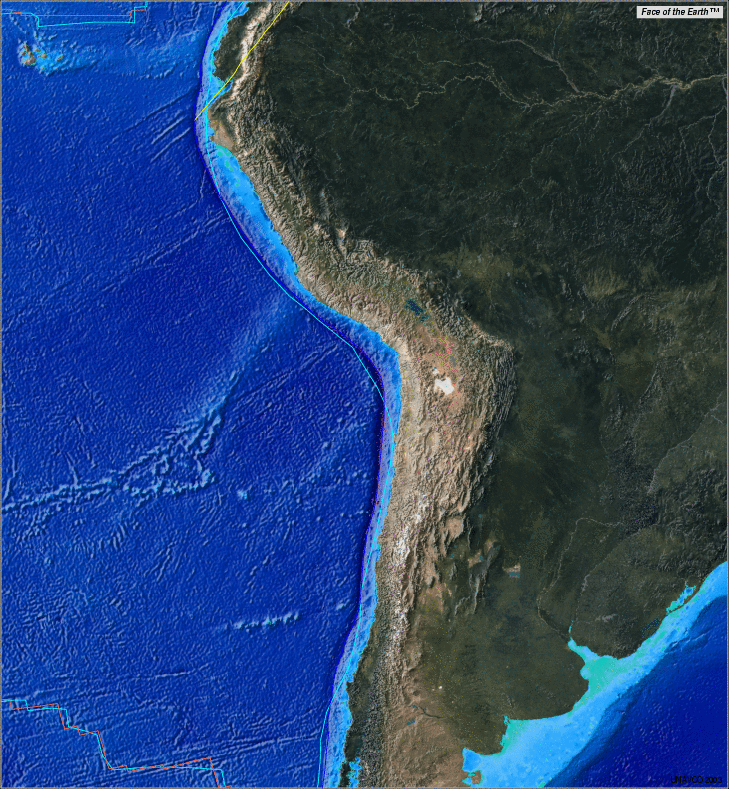
Important Depositional Features
1. Stalactites and Stalagmites
Particularly in caverns lying above the water table, water may be seen dripping from the straight line of a crack in the ceiling of the cave. These droplets lose some of its dissolved gas by evaporation and deposit small granules of calcium carbonate at the point of the evaporated drop.
In due course, with subsequent deposition of calcium carbonate (by the process as stated above) it grows downwards as an icicle-like pendant. These deposits hanging from the roof taper towards the floor and are called Stalactites.
The water that drops from the end of the stalactite falls to the floor of the cave immediately beneath it and with continued evaporation and deposition dome shaped or conical deposits of calcium carbonate start growing upwards. Such deposits are called Stalagmites.
Stalactites and stalagmites together constitute what is known as drip-stone.
2. Sinter and Travertine
Ground water emerging on the surface as springs or seepages form loose superficial deposits of silica or calcium carbonate.
The silica deposits thus formed at or near the exit of such springs are known as siliceous sinters whereas those formed of calcium carbonate are called travertine or calc-sinter.
3. Geode
Deposits resulting from the ground water often forms incrustations on the walls of the cave or fissure, below the water-table. Successive layers of amorphous silica thus formed differ in their colour and texture, and are known as agate.
But, when crystallization is perfect, well developed crystals of quartz etc. are found tapering towards the centre of the cavity as the teeth of a comb. Such deposits are known as Geode-which are partially or completely filled cavities.
4. Concretion
These are spherical, nodular, discoid or lens-like forms and are due to concentrated solution effects of groundwater on rock substances which are rather difficultly soluble.
These are deposits formed around some nucleus which differ in chemical and mineral composition from the enclosing substance. In clays and shales the concretions are mainly calcareous and in sandstones they may be ferruginous or calcareous.
5. Replacement deposits
By the process of replacement, ground water dissolves matter present in any particular substance while depositing an equal volume of material it contains. Thus it is some sort of a substitution on a volume-for-volume basis and the new material preserves the most minute texture of the one replaced.
Shells of fossils are replaced in this way; even petrified wood is also a result of such replacement.
Great post I was checking continuously this blog and I’m impressed! Very helpful info specially the last part :) I handle such info much. I was looking for this particular information for a long time. Thanks and good luck :
ReplyDeletePackers And Movers Hampinagar
Packers And Movers JP Nagar
Packers And Movers Doddakallasandra
Packers And Movers gaviopuram
Packers And Movers Bangalore guarantee to convey all your stuff from way to entryway. We don't call ourselves the #best #packers and #movers in #Bangalore simply like that. It is our administrations that backing our case.
i really like your blog, thanks for share...
ReplyDeleteplease visit are website..
Packers And Movers Hyderabad
Packers And Movers gachibowli Hyderabad
ReplyDeleteI cannot truly enable but admire your weblog, your weblog is so adorable and great.It has given me courage to try scarier things. I tend to steer clear of them but not anymore.
Packers And Movers lingampally Hyderabad
Packers And Movers Kondapur Hyderabad
Packers and Movers in India
ReplyDeletePackers and Movers Raipur
Packers and Movers Nagpur
Packers and Movers Jaipur
Packers and Movers Udaipur
Packers and Movers Surat
Packers and Movers Vadodara
Packers and Movers Chandigarh
Packers and Movers Jabalpur
Packers and Movers Hyderabad
Packers and Movers in Delhi- Transportation, the movement of goods and persons from place to place and the various means by which such movement is accomplished.scretch free Transportation service by giving Gaurantee to their customers.Persons operating in ACPL (Air Cargo Packers Logistics ) square measure Well Trained and Qualified
ReplyDeleteHiring packers and movers in Gurgaon is not too hard if you take help of the best moving professionals. Best movers and packers Gurgaon assist with their skilled and trained team to pack, load, unload and unpack your belongings.
ReplyDeleteSo be aware and hire the best mover packer to save your valuables.
packers and movers Gurgaon
packers and movers Gurgaon Charges
There might be occasions once you might face some form of delay in reaching us, let’s say during the time of filing taxes since there is a lot of hush-hush then. We assure you that individuals will revert for your requirements in less time and work out us accessible to you at QuickBooks Premier Support Phone Number US.
ReplyDeleteQuickBooks Intuit Tech Support Number
QuickBooks Error Help Number
QuickBooks Customer Number
QuickBooks Phone Number Tech Support
QuickBooks Online Tech Support Phone Number
QuickBooks Desktop Support Phone Number
Quickoboks Phone Number
QuickBooks Online Technical Support Phone Number
Quick Phone Number
QuickBooks Online Technical Support
QuickBooks Online Support
QuickBooks Toll Free Number
QuickBooks 2018 Support Phone Number
Phone Number For QuickBooks Technical Support
QuickBooks Error Support
QuickBooks Online Tech Support Number
QuickBooks Premier Tech Support Phone Number
QuickBooks Technical Support Phone Number
Tech Support Quick Books Phone Number
Phone Number For QuickBooks Help
Intuit QuickBooks Phone Number
Quick Books Tech Support
Flexible scheduling allows clients to choose moving dates and times that suit their convenience. packers and movers in Kolkata
ReplyDelete